
فائل:Java-Map.jpg
اصل فائل (۳,۰۰۰ × ۲,۰۸۸ پکسلز, فائل حجم: ۱.۱۲ میگابائٹ, MIME type: image/jpeg)
خلاصہ
| تفصیل |
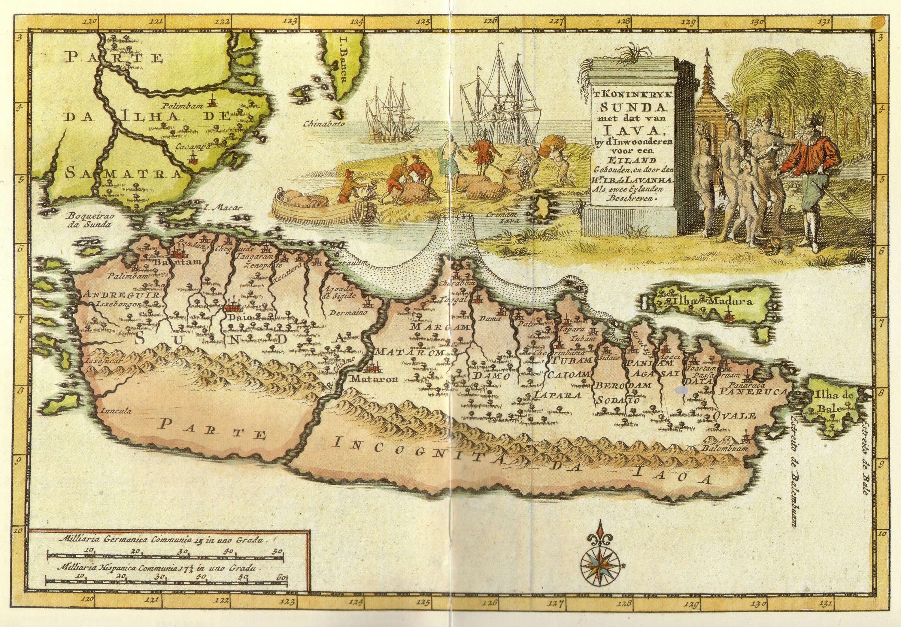
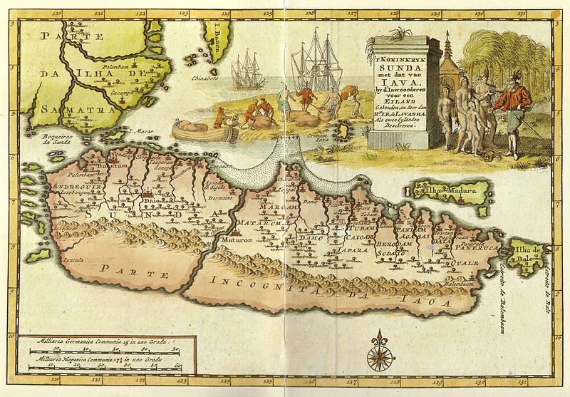
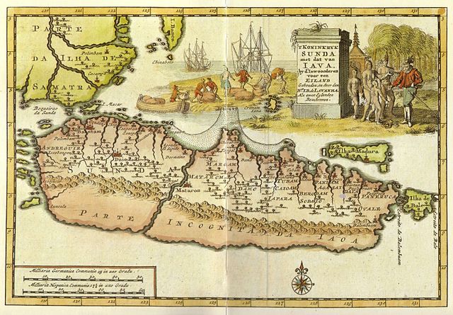
Kingdom of Sunda and Java as two islands. The toponym includes: |
| تریخ | early 18 century |
| سروت | from "Java" - Periplus Adventure Guide. Periplus Editions 1997. ISBN 962-593-244-5 |
| لکھاری |
Pieter van der Aa (1659-1733) Hr. L. B. de Lavanha |
| دوجے ورژن |
|

| Camera location | | View this and other nearby images on: OpenStreetMap |
|---|
لائسنس –
|
This work is in the public domain in its country of origin and other countries and areas where the copyright term is the author's life plus 70 years or fewer.
| |
| ایہ فائل دے بارے چ دس اے جے اے کاپی حف دیاں روکاں توں کھلی اے تے نالدے رلدے حقاں توں وی۔ | |
فائل دی تریخ
فائل نو اس ویلے دی حالت وچ ویکھن واسطے تاریخ/ویلے تے کلک کرو۔
| تریخ تے ویلہ | نکی مورت | پاسے | ورتن والا | تیپّݨی کرو | |
|---|---|---|---|---|---|
| موجودہ | ۱۷:۱۲, ۲۰ جنوری ۲۰۰۸ | | ۳,۰۰۰ × ۲,۰۸۸ (۱.۱۲ میگابائٹ) | Merbabu~commonswiki | {{Information |Description=Early 18th century Dutch map. |Source= |Date=early 18th century |Author= |Permission= |other_versions= }} |
فائل دی ورتوں
تھلے دتے گئے 1 صفحے اس فائل نال جُڑدے نیں
فائل ویاپک ورتوں
ایہہ دوجے وکیاں ایس فائل نوں ورتدے نیں –
- ar.wikipedia.org تے ورتوں
- ca.wikipedia.org تے ورتوں
- en.wikipedia.org تے ورتوں
- fr.wikipedia.org تے ورتوں
- hr.wikipedia.org تے ورتوں
- id.wikipedia.org تے ورتوں
- it.wikipedia.org تے ورتوں
- ja.wikipedia.org تے ورتوں
- mk.wikipedia.org تے ورتوں
- mt.wikipedia.org تے ورتوں
- nl.wikipedia.org تے ورتوں
- pl.wikipedia.org تے ورتوں
- ru.wikipedia.org تے ورتوں
- ur.wikipedia.org تے ورتوں
- zh.wikipedia.org تے ورتوں