
فائل:Montenegro Map.png

اصل فائل (۲,۴۲۷ × ۱,۸۰۷ پکسلز, فائل حجم: ۱.۰۳ میگابائٹ, MIME type: image/png)
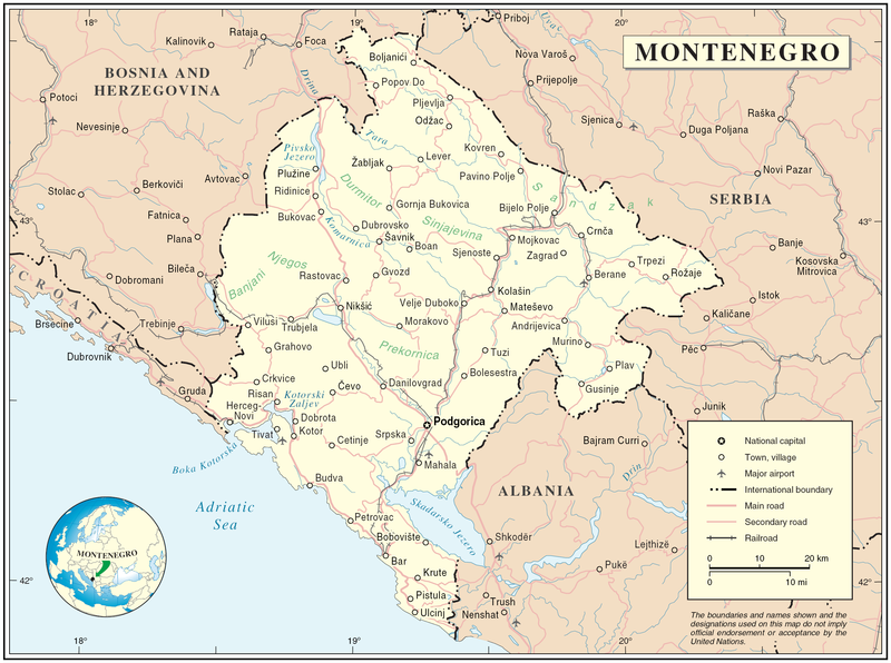
Map of Montenegro
| تفصیل | Map of Montenegro | |||
| تریخ | ||||
| سروت | The Cartographic Section of the United Nations (CSUN) | |||
| لکھاری | Cartographer of the United Nations | |||
| اجازت (فائل نوں دوبارہ ورتنا) |
|

فائل دی تریخ
فائل نو اس ویلے دی حالت وچ ویکھن واسطے تاریخ/ویلے تے کلک کرو۔
| تریخ تے ویلہ | نکی مورت | پاسے | ورتن والا | تیپّݨی کرو | |
|---|---|---|---|---|---|
| موجودہ | ۲۲:۰۳, ۱۰ مارچ ۲۰۰۷ | | ۲,۴۲۷ × ۱,۸۰۷ (۱.۰۳ میگابائٹ) | Minestrone | Map of Montenegro {{Information |Description=Map of Montenegro |Source=The Cartographic Section of the United Nations (CSUN) |Date=2007-03-10 |Author=Cartographer of the United Nations |Permission={{Template:UN map}} and the cartographer of the UN [ |
فائل دی ورتوں
تھلے دتے گئے 1 صفحے اس فائل نال جُڑدے نیں
فائل ویاپک ورتوں
ایہہ دوجے وکیاں ایس فائل نوں ورتدے نیں –
- als.wikipedia.org تے ورتوں
- ar.wikipedia.org تے ورتوں
- avk.wikipedia.org تے ورتوں
- be-tarask.wikipedia.org تے ورتوں
- bg.wikipedia.org تے ورتوں
- cs.wikipedia.org تے ورتوں
- cy.wikipedia.org تے ورتوں
- de.wikipedia.org تے ورتوں
- el.wikipedia.org تے ورتوں
- en.wikipedia.org تے ورتوں
- fa.wikipedia.org تے ورتوں
- fr.wikipedia.org تے ورتوں
- gag.wikipedia.org تے ورتوں
- gd.wikipedia.org تے ورتوں
- hr.wiktionary.org تے ورتوں
- ia.wikipedia.org تے ورتوں
- incubator.wikimedia.org تے ورتوں
- io.wikipedia.org تے ورتوں
- ka.wikipedia.org تے ورتوں
- la.wikipedia.org تے ورتوں
- ms.wikipedia.org تے ورتوں
- nl.wikipedia.org تے ورتوں
- pl.wikipedia.org تے ورتوں
- pl.wiktionary.org تے ورتوں
- ps.wikipedia.org تے ورتوں
- rm.wikipedia.org تے ورتوں
- roa-tara.wikipedia.org تے ورتوں
- ro.wikipedia.org تے ورتوں
- ro.wikivoyage.org تے ورتوں
- ru.wikipedia.org تے ورتوں
ایس فائل دا ویکھو ہور جگت ورتن .