
فائل:Sierra Nevada map.png
اس توں وڈی مورت موجود نہیں۔
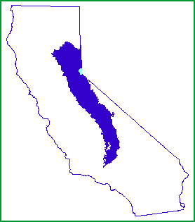
Sierra_Nevada_map.png (۲۷۸ × ۳۱۵ پکسلز, فائل حجم: ۵ کلوبائٹ, MIME type: image/png)

|
File:Sierra Nevada map vector.svg is a vector version of this file. It should be used in place of this PNG file when not inferior.
File:Sierra Nevada map.png → File:Sierra Nevada map vector.svg
For more information, see Help:SVG. |
 |
خلاصہ
| تفصیل | |
| تریخ | |
| سروت | http://www.fs.fed.us/r5/spf/publications/fh_94-95/m261e.htm |
| لکھاری | John W. Dale, U.S. Forest Service |
| اجازت (فائل نوں دوبارہ ورتنا) |
Public Domain |
لائسنس –
This image is a work of the Forest Service of the United States Department of Agriculture. As a work of the U.S. federal government, the image is in the public domain.
|
فائل دی تریخ
فائل نو اس ویلے دی حالت وچ ویکھن واسطے تاریخ/ویلے تے کلک کرو۔
| تریخ تے ویلہ | نکی مورت | پاسے | ورتن والا | تیپّݨی کرو | |
|---|---|---|---|---|---|
| موجودہ | ۰۴:۲۱, ۸ جنوری ۲۰۰۷ | | ۲۷۸ × ۳۱۵ (۵ کلوبائٹ) | Hike395 | {{Information |Description=Map of the Sierra Nevada, United States |Source=http://www.fs.fed.us/r5/spf/publications/fh_94-95/m261e.htm |Date=1999-07-12 |Author=John W. Dale, U.S. Forest Service |Permission=Public Domain }} |
فائل دی ورتوں
تھلے دتے گئے 1 صفحے اس فائل نال جُڑدے نیں
فائل ویاپک ورتوں
ایہہ دوجے وکیاں ایس فائل نوں ورتدے نیں –
- af.wikipedia.org تے ورتوں
- cs.wikipedia.org تے ورتوں
- cy.wikipedia.org تے ورتوں
- de.wikipedia.org تے ورتوں
- en.wikipedia.org تے ورتوں
- eo.wikipedia.org تے ورتوں
- fi.wiktionary.org تے ورتوں
- frr.wikipedia.org تے ورتوں
- fy.wikipedia.org تے ورتوں
- gd.wikipedia.org تے ورتوں
- gl.wikipedia.org تے ورتوں
- he.wikipedia.org تے ورتوں
- hr.wikipedia.org تے ورتوں
- id.wikipedia.org تے ورتوں
- ja.wikipedia.org تے ورتوں
- ko.wikipedia.org تے ورتوں
- ml.wikipedia.org تے ورتوں
- mr.wikipedia.org تے ورتوں
- nn.wikipedia.org تے ورتوں
- no.wikipedia.org تے ورتوں
- pt.wikipedia.org تے ورتوں
- sco.wikipedia.org تے ورتوں
- sh.wikipedia.org تے ورتوں
- simple.wikipedia.org تے ورتوں
- sk.wikipedia.org تے ورتوں
- sl.wikipedia.org تے ورتوں
- sr.wikipedia.org تے ورتوں
- sv.wikipedia.org تے ورتوں
- ta.wikipedia.org تے ورتوں
- tr.wikipedia.org تے ورتوں
- uk.wikipedia.org تے ورتوں
- vi.wikipedia.org تے ورتوں
- zh.wikipedia.org تے ورتوں