
فائل:Thailand Yala.png
اس توں وڈی مورت موجود نہیں۔
Thailand_Yala.png (۱۷۸ × ۳۰۰ پکسلز, فائل حجم: ۱۴ کلوبائٹ, MIME type: image/png)
خلاصہ
| تفصیل |
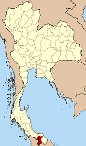
English: Map of Thailand highlighting Yala province |
| سروت | آپݨا کم |
| لکھاری | Ahoerstemeier |
لائسنس –

|
کاپی کرن، ونڈن تے بدلن دی ایس ڈوکومنٹ لئی اجازت دتی جاندی اے ایہناں GNU Free Documentation License, Version 1.2 شرطاں نال یا مگروں کسے وی چھپے ورین Free Software Foundation توں بنا کسے انویرینٹ سیکشن دے، ناں فرنٹ کور لکھت تے ناں بیک کور لکھت دے۔ لسنس دی اک کاپی سیکشن وچ ہیگی اے جہدا ناں اے GNU Free Documentation License۔ |
| ایس فائل نوں کریٹو کامنز Attribution 2.5 پولینڈ لائسنس دتا گیا. | ||
| ||
| اس لائسنس دا ٹیگ GFDL دے مطابق اس فائل چ پایا گیا اے licensing update۔ |
ایس فائل نوں کریٹو کامنز Attribution 1.0 جنرک لائسنس دتا گیا.
- تہانوں کھلھ اے:
- حصہ کرنا – کاپی، ونڈنا تے کم بھیجنا
- فیر رلانا – کم نوں فٹ کرنا
- تھلے دتیاں شرطاں نال:
- کس دے ناں – تسیں لازمی ایس کم دے بناں والے بارے دسو جنج اونے آکھیا اے یا جنج لسنس چ آکھیا گیا ہے۔
- اکو جہا شئیر کرو۔ – If you alter, transform, or build upon this work, you must distribute the resulting work under the same license as the original.
فائل دی تریخ
فائل نو اس ویلے دی حالت وچ ویکھن واسطے تاریخ/ویلے تے کلک کرو۔
| تریخ تے ویلہ | نکی مورت | پاسے | ورتن والا | تیپّݨی کرو | |
|---|---|---|---|---|---|
| موجودہ | ۲۳:۵۰, ۲۶ نومبر ۲۰۰۴ | | ۱۷۸ × ۳۰۰ (۱۴ کلوبائٹ) | Ahoerstemeier | Map of Thailand hightlighting Yala province {{GFDL}}{{cc-by-sa}} |
فائل دی ورتوں
تھلے دتے گئے 1 صفحے اس فائل نال جُڑدے نیں
فائل ویاپک ورتوں
ایہہ دوجے وکیاں ایس فائل نوں ورتدے نیں –
- ar.wikipedia.org تے ورتوں
- de.wikinews.org تے ورتوں
- en.wikipedia.org تے ورتوں
- Mueang Yala district
- Betong, Thailand
- Betong district
- Than To district
- Bannang Sata district
- Yaha district
- Kabang district
- Krong Pinang district
- Raman district
- Portal:Thailand/Selected article/4
- Template:Yala-geo-stub
- Bannang Sata (town)
- Seals of the provinces of Thailand
- Sateng Nok
- Yupo subdistrict
- id.wikipedia.org تے ورتوں
- no.wikipedia.org تے ورتوں
- pl.wikipedia.org تے ورتوں
- pt.wikipedia.org تے ورتوں
- tg.wikipedia.org تے ورتوں
- war.wikipedia.org تے ورتوں
- www.wikidata.org تے ورتوں
- zh-min-nan.wikipedia.org تے ورتوں