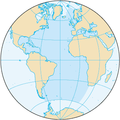
فائل:Atlantic Ocean.png
Atlantic_Ocean.png (۳۳۰ × ۳۳۰ پکسلز, فائل حجم: ۲۶ کلوبائٹ, MIME type: image/png)
فائل دی تریخ
فائل نو اس ویلے دی حالت وچ ویکھن واسطے تاریخ/ویلے تے کلک کرو۔
| تریخ تے ویلہ | نکی مورت | پاسے | ورتن والا | تیپّݨی کرو | |
|---|---|---|---|---|---|
| موجودہ | ۰۱:۱۱, ۲۸ اگست ۲۰۱۹ |  | ۳۳۰ × ۳۳۰ (۲۶ کلوبائٹ) | Kaldari | same dimensions as other ocean images |
| ۰۱:۲۰, ۲۳ اگست ۲۰۰۹ |  | ۳۲۸ × ۳۲۸ (۱۲ کلوبائٹ) | Serg!o | ups | |
| ۰۱:۱۶, ۲۳ اگست ۲۰۰۹ |  | ۳۲۹ × ۳۳۰ (۱۴ کلوبائٹ) | Serg!o | language neutral map | |
| ۱۵:۱۳, ۳ نومبر ۲۰۰۴ |  | ۳۲۸ × ۳۲۸ (۱۲ کلوبائٹ) | Maximaximax | North and South Atlantic Ocean from [http://www.cia.gov/cia/publications/factbook/geos/zh.html CIA World Factbook - Atlantic Ocean] (picture URL is [http://www.cia.gov/cia/publications/factbook/maps/zh-map.gif]). {{PD-USGov}} Category:Oceans |
فائل دی ورتوں
تھلے دتے گئے 1 صفحے اس فائل نال جُڑدے نیں
فائل ویاپک ورتوں
ایہہ دوجے وکیاں ایس فائل نوں ورتدے نیں –
- ab.wikipedia.org تے ورتوں
- als.wikipedia.org تے ورتوں
- an.wikipedia.org تے ورتوں
- arc.wikipedia.org تے ورتوں
- ar.wikipedia.org تے ورتوں
- arz.wikipedia.org تے ورتوں
- ast.wikipedia.org تے ورتوں
- ast.wiktionary.org تے ورتوں
- as.wikipedia.org تے ورتوں
- av.wikipedia.org تے ورتوں
- az.wikipedia.org تے ورتوں
- ba.wikipedia.org تے ورتوں
- be-tarask.wikipedia.org تے ورتوں
- be.wikipedia.org تے ورتوں
- bg.wikipedia.org تے ورتوں
- bjn.wikipedia.org تے ورتوں
- bo.wikipedia.org تے ورتوں
- br.wikipedia.org تے ورتوں
- bs.wikipedia.org تے ورتوں
- bxr.wikipedia.org تے ورتوں
- ceb.wikipedia.org تے ورتوں
- ce.wikipedia.org تے ورتوں
- ckb.wikipedia.org تے ورتوں
- cs.wikipedia.org تے ورتوں
ایس فائل دا ویکھو ہور جگت ورتن .


