
فائل:Europe location ENG2.png

ایس وکھالے دا ناپ: ۸۰۰ × ۵۹۹ پکسلز۔ دوجے ریزولوشنز: ۳۲۰ × ۲۴۰ پکسلز | ۶۴۰ × ۴۷۹ پکسلز | ۱,۰۲۴ × ۷۶۷ پکسلز | ۱,۲۸۰ × ۹۵۹ پکسلز | ۱,۵۹۴ × ۱,۱۹۴ پکسلز ۔
اصل فائل (۱,۵۹۴ × ۱,۱۹۴ پکسلز, فائل حجم: ۷۲۸ کلوبائٹ, MIME type: image/png)
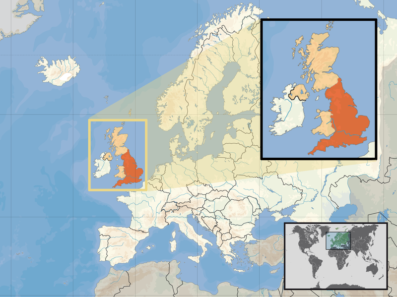
| تفصیل | Location of England in the UK and Europe, on terrain map showing surface and underwater contour areas. | |||
| تریخ | ||||
| سروت | Derived from Wikimedia Commons image of original work forming part of the "Europe location" map series created by David Liuzzo: derived from Image:Europe_location_ENG.png. | |||
| لکھاری | uploaded by User:Kmusser (excerpt from User:David_Liuzzo) | |||
| اجازت (فائل نوں دوبارہ ورتنا) |
|
|||
| دوجے ورژن |
|


فائل دی تریخ
فائل نو اس ویلے دی حالت وچ ویکھن واسطے تاریخ/ویلے تے کلک کرو۔
| تریخ تے ویلہ | نکی مورت | پاسے | ورتن والا | تیپّݨی کرو | |
|---|---|---|---|---|---|
| موجودہ | ۱۹:۵۸, ۱۴ فروری ۲۰۱۱ | | ۱,۵۹۴ × ۱,۱۹۴ (۷۲۸ کلوبائٹ) | Beao | Removed border. |
| ۰۰:۰۰, ۳۰ ستمبر ۲۰۰۸ |  | ۱,۶۰۰ × ۱,۲۰۰ (۷۹۲ کلوبائٹ) | Kmusser | {{Information |Description= Location of England in the UK and Europe, on terrain map showing surface and underwater contour areas. |Source=Derived from Wikimedia Commons image of original work forming part of the "Europe location" map series c |
فائل دی ورتوں
تھلے دتے گئے 1 صفحے اس فائل نال جُڑدے نیں
فائل ویاپک ورتوں
ایہہ دوجے وکیاں ایس فائل نوں ورتدے نیں –
- ace.wikipedia.org تے ورتوں
- ar.wikipedia.org تے ورتوں
- az.wiktionary.org تے ورتوں
- bn.wikipedia.org تے ورتوں
- br.wikipedia.org تے ورتوں
- cs.wikipedia.org تے ورتوں
- da.wikipedia.org تے ورتوں
- dsb.wikipedia.org تے ورتوں
- dty.wikipedia.org تے ورتوں
- en.wikipedia.org تے ورتوں
- es.wikipedia.org تے ورتوں
- eu.wiktionary.org تے ورتوں
- ext.wikipedia.org تے ورتوں
- fiu-vro.wikipedia.org تے ورتوں
- hr.wikiquote.org تے ورتوں
- incubator.wikimedia.org تے ورتوں
- ja.wiktionary.org تے ورتوں
- ka.wikipedia.org تے ورتوں
- my.wikipedia.org تے ورتوں
- nds-nl.wikipedia.org تے ورتوں
- nl.wikibooks.org تے ورتوں
- pam.wikipedia.org تے ورتوں
- pl.wikipedia.org تے ورتوں
- pl.wiktionary.org تے ورتوں
- pt.wiktionary.org تے ورتوں
- sc.wikipedia.org تے ورتوں
- shn.wikipedia.org تے ورتوں
- simple.wikipedia.org تے ورتوں
- sr.wikipedia.org تے ورتوں
- sv.wikivoyage.org تے ورتوں
- vls.wikipedia.org تے ورتوں
- xmf.wikipedia.org تے ورتوں
- yo.wikipedia.org تے ورتوں
- zh.wikinews.org تے ورتوں