
فائل:India Kerala location map.svg

اصل فائل (ایس وی جی فائل، پکسل:۸۷۴ × ۱,۲۷۴، فائل سائز: ۳۵۰ کلوبائٹ)
خلاصہ
| تفصیل |
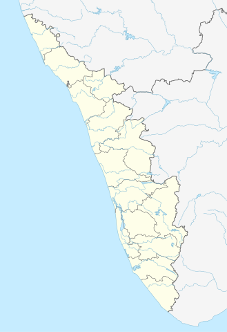
Quadratische Plattkarte, N-S-Streckung 102 %. Geographische Begrenzung der Karte:
Equirectangular projection, N/S stretching 102 %. Geographic limits of the map:
|
|
| تریخ | ||
| سروت |
آپݨا کم, using
|
|
| لکھاری | NordNordWest | |
| اجازت (فائل نوں دوبارہ ورتنا) |
ایس فائل نوں کریٹو کامنز Attribution 3.0 جرمنی لائسنس دتا گیا.
 ایس فائل نوں کریٹو کامنز Attribution 2.5 پولینڈ لائسنس دتا گیا.
|


|
This map has been made or improved in the German Kartenwerkstatt (Map Lab). You can propose maps to improve as well.
|
فائل دی تریخ
فائل نو اس ویلے دی حالت وچ ویکھن واسطے تاریخ/ویلے تے کلک کرو۔
| تریخ تے ویلہ | نکی مورت | پاسے | ورتن والا | تیپّݨی کرو | |
|---|---|---|---|---|---|
| موجودہ | ۲۱:۱۳, ۱۰ جون ۲۰۲۳ | | ۸۷۴ × ۱,۲۷۴ (۳۵۰ کلوبائٹ) | C1MM | c boundaries |
| ۲۱:۰۴, ۱۰ جون ۲۰۲۳ |  | ۸۷۴ × ۱,۲۷۴ (۳۵۱ کلوبائٹ) | C1MM | c bounds | |
| ۱۹:۴۱, ۲۲ اگست ۲۰۲۱ |  | ۷۷۵ × ۱,۱۲۹ (۳۹۴ کلوبائٹ) | C1MM | Corrected rivers and dist boundaries | |
| ۲۳:۱۷, ۴ مئی ۲۰۱۲ |  | ۸۲۷ × ۱,۲۰۵ (۱۳۵ کلوبائٹ) | NordNordWest | upd | |
| ۱۴:۳۰, ۱۱ مارچ ۲۰۱۱ |  | ۸۲۷ × ۱,۲۰۵ (۱۳۲ کلوبائٹ) | NordNordWest | =={{int:filedesc}}== {{Information |Description= {{de|Positionskarte von Kerala, Indien}} Quadratische Plattkarte, N-S-Streckung 102 %. Geographische Begrenzung der Karte: * N: 13.0° N * S: 8.0° N * W: 74.5° O * O: 78.0° |
فائل دی ورتوں
تھلے دتے گئے 13 صفحے اس فائل نال جُڑدے نیں
فائل ویاپک ورتوں
ایہہ دوجے وکیاں ایس فائل نوں ورتدے نیں –
- ar.wikipedia.org تے ورتوں
- azb.wikipedia.org تے ورتوں
- باتی چاتالور
- باتی پودوسری
- پیدیکاپارامبو
- پیداوور
- وایاتوپوژا
- وئیلور
- پرووانتانام
- پرووالور
- پرووا (هیندوستان)
- پرونا (هیندوستان)
- پرونیلام
- واوانور
- پرونقوژی
- وانیمال
- وانییامبالام
- ونیکود
- ونجینیسری
- ونقانور
- سارکارا-چیرایینکیژو
- سانتانپارا
- ماژووانور
- ماژوکیر
- کالکونتال
- کالیکاو
- ماترا (هیندوستان)
- ماتیلاکام
- ماتامبا
- کالایاپورام
- کالاتوکاداوو
- کالانجور
- ونقانلور
- ونقولا
- ماروتا, ایندیا
- کالامپالا
- ونقارا, مالاپورام دیستریکت
- ونکیتانقو
- کالاکتی
- واندیتاوالام
- واندانمدو
- واندانپاتال
- وانداماتوم
- وانداژی-یی
- وانداژی-ی
- ونجارامودو
- ونپاکال
- کاکور (هیندوستان)
- ماریاناد
- کاکولیسری
- کاکودی
ایس فائل دا ویکھو ہور جگت ورتن .