
فائل:Island of Ireland location map Donegal.svg

Size of this PNG preview of this SVG file: ۴۸۱ × ۵۹۹ پکسلز. دوجے ریزولوشنز: ۱۹۲ × ۲۴۰ پکسلز | ۳۸۵ × ۴۸۰ پکسلز | ۶۱۶ × ۷۶۸ پکسلز | ۸۲۲ × ۱,۰۲۴ پکسلز | ۱,۶۴۳ × ۲,۰۴۸ پکسلز | ۱,۴۵۰ × ۱,۸۰۷ پکسلز ۔
اصل فائل (ایس وی جی فائل، پکسل:۱,۴۵۰ × ۱,۸۰۷، فائل سائز: ۶۴۲ کلوبائٹ)
| تفصیل |
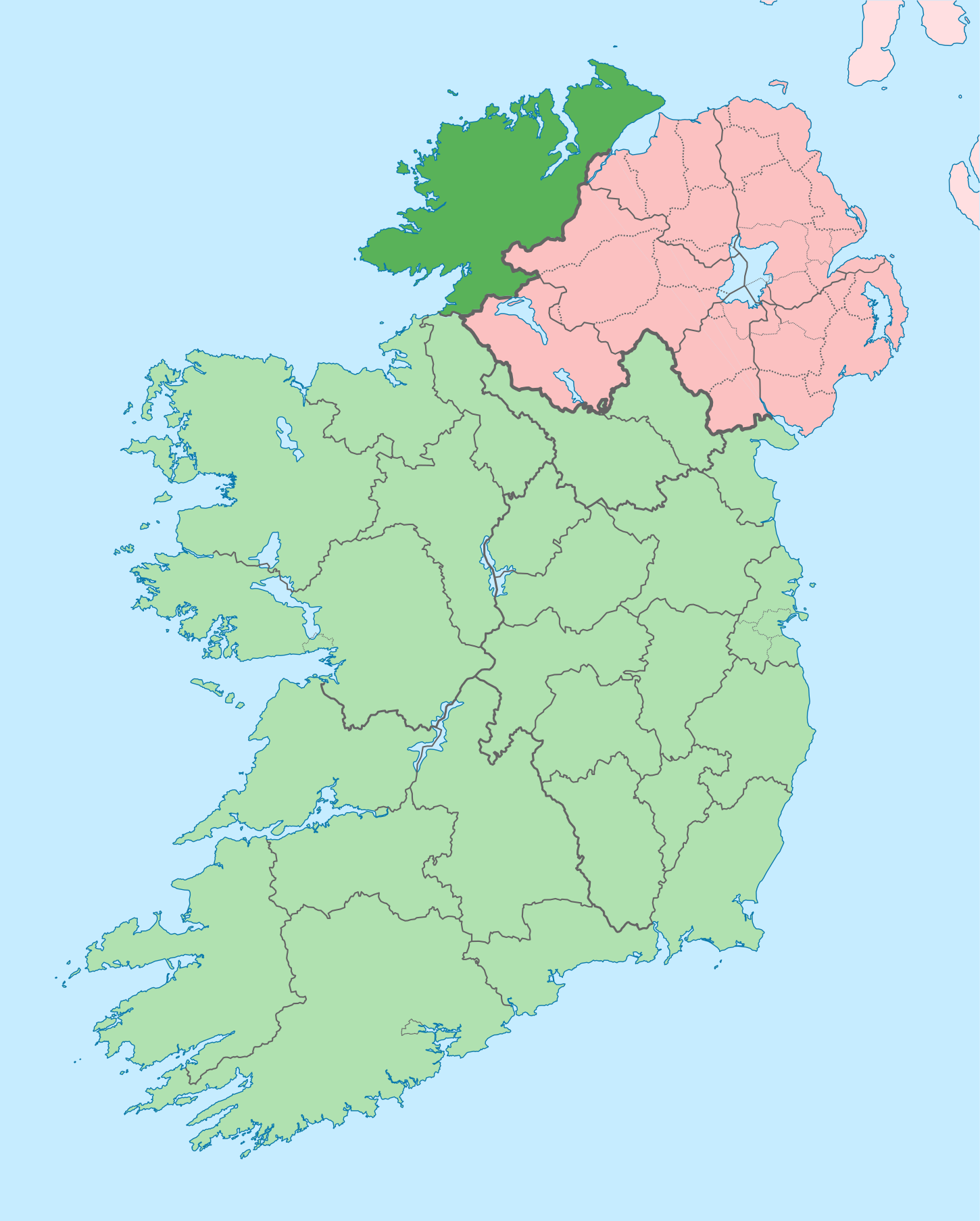
English: The island of Ireland, showing international border between Ireland and Northern Ireland, traditional provinces, traditional counties, and local authority areas in Ireland and Northern Ireland. |
| تریخ | (UTC) |
| سروت | |
| لکھاری |
|
| This is a retouched picture, which means that it has been digitally altered from its original version. Modifications: Coloured in regions with county of article highlighted. The original can be viewed here: Island of Ireland location map.svg:
|
میں، اس کم دے کاپیرائٹ دا مالک، اس کم نوں اس لائسنس دے مطابق چھاپدا واں:
ایس فائل نوں کریٹو کامنز Attribution 2.5 پولینڈ لائسنس دتا گیا.
- تہانوں کھلھ اے:
- حصہ کرنا – کاپی، ونڈنا تے کم بھیجنا
- فیر رلانا – کم نوں فٹ کرنا
- تھلے دتیاں شرطاں نال:
- کس دے ناں – تسیں لازمی ایس کم دے بناں والے بارے دسو جنج اونے آکھیا اے یا جنج لسنس چ آکھیا گیا ہے۔
- اکو جہا شئیر کرو۔ – اگر تسیں بدلدے یا ایس کم تے بناندے تے بنن والے کم نوں اینج دے لسنس نال ای ونڈو گے۔
پہلا اپلوڈ دا ریکارڈ
This image is a derivative work of the following images:
- File:Island_of_Ireland_location_map.svg licensed with Cc-by-sa-3.0
- 2010-03-06T20:43:33Z Rannpháirtí anaithnid 1450x1807 (679207 Bytes) Fix incorrectly coloured isands.
- 2010-03-03T22:19:29Z Rannpháirtí anaithnid 1450x1807 (679744 Bytes) {{Information |Description={{de|Positionskarte von [[:de:Irland|Irland]]}} Quadratische Plattkarte, N-S-Streckung 170 %. Geographische Begrenzung der Karte: * N: 55.6° N * S: 51.2° N * W: 11.0° W * O: 5.0° W {{en|Location
Uploaded with derivativeFX
فائل دی تریخ
فائل نو اس ویلے دی حالت وچ ویکھن واسطے تاریخ/ویلے تے کلک کرو۔
| تریخ تے ویلہ | نکی مورت | پاسے | ورتن والا | تیپّݨی کرو | |
|---|---|---|---|---|---|
| موجودہ | ۱۸:۴۱, ۲۹ جون ۲۰۲۰ | | ۱,۴۵۰ × ۱,۸۰۷ (۶۴۲ کلوبائٹ) | Chipmunkdavis | Further edits per the Local Government Reform Act 2014, joining both Tipperarys and both Waterfords (and removing Limerick City code). Colouring in islands, cleaning up and grouping code to remove stray objects and show Galway and Lough Ree. |
| ۰۸:۴۹, ۶ مئی ۲۰۱۶ |  | ۱,۴۵۰ × ۱,۸۰۷ (۸۳۳ کلوبائٹ) | Houdinipeter | to reflect the changes of the w:Local Government Reform Act 2014 | |
| ۰۵:۴۳, ۱۹ جولائی ۲۰۱۰ |  | ۱,۴۵۰ × ۱,۸۰۷ (۸۱۵ کلوبائٹ) | Mabuska | {{Information |Description={{en|The island of Ireland, showing international border between Northern Ireland and Republic of Ireland, traditional provinces, traditional counties, and local authority areas in the Republic of Ireland and Northern Ireland.}} |
فائل دی ورتوں
تھلے دتے گئے 1 صفحے اس فائل نال جُڑدے نیں
فائل ویاپک ورتوں
ایہہ دوجے وکیاں ایس فائل نوں ورتدے نیں –
- ar.wikipedia.org تے ورتوں
- ast.wikipedia.org تے ورتوں
- bg.wikipedia.org تے ورتوں
- ca.wikipedia.org تے ورتوں
- Comtat de Donegal
- Gaoth Dobhair
- Lifford
- Letterkenny
- Plantilla:Comtat Donegal
- Ballyshannon
- Buncrana
- Bundoran
- Ballybofey
- Carndonagh
- Donegal
- Na Rosa
- Cloch Cheann Fhaola
- Gort an Choirce
- An Fál Carrach
- Machaire Rabhartaigh
- Toraigh
- Baile na Finne
- Teileann
- Gleann Cholm Cille
- Carraig Airt
- Na Dúnaibh
- Cill Charthaigh
- Doirí Beaga
- Croithlí
- Oileán na Cruite
- Gabhla
- An Bun Beag
- Anagaire
- Ailt an Chorráin
- An Dúchoraidh
- Cionn Caslach
- Leitir Mhic an Bhaird
- Loch an Iúir
- Rann na Feirste
- An Clochán Liath
- Árainn Mhór
- Rathmullan
- Ramelton
- Milford (Donegal)
- Raphoe
- Inishowen
- Corredor de Donegal
- Killybegs
- ceb.wikipedia.org تے ورتوں
- cs.wikipedia.org تے ورتوں
- en.wikipedia.org تے ورتوں
ایس فائل دا ویکھو ہور جگت ورتن .