
فائل:Island of Ireland location map Down.svg

Size of this PNG preview of this SVG file: ۷۹۶ × ۵۹۹ پکسلز. دوجے ریزولوشنز: ۳۱۹ × ۲۴۰ پکسلز | ۶۳۸ × ۴۸۰ پکسلز | ۱,۰۲۰ × ۷۶۸ پکسلز | ۱,۲۸۰ × ۹۶۴ پکسلز | ۲,۵۶۰ × ۱,۹۲۸ پکسلز | ۹۳۱ × ۷۰۱ پکسلز ۔
اصل فائل (ایس وی جی فائل، پکسل:۹۳۱ × ۷۰۱، فائل سائز: ۸۲۶ کلوبائٹ)
| تفصیل |
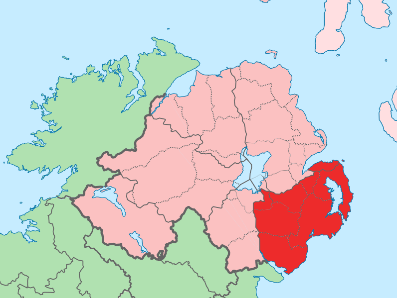
English: The island of Ireland, showing international border between Ireland and Northern Ireland, traditional provinces, traditional counties, and local authority areas in Ireland and Northern Ireland. |
| تریخ | (UTC) |
| سروت | |
| لکھاری |
|
| This is a retouched picture, which means that it has been digitally altered from its original version. Modifications: Added colours for specific county. The original can be viewed here: Island of Ireland location map.svg:
|
میں، اس کم دے کاپیرائٹ دا مالک، اس کم نوں اس لائسنس دے مطابق چھاپدا واں:
ایس فائل نوں کریٹو کامنز Attribution 2.5 پولینڈ لائسنس دتا گیا.
- تہانوں کھلھ اے:
- حصہ کرنا – کاپی، ونڈنا تے کم بھیجنا
- فیر رلانا – کم نوں فٹ کرنا
- تھلے دتیاں شرطاں نال:
- کس دے ناں – تسیں لازمی ایس کم دے بناں والے بارے دسو جنج اونے آکھیا اے یا جنج لسنس چ آکھیا گیا ہے۔
- اکو جہا شئیر کرو۔ – اگر تسیں بدلدے یا ایس کم تے بناندے تے بنن والے کم نوں اینج دے لسنس نال ای ونڈو گے۔
پہلا اپلوڈ دا ریکارڈ
This image is a derivative work of the following images:
- File:Island_of_Ireland_location_map.svg licensed with Cc-by-sa-3.0
- 2010-03-06T20:43:33Z Rannpháirtí anaithnid 1450x1807 (679207 Bytes) Fix incorrectly coloured isands.
- 2010-03-03T22:19:29Z Rannpháirtí anaithnid 1450x1807 (679744 Bytes) {{Information |Description={{de|Positionskarte von [[:de:Irland|Irland]]}} Quadratische Plattkarte, N-S-Streckung 170 %. Geographische Begrenzung der Karte: * N: 55.6° N * S: 51.2° N * W: 11.0° W * O: 5.0° W {{en|Location
Uploaded with derivativeFX
فائل دی تریخ
فائل نو اس ویلے دی حالت وچ ویکھن واسطے تاریخ/ویلے تے کلک کرو۔
| تریخ تے ویلہ | نکی مورت | پاسے | ورتن والا | تیپّݨی کرو | |
|---|---|---|---|---|---|
| موجودہ | ۱۸:۰۲, ۱۹ جولائی ۲۰۱۰ | | ۹۳۱ × ۷۰۱ (۸۲۶ کلوبائٹ) | Mabuska | fixed scotland boundary |
| ۱۶:۴۵, ۱۹ جولائی ۲۰۱۰ |  | ۹۳۴ × ۷۱۷ (۸۲۸ کلوبائٹ) | Mabuska | {{Information |Description={{en|The island of Ireland, showing international border between Northern Ireland and Republic of Ireland, traditional provinces, traditional counties, and local authority areas in the Republic of Ireland and Northern Ireland.}} |
فائل دی ورتوں
تھلے دتے گئے 1 صفحے اس فائل نال جُڑدے نیں
فائل ویاپک ورتوں
ایہہ دوجے وکیاں ایس فائل نوں ورتدے نیں –
- ar.wikipedia.org تے ورتوں
- ast.wikipedia.org تے ورتوں
- bg.wikipedia.org تے ورتوں
- ca.wikipedia.org تے ورتوں
- cs.wikipedia.org تے ورتوں
- de.wikipedia.org تے ورتوں
- en.wikipedia.org تے ورتوں
- eo.wikipedia.org تے ورتوں
- es.wikipedia.org تے ورتوں
- eu.wikipedia.org تے ورتوں
- Belfast
- Newry
- Lisburn
- Bangor (Ipar Irlanda)
- Downpatrick
- Lankide:Euskaldunaa
- Newtownards
- Banbridge
- Down konderria
- Txantiloi:Down konderriko udalerriak
- Lurganville
- Ballynahinch (Down konderria)
- Carryduff
- Comber
- Donaghadee
- Dromore (Down konderria)
- Dundonald
- Holywood
- Kilkeel
- Newcastle (Down konderria)
- Warrenpoint
- Annahilt
- Annalong
- Annsborough
- Ardglass
- Atticall
- Aughnacloy (Down konderria)
- Ballela
- Balloo (Down konderria)
- Ballybannan
- Ballybeen
- Ballydargan
- Ballygowan
- Ballyhalbert
- Ballyhay
- Ballyhornan
- Ballykinler
- Ballylesson
- Ballylough
- Ballymacmaine
ایس فائل دا ویکھو ہور جگت ورتن .