
فائل:Karte pforzheim in deutschland.png
اس توں وڈی مورت موجود نہیں۔
Karte_pforzheim_in_deutschland.png (۱۷۶ × ۲۳۴ پکسلز, فائل حجم: ۳ کلوبائٹ, MIME type: image/png)
لائسنس –
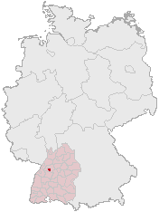
This image was generated with OpenGeoDB. The information there is placed in the public domain, images generated from OpenGeoDB are derivative works without passing the threshold of creativity, they are therefore also public domain.
| This work is ineligible for copyright and therefore in the public domain because it consists entirely of information that is common property and contains no original authorship. |
فائل دی تریخ
فائل نو اس ویلے دی حالت وچ ویکھن واسطے تاریخ/ویلے تے کلک کرو۔
| تریخ تے ویلہ | نکی مورت | پاسے | ورتن والا | تیپّݨی کرو | |
|---|---|---|---|---|---|
| موجودہ | ۱۴:۳۱, ۶ ستمبر ۲۰۰۶ | | ۱۷۶ × ۲۳۴ (۳ کلوبائٹ) | Conscious | version from de:Bild:Lage_der_kreisfreien_Stadt_Pforzheim_in_Deutschland.GIF |
| ۱۳:۵۱, ۱۶ مارچ ۲۰۰۶ |  | ۱۸۸ × ۲۳۵ (۵ کلوبائٹ) | Jed |
فائل دی ورتوں
تھلے دتے گئے 1 صفحے اس فائل نال جُڑدے نیں
فائل ویاپک ورتوں
ایہہ دوجے وکیاں ایس فائل نوں ورتدے نیں –