
فائل:LocationBritishVirginIslands.svg

Size of this PNG preview of this SVG file: ۸۰۰ × ۳۲۰ پکسلز. دوجے ریزولوشنز: ۳۲۰ × ۱۲۸ پکسلز | ۶۴۰ × ۲۵۶ پکسلز | ۱,۰۲۴ × ۴۱۰ پکسلز | ۱,۲۸۰ × ۵۱۲ پکسلز | ۲,۵۶۰ × ۱,۰۲۴ پکسلز | ۱,۷۵۰ × ۷۰۰ پکسلز ۔
اصل فائل (ایس وی جی فائل، پکسل:۱,۷۵۰ × ۷۰۰، فائل سائز: ۳۲۴ کلوبائٹ)

|
A raster version of this image is available. It should be used in place of this vector image when superior.
File:LocationBritishVirginIslands.svg → File:LocationBritishVirginIslands.png
In general, it is better to use a good SVG version. |
خلاصہ
| تفصیل |
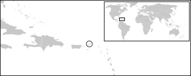
English: Location map for British Virgin Islands. Vectorised version of Image:LocationBritishVirginIslands.png |
| تریخ | (UTC) |
| سروت |
This W3C-unspecified vector image was created with Inkscape . |
| لکھاری |
|
لائسنس –
| This is a retouched picture, which means that it has been digitally altered from its original version. Modifications: Combined two maps to form a newly vectorised version of the British Virgin Islands map. The original can be viewed here: BlankMap-Caribbean.svg:
|
| میں، اس کم دے کاپیرائٹ دا مالک، اس کم نوں لوکاں واسطے دیندا واں۔ اے سارے جگ واسطے لاگو اے۔ کج ملکاں چ قانونی طور تے اے ممکن نئیں اے؛ اگر انج ای اے ے: میں ہر کسے نوں اس کم نوں کسے وی مقصد واسطے ورتن دا بغیر کسے شرط دے حق دیندا واں، اگر اوہ قانون دے خلاف نا ہوۓ۔ |
پہلا اپلوڈ دا ریکارڈ
This image is a derivative work of the following images:
- File:BlankMap-World-v2.svg licensed with PD-self
- 2011-03-27T23:08:42Z Wayiran 1243x564 (209452 Bytes) Some correction on North-west border of Iran's map + south of Caspian sea
- 2008-12-03T18:02:36Z Harbin 1326x601 (192122 Bytes)
- 2008-12-02T19:55:14Z Harbin 1326x601 (197882 Bytes)
- 2008-12-02T19:04:59Z Harbin 1326x601 (176022 Bytes) {{Information |Description={{en|1=A blank map of the world as of 2005, with country outlines. Sovereign microstates less than 2 500 km² in area are depicted as circles (see Wikipedia:Image_talk:BlankMap-World-v2.png for list
- File:BlankMap-Caribbean.svg licensed with PD-self
- 2010-09-20T02:01:50Z NuclearVacuum 896x633 (274735 Bytes) new version
- 2010-02-23T15:29:09Z NuclearVacuum 2201x1507 (214283 Bytes) cleanup
- 2010-02-11T19:26:10Z NuclearVacuum 2201x1507 (211807 Bytes) I have started from scratch and made a completely new map of the Caribbean. This current version has an invalid code, but I will work on that later.
- 2009-09-22T00:08:34Z NuclearVacuum 940x477 (252618 Bytes) {{Information |Description={{en|1=Map of the [[:en:Caribbean|Caribbean nations]].}} |Source=[[:File:BlankMap-World6.svg]]{{Inkscape}} |Author=[[User:NuclearVacuum|NuclearVacuum]] |Date=2009-09-21 |Permission= |other_versions=
Uploaded with derivativeFX
فائل دی تریخ
فائل نو اس ویلے دی حالت وچ ویکھن واسطے تاریخ/ویلے تے کلک کرو۔
| تریخ تے ویلہ | نکی مورت | پاسے | ورتن والا | تیپّݨی کرو | |
|---|---|---|---|---|---|
| موجودہ | ۰۷:۰۸, ۳۰ جون ۲۰۱۱ | ۱,۷۵۰ × ۷۰۰ (۳۲۴ کلوبائٹ) | Maky | {{Bitmap version available|LocationBritishVirginIslands.png}} {{Information |Description={{en|1=Location map for British Virgin Islands.<br> Vectorised version of Image:LocationBritishVirginIslands.png}} |Source=*File:BlankMap-World-v2.svg |
فائل دی ورتوں
تھلے دتے گئے 1 صفحے اس فائل نال جُڑدے نیں
فائل ویاپک ورتوں
ایہہ دوجے وکیاں ایس فائل نوں ورتدے نیں –
- ceb.wikipedia.org تے ورتوں
- el.wikipedia.org تے ورتوں
- en.wikipedia.org تے ورتوں
- es.wikinews.org تے ورتوں
- eu.wikipedia.org تے ورتوں
- fr.wikipedia.org تے ورتوں
- fr.wiktionary.org تے ورتوں
- gcr.wikipedia.org تے ورتوں
- ko.wikipedia.org تے ورتوں
- mk.wikipedia.org تے ورتوں
- ro.wikipedia.org تے ورتوں
- su.wikipedia.org تے ورتوں
- sv.wikipedia.org تے ورتوں
- vi.wikipedia.org تے ورتوں
- www.wikidata.org تے ورتوں