
فائل:Location Ardennes.PNG
اس توں وڈی مورت موجود نہیں۔
Location_Ardennes.PNG (۵۰۶ × ۴۳۹ پکسلز, فائل حجم: ۴۰ کلوبائٹ, MIME type: image/png)
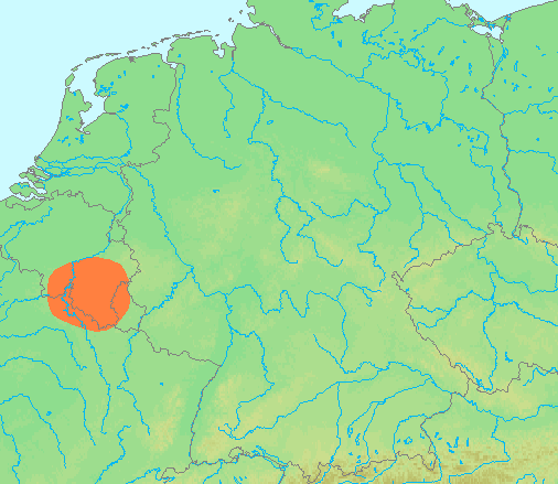
| تفصیل | Locator maps for mountain ranges : Location Ardennes.PNG |
| سروت | demis maps, see below |
| لکھاری | 13:44, 29 June 2007 (UTC) |
This image is in the public domain because it came from the site https://www.demis.nl/products/web-map-server/examples/ and was released by the copyright holder. Permission is granted to copy, distribute and/or modify this map since it is based on free of copyright images from: www.demis.nl. See also approval email on de.wp and its clarification.
|
| This work has been released into the public domain by its copyright holder, www.demis.nl. This applies worldwide. کج ملکاں چ قانونی طور تے اے ممکن نئیں اے؛ اگر انج ای اے ے: www.demis.nl ہر کسے نوں اس کم نوں کسے وی مقصد واسطے ورتن دا بغیر کسے شرط دے حق دیندا واں، اگر اوہ قانون دے خلاف نا ہوۓ۔
|
فائل دی تریخ
فائل نو اس ویلے دی حالت وچ ویکھن واسطے تاریخ/ویلے تے کلک کرو۔
| تریخ تے ویلہ | نکی مورت | پاسے | ورتن والا | تیپّݨی کرو | |
|---|---|---|---|---|---|
| موجودہ | ۱۸:۴۲, ۲۹ جون ۲۰۰۷ | | ۵۰۶ × ۴۳۹ (۴۰ کلوبائٹ) | Michiel1972 | {{Information |Description=Locator maps for mountain ranges : {{subst:PAGENAME}} |Source=demis maps, see below |Date= |Author={{Statistics Netherlands map}} |Permission=see below |other_versions= }} {{PD-Demis}} [[Category:Maps of mountain_ranges_of_Eu |
فائل دی ورتوں
تھلے دتے گئے 1 صفحے اس فائل نال جُڑدے نیں
فائل ویاپک ورتوں
ایہہ دوجے وکیاں ایس فائل نوں ورتدے نیں –
- af.wikipedia.org تے ورتوں
- ar.wikipedia.org تے ورتوں
- arz.wikipedia.org تے ورتوں
- be-tarask.wikipedia.org تے ورتوں
- ca.wikipedia.org تے ورتوں
- ceb.wikipedia.org تے ورتوں
- cs.wikipedia.org تے ورتوں
- de.wikipedia.org تے ورتوں
- de.wiktionary.org تے ورتوں
- en.wikipedia.org تے ورتوں
- eo.wikipedia.org تے ورتوں
- es.wikipedia.org تے ورتوں
- eu.wikipedia.org تے ورتوں
- fy.wikipedia.org تے ورتوں
- hy.wikipedia.org تے ورتوں
- ia.wikipedia.org تے ورتوں
- incubator.wikimedia.org تے ورتوں
- is.wikipedia.org تے ورتوں
- ja.wikipedia.org تے ورتوں
- ko.wikipedia.org تے ورتوں
- li.wikipedia.org تے ورتوں
- lt.wikipedia.org تے ورتوں
- ms.wikipedia.org تے ورتوں
- pcd.wikipedia.org تے ورتوں
- pl.wikipedia.org تے ورتوں
- pl.wiktionary.org تے ورتوں
- simple.wikipedia.org تے ورتوں
- sk.wikipedia.org تے ورتوں
- sv.wikipedia.org تے ورتوں
- th.wikipedia.org تے ورتوں
- uk.wikipedia.org تے ورتوں
- wa.wikipedia.org تے ورتوں
- www.wikidata.org تے ورتوں
- zh-yue.wikipedia.org تے ورتوں
- zh.wikipedia.org تے ورتوں