
فائل:Oxfordshire UK locator map 2010.svg

Size of this PNG preview of this SVG file: ۴۹۴ × ۶۰۰ پکسلز. دوجے ریزولوشنز: ۱۹۸ × ۲۴۰ پکسلز | ۳۹۵ × ۴۸۰ پکسلز | ۶۳۳ × ۷۶۸ پکسلز | ۸۴۳ × ۱,۰۲۴ پکسلز | ۱,۶۸۷ × ۲,۰۴۸ پکسلز | ۱,۱۰۸ × ۱,۳۴۵ پکسلز ۔
اصل فائل (ایس وی جی فائل، پکسل:۱,۱۰۸ × ۱,۳۴۵، فائل سائز: ۳۰۲ کلوبائٹ)
خلاصہ
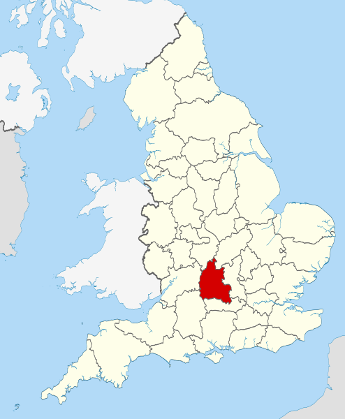
| تفصیل | Location of the ceremonial county of Oxfordshire within England. |
| تریخ | |
| سروت |
National Geospatial-Intelligence Agency
|
| لکھاری | Nilfanion |
لائسنس –
میں، اس کم دے کاپیرائٹ دا مالک، اس کم نوں اس لائسنس دے مطابق چھاپدا واں:
ایس فائل نوں کریٹو کامنز Attribution 2.5 پولینڈ لائسنس دتا گیا.
- تہانوں کھلھ اے:
- حصہ کرنا – کاپی، ونڈنا تے کم بھیجنا
- فیر رلانا – کم نوں فٹ کرنا
- تھلے دتیاں شرطاں نال:
- کس دے ناں – تسیں لازمی ایس کم دے بناں والے بارے دسو جنج اونے آکھیا اے یا جنج لسنس چ آکھیا گیا ہے۔
- اکو جہا شئیر کرو۔ – اگر تسیں بدلدے یا ایس کم تے بناندے تے بنن والے کم نوں اینج دے لسنس نال ای ونڈو گے۔

|
کاپی کرن، ونڈن تے بدلن دی ایس ڈوکومنٹ لئی اجازت دتی جاندی اے ایہناں GNU Free Documentation License, Version 1.2 شرطاں نال یا مگروں کسے وی چھپے ورین Free Software Foundation توں بنا کسے انویرینٹ سیکشن دے، ناں فرنٹ کور لکھت تے ناں بیک کور لکھت دے۔ لسنس دی اک کاپی سیکشن وچ ہیگی اے جہدا ناں اے GNU Free Documentation License۔ |
تسیں اپنی مرضی دا لائسنس چݨ سکدے اوہ۔

|
This is one of the images forming part of the Valued image set: Locator maps of the Ceremonial counties of England on Wikimedia Commons. The image set has been assessed under the valued image set criteria and is considered the most valued set on Commons within the scope:
Locator maps of the Ceremonial counties of England
You can see its nomination at Commons:Valued image candidates/Locator maps of English ceremonial counties. |
فائل دی تریخ
فائل نو اس ویلے دی حالت وچ ویکھن واسطے تاریخ/ویلے تے کلک کرو۔
| تریخ تے ویلہ | نکی مورت | پاسے | ورتن والا | تیپّݨی کرو | |
|---|---|---|---|---|---|
| موجودہ | ۰۳:۲۵, ۲۴ نومبر ۲۰۱۰ | | ۱,۱۰۸ × ۱,۳۴۵ (۳۰۲ کلوبائٹ) | Nilfanion | use ceremonial counties - corresponds with text of article better |
| ۲۱:۳۹, ۲۳ نومبر ۲۰۱۰ |  | ۱,۱۰۸ × ۱,۳۴۵ (۳۳۲ کلوبائٹ) | Nilfanion | Fix coast - add Arran | |
| ۰۵:۴۷, ۱۶ نومبر ۲۰۱۰ |  | ۱,۱۰۸ × ۱,۳۴۵ (۳۲۵ کلوبائٹ) | Nilfanion | thicker lines | |
| ۰۵:۴۴, ۱۶ نومبر ۲۰۱۰ |  | ۱,۱۰۸ × ۱,۳۴۵ (۳۲۵ کلوبائٹ) | Nilfanion | {{Information |Description=Location of Oxfordshire within England, with the administrative counties shown. |Source=Ordnance Survey [https://www.ordnancesurvey.co.uk/opendatadownload/products.html OpenData]: *County |
فائل دی ورتوں
تھلے دتے گئے 1 صفحے اس فائل نال جُڑدے نیں
فائل ویاپک ورتوں
ایہہ دوجے وکیاں ایس فائل نوں ورتدے نیں –
- af.wikipedia.org تے ورتوں
- an.wikipedia.org تے ورتوں
- ar.wikipedia.org تے ورتوں
- arz.wikipedia.org تے ورتوں
- ast.wikipedia.org تے ورتوں
- be-tarask.wikipedia.org تے ورتوں
- bg.wikipedia.org تے ورتوں
- bn.wikipedia.org تے ورتوں
- br.wikipedia.org تے ورتوں
- ca.wikipedia.org تے ورتوں
- ceb.wikipedia.org تے ورتوں
- cs.wikipedia.org تے ورتوں
- en.wikipedia.org تے ورتوں
- Oxfordshire
- Dragon Hill, Uffington
- RAF Bampton Castle
- Whitchurch-on-Thames
- Cowley Road, Oxford
- Redgrave Pinsent Rowing Lake
- Roke
- Farmoor Reservoir
- Mill Meadows, Henley-on-Thames
- River Evenlode
- Radford, Oxfordshire
- Angel & Greyhound Meadow, Oxford
- Curbridge, Oxfordshire
- Risinghurst and Sandhills
- Barford St. John and St. Michael
- Template:Oxfordshire-geo-stub
- Ardington
- Aston, Cote, Shifford and Chimney
- Aston Upthorpe
- Beckley and Stowood
- Bix and Assendon
- Blenheim, Oxfordshire
- Peckwater Quadrangle
- Bourton, Cherwell
- Bruern
- Ploughley Rural District
- Hanney
- Waterperry
- Dunsden Green
- Milton-under-Wychwood
- North Newington
- The Trout Inn
- Badbury Hill
- Oxford MSA
ایس فائل دا ویکھو ہور جگت ورتن .