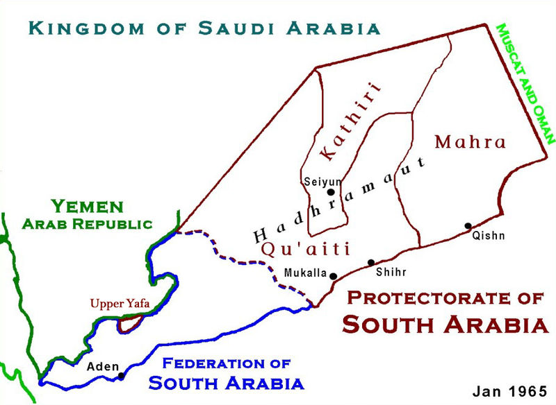
فائل:ProtectorateOfSouthArabiaMap.jpg

ایس وکھالے دا ناپ: ۸۰۰ × ۵۸۴ پکسلز۔ دوجے ریزولوشنز: ۳۲۰ × ۲۳۴ پکسلز | ۶۴۰ × ۴۶۷ پکسلز | ۹۱۲ × ۶۶۶ پکسلز ۔
اصل فائل (۹۱۲ × ۶۶۶ پکسلز, فائل حجم: ۲۷۳ کلوبائٹ, MIME type: image/jpeg)
فائل دی تریخ
فائل نو اس ویلے دی حالت وچ ویکھن واسطے تاریخ/ویلے تے کلک کرو۔
| تریخ تے ویلہ | نکی مورت | پاسے | ورتن والا | تیپّݨی کرو | |
|---|---|---|---|---|---|
| موجودہ | ۰۷:۱۲, ۱۸ جنوری ۲۰۱۰ |  | ۹۱۲ × ۶۶۶ (۲۷۳ کلوبائٹ) | Anonimosanhueza | borders removed |
| ۰۶:۱۴, ۲۸ نومبر ۲۰۰۸ |  | ۹۲۸ × ۶۸۲ (۲۸۴ کلوبائٹ) | Nickpo | {{svg|map}} {{ew|en|AjaxSmack}} == Summary == Based on Work of US Government agency == Licensing == {{PD-USGov}} Category:Maps of Yemen Category:Qu'aiti State of Shihr and Mukalla Category:Federation of South Arabia [[Category:Kathiri State | |
| ۰۳:۵۶, ۱۸ دسمبر ۲۰۰۶ |  | ۹۲۸ × ۶۸۲ (۱۱۸ کلوبائٹ) | Electionworld | {{ew|en|AjaxSmack}} == Summary == Based on Work of US Government agency == Licensing == {{PD-USGov}} |
فائل دی ورتوں
تھلے دتے گئے 2 صفحے اس فائل نال جُڑدے نیں
فائل ویاپک ورتوں
ایہہ دوجے وکیاں ایس فائل نوں ورتدے نیں –
- ar.wikipedia.org تے ورتوں
- be.wikipedia.org تے ورتوں
- bn.wikipedia.org تے ورتوں
- ca.wikipedia.org تے ورتوں
- cs.wikipedia.org تے ورتوں
- de.wikipedia.org تے ورتوں
- en.wikipedia.org تے ورتوں
- es.wikipedia.org تے ورتوں
- fr.wikipedia.org تے ورتوں
- fr.wiktionary.org تے ورتوں
- hr.wikipedia.org تے ورتوں
- id.wikipedia.org تے ورتوں
- it.wikipedia.org تے ورتوں
- ja.wikipedia.org تے ورتوں
- lt.wikipedia.org تے ورتوں
- mk.wikipedia.org تے ورتوں
- no.wikipedia.org تے ورتوں
- pl.wikipedia.org تے ورتوں
- pt.wikipedia.org تے ورتوں
- ru.wikipedia.org تے ورتوں
ایس فائل دا ویکھو ہور جگت ورتن .


