
فائل:Sulphur Tornado Radar Image.png
ایس وکھالے دا ناپ: ۸۰۰ × ۳۹۴ پکسلز۔ دوجے ریزولوشنز: ۳۲۰ × ۱۵۸ پکسلز | ۶۴۰ × ۳۱۵ پکسلز | ۱,۰۲۴ × ۵۰۵ پکسلز | ۱,۲۸۰ × ۶۳۱ پکسلز | ۲,۳۲۲ × ۱,۱۴۴ پکسلز ۔
اصل فائل (۲,۳۲۲ × ۱,۱۴۴ پکسلز, فائل حجم: ۵.۰۳ میگابائٹ, MIME type: image/png)
خلاصہ
| تفصیل |
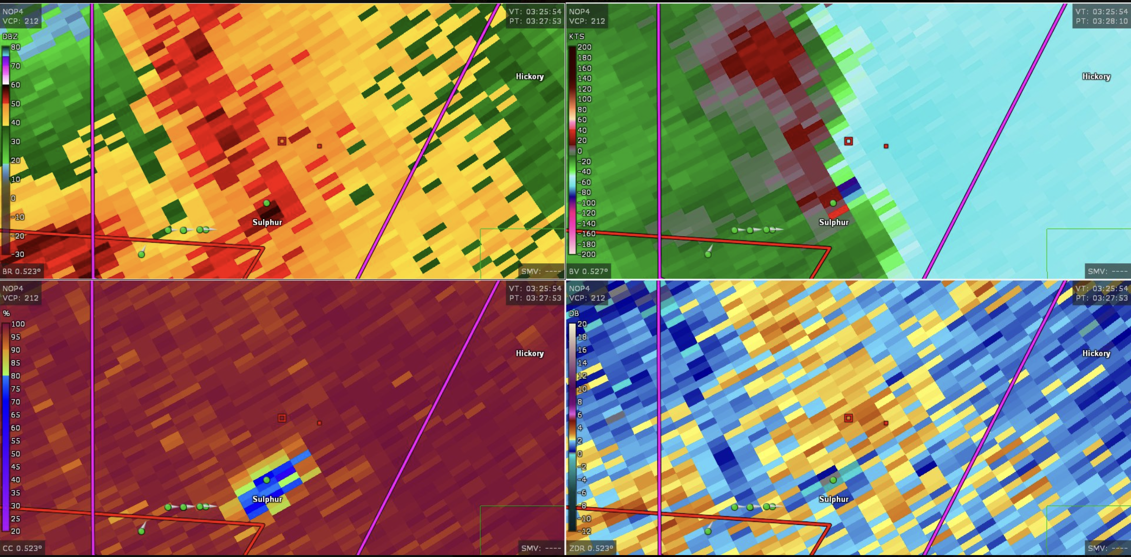
English: This image shows the radar presentation of a damaging tornado in Sulphu,r Oklahoma on April 27, 2024. |
| تریخ | |
| سروت | NEXRAD |
| لکھاری | National Weather Service, Federal Aviation Administration, United States Air Force |
لائسنس –
This image is in the public domain because it is from one or more of the U.S. government’s 159 NEXRAD radars, which are jointly owned and operated by the National Weather Service (NWS), an agency of the National Oceanic and Atmospheric Administration (NOAA) within the United States Department of Commerce, the Federal Aviation Administration (FAA) within the Department of Transportation, and the U.S. Air Force within the Department of Defense.
Thus all NEXRAD images are public domain.
|
  |
فائل دی تریخ
فائل نو اس ویلے دی حالت وچ ویکھن واسطے تاریخ/ویلے تے کلک کرو۔
| تریخ تے ویلہ | نکی مورت | پاسے | ورتن والا | تیپّݨی کرو | |
|---|---|---|---|---|---|
| موجودہ | ۰۰:۴۴, ۲۹ اپریل ۲۰۲۴ | | ۲,۳۲۲ × ۱,۱۴۴ (۵.۰۳ میگابائٹ) | Floriangkmcc | Uploaded a work by The National Weather Service from Nexrad Radar with UploadWizard |
فائل دی ورتوں
اس فائل نال جڑیا کوئی صفحہ نئیں۔