
فائل:Victoria locator-MJC.png
اس توں وڈی مورت موجود نہیں۔
Victoria_locator-MJC.png (۵۶۳ × ۴۷۶ پکسلز, فائل حجم: ۱۲ کلوبائٹ, MIME type: image/png)

|
This locator map image could be re-created using vector graphics as an SVG file. This has several advantages; see Commons:Media for cleanup for more information. If an SVG form of this image is available, please upload it and afterwards replace this template with
{{vector version available|new image name}}.
It is recommended to name the SVG file “Victoria locator-MJC.svg”—then the template Vector version available (or Vva) does not need the new image name parameter. |
خلاصہ
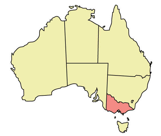
Map of Australia highlighting Victoria
Made in Adobe Illustrator by Martynam and released under the GFDL
لائسنس –
| ایس فائل نوں کریٹو کامنز Attribution 2.5 پولینڈ لائسنس دتا گیا. Subject to disclaimers. | ||
| ||
| اس لائسنس دا ٹیگ GFDL دے مطابق اس فائل چ پایا گیا اے licensing update۔ |

|
کاپی کرن، ونڈن تے بدلن دی ایس ڈوکومنٹ لئی اجازت دتی جاندی اے ایہناں GNU Free Documentation License, Version 1.2 شرطاں نال یا مگروں کسے وی چھپے ورین Free Software Foundation توں بنا کسے انویرینٹ سیکشن دے، ناں فرنٹ کور لکھت تے ناں بیک کور لکھت دے۔ لسنس دی اک کاپی سیکشن وچ ہیگی اے جہدا ناں اے GNU Free Documentation License۔ Subject to disclaimers. |
فائل دی تریخ
فائل نو اس ویلے دی حالت وچ ویکھن واسطے تاریخ/ویلے تے کلک کرو۔
| تریخ تے ویلہ | نکی مورت | پاسے | ورتن والا | تیپّݨی کرو | |
|---|---|---|---|---|---|
| موجودہ | ۰۳:۴۹, ۳۱ دسمبر ۲۰۰۵ | | ۵۶۳ × ۴۷۶ (۱۲ کلوبائٹ) | Snowdog | Map of Australia highlighting Victoria Made in Adobe Illustrator by Martynam and released under the GFDL Category:Maps of Australia |
فائل دی ورتوں
تھلے دتے گئے 1 صفحے اس فائل نال جُڑدے نیں
فائل ویاپک ورتوں
ایہہ دوجے وکیاں ایس فائل نوں ورتدے نیں –
- af.wikipedia.org تے ورتوں
- ar.wikipedia.org تے ورتوں
- be.wikipedia.org تے ورتوں
- ckb.wikipedia.org تے ورتوں
- cs.wikipedia.org تے ورتوں
- cy.wikipedia.org تے ورتوں
- de.wikipedia.org تے ورتوں
- en.wikipedia.org تے ورتوں
- City of Maroondah
- Hobsons Bay
- Paisley railway station, Melbourne
- Galvin railway station
- Williamstown Pier railway station
- Chum Creek, Victoria
- Don Valley, Victoria
- Gruyere, Victoria
- Kalorama, Victoria
- Launching Place, Victoria
- Macclesfield, Victoria
- Menzies Creek, Victoria
- Seville, Victoria
- Seville East, Victoria
- Sherbrooke, Victoria
- Tremont, Victoria
- Yellingbo, Victoria
- Cranbourne South, Victoria
- Narre Warren East, Victoria
- Warneet, Victoria
- Dandenong North, Victoria
- Dandenong South, Victoria
- Noble Park North, Victoria
- Skye, Victoria
- Blairgowrie, Victoria
- Boneo, Victoria
- Main Ridge, Victoria
- Merricks North, Victoria
- Red Hill, Victoria
- Red Hill South, Victoria
- Capel Sound, Victoria
- Simpson Barracks
- Yallambie
- Attwood, Victoria
- Coolaroo, Victoria
- Oaklands Junction, Victoria
- Somerton, Victoria
- Burnside, Victoria
- Hillside, Victoria
- Kurunjang
- Rockbank, Victoria
- Ardeer, Victoria
- Calder Park, Victoria
ایس فائل دا ویکھو ہور جگت ورتن .