
فائل:Albania districts.svg

Size of this PNG preview of this SVG file: ۲۸۴ × ۶۰۰ پکسلز. دوجے ریزولوشنز: ۱۱۳ × ۲۴۰ پکسلز | ۲۲۷ × ۴۸۰ پکسلز | ۳۶۳ × ۷۶۸ پکسلز | ۴۸۵ × ۱,۰۲۴ پکسلز | ۹۶۹ × ۲,۰۴۸ پکسلز | ۱,۰۰۰ × ۲,۱۱۲ پکسلز ۔
اصل فائل (ایس وی جی فائل، پکسل:۱,۰۰۰ × ۲,۱۱۲، فائل سائز: ۱۱۱ کلوبائٹ)
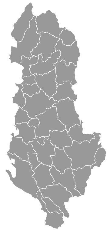
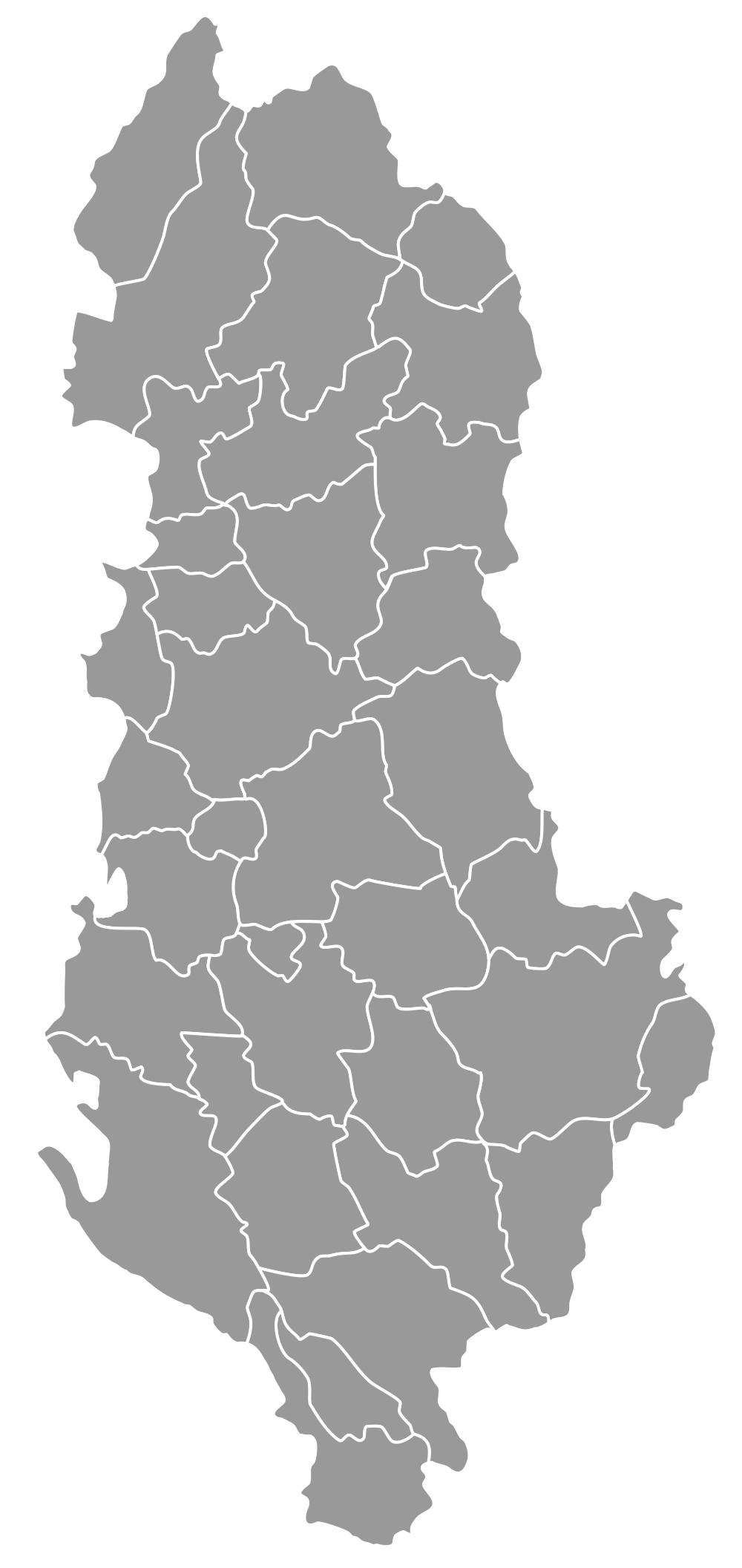
| تفصیل | Blank map of the districts of Albania, useful for numbering/labelling for other languages. | ||
| تریخ | (UTC) | ||
| سروت | Albania districts blank 2.svg | ||
| لکھاری |
|
||
| دوجے ورژن | Derivative works of this file: Albania District.svg | ||
| SVG genesis |
|
میں، اس کم دے کاپیرائٹ دا مالک، اس کم نوں اس لائسنس دے مطابق چھاپدا واں:
اے فائل ایس لائسنس تھلے آندی اے Creative Commons Attribution 1.0 Generic .
- تہانوں کھلھ اے:
- حصہ کرنا – کاپی، ونڈنا تے کم بھیجنا
- فیر رلانا – کم نوں فٹ کرنا
- تھلے دتیاں شرطاں نال:
- کس دے ناں – تسیں لازمی ایس کم دے بناں والے بارے دسو جنج اونے آکھیا اے یا جنج لسنس چ آکھیا گیا ہے۔
| ایس فائل نوں کریٹو کامنز Attribution 2.5 پولینڈ لائسنس دتا گیا. | ||
| ||
| اس لائسنس دا ٹیگ GFDL دے مطابق اس فائل چ پایا گیا اے licensing update۔ |

|
کاپی کرن، ونڈن تے بدلن دی ایس ڈوکومنٹ لئی اجازت دتی جاندی اے ایہناں GNU Free Documentation License, Version 1.2 شرطاں نال یا مگروں کسے وی چھپے ورین Free Software Foundation توں بنا کسے انویرینٹ سیکشن دے، ناں فرنٹ کور لکھت تے ناں بیک کور لکھت دے۔ لسنس دی اک کاپی سیکشن وچ ہیگی اے جہدا ناں اے GNU Free Documentation License۔ |
تسیں اپنی مرضی دا لائسنس چݨ سکدے اوہ۔
پہلا اپلوڈ دا ریکارڈ
This image is a derivative work of the following images:
- File:Albania districts blank 2.svg licensed with Cc-by-2.5, Cc-by-sa-3.0-migrated, GFDL
- 2011-05-07T18:42:02Z Malyszkz 1000x2112 (112940 Bytes) {{Information |Description=Blank map of the districts of Albania, useful for numbering/labelling for other languages. |Source=*[[:File:Albania_districts_blank.png|]] |Date=2011-05-07 18:41 (UTC) |Author=*[[:File:Albania_distr
Uploaded with derivativeFX
فائل دی تریخ
فائل نو اس ویلے دی حالت وچ ویکھن واسطے تاریخ/ویلے تے کلک کرو۔
| تریخ تے ویلہ | نکی مورت | پاسے | ورتن والا | تیپّݨی کرو | |
|---|---|---|---|---|---|
| موجودہ | ۰۰:۳۶, ۸ مئی ۲۰۱۱ | | ۱,۰۰۰ × ۲,۱۱۲ (۱۱۱ کلوبائٹ) | Malyszkz | change border size |
| ۲۳:۴۶, ۷ مئی ۲۰۱۱ |  | ۱,۰۰۰ × ۲,۱۱۲ (۱۱۱ کلوبائٹ) | Malyszkz | {{Information |Description=Blank map of the districts of Albania, useful for numbering/labelling for other languages. |Source=*File:Albania_districts_blank_2.svg |Date=2011-05-07 18:46 (UTC) |Author=*File:Albania_districts_blank_2.svg: *[[:Fil |
فائل دی ورتوں
تھلے دتے گئے 2 صفحے اس فائل نال جُڑدے نیں
فائل ویاپک ورتوں
ایہہ دوجے وکیاں ایس فائل نوں ورتدے نیں –
- en.wikipedia.org تے ورتوں
- sq.wikipedia.org تے ورتوں
- ur.wikipedia.org تے ورتوں