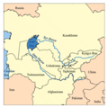
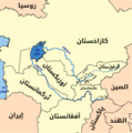
فائل:Aral map.png
Aral_map.png (۲۷۹ × ۲۸۱ پکسلز, فائل حجم: ۱۹ کلوبائٹ, MIME type: image/png)
فائل دی تریخ
فائل نو اس ویلے دی حالت وچ ویکھن واسطے تاریخ/ویلے تے کلک کرو۔
| تریخ تے ویلہ | نکی مورت | پاسے | ورتن والا | تیپّݨی کرو | |
|---|---|---|---|---|---|
| موجودہ | ۲۲:۴۱, ۹ اپریل ۲۰۰۸ |  | ۲۷۹ × ۲۸۱ (۱۹ کلوبائٹ) | Claus Obana | |
| ۱۹:۰۲, ۲۲ جنوری ۲۰۰۷ |  | ۳۰۰ × ۳۰۰ (۱۸ کلوبائٹ) | Kmusser | added label for Naryn River | |
| ۲۳:۵۲, ۱۶ نومبر ۲۰۰۵ |  | ۳۰۰ × ۳۰۰ (۱۶ کلوبائٹ) | Kmusser | ||
| ۲۳:۳۳, ۱۶ نومبر ۲۰۰۵ |  | ۳۰۰ × ۳۰۰ (۶۵ کلوبائٹ) | Kmusser | This is a map of area around the Aral Sea including the Amu Darya and Syr Darya rivers. I, Karl Musser, created it based on USGS data. The Aral Sea b |
فائل دی ورتوں
تھلے دتے گئے 1 صفحے اس فائل نال جُڑدے نیں
فائل ویاپک ورتوں
ایہہ دوجے وکیاں ایس فائل نوں ورتدے نیں –
- af.wikipedia.org تے ورتوں
- ar.wikipedia.org تے ورتوں
- arz.wikipedia.org تے ورتوں
- ast.wikipedia.org تے ورتوں
- az.wikipedia.org تے ورتوں
- ba.wikipedia.org تے ورتوں
- be-tarask.wikipedia.org تے ورتوں
- be.wikipedia.org تے ورتوں
- bg.wikipedia.org تے ورتوں
- br.wikipedia.org تے ورتوں
- ca.wikipedia.org تے ورتوں
- ceb.wikipedia.org تے ورتوں
- cs.wikipedia.org تے ورتوں
- cv.wikipedia.org تے ورتوں
- cy.wikipedia.org تے ورتوں
- da.wikipedia.org تے ورتوں
- de.wikipedia.org تے ورتوں
- diq.wikipedia.org تے ورتوں
- el.wikipedia.org تے ورتوں
- en.wikipedia.org تے ورتوں
- en.wiktionary.org تے ورتوں
- eo.wikipedia.org تے ورتوں
- es.wikipedia.org تے ورتوں
- eu.wikipedia.org تے ورتوں
- fa.wikipedia.org تے ورتوں
- fi.wikipedia.org تے ورتوں
ایس فائل دا ویکھو ہور جگت ورتن .


