
فائل:Chamba Kangra Bilaspur Mandi Kulu 1911.jpeg
اصل فائل (۷۴۴ × ۸۷۳ پکسلز, فائل حجم: ۱۳۰ کلوبائٹ, MIME type: image/jpeg)
خلاصہ
| تفصیل |
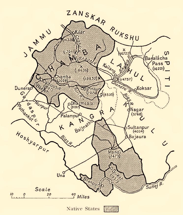
English: Map of some Indian princely states in the "Shimla Hill/Punjab Hill Agency" amongst them Chamba, Kangra, Bilaspur (= Khalur), Mandi, Kulu, 1911
Deutsch: Karte einiger kleinerer indischer Fürstenstaaten in der "Shimla Hill/Punjab Hill Agency" unter anderem Chamba, Kangra, Bilaspur(= Khalur), Mandi, Kulu, 1911 |
| تریخ | |
| سروت | Provincial Geographies of India , Vol. III |
| لکھاری | Holland, Thomas H. (Thomas Henry), Sir |


لائسنس –
|
This work is in the public domain in its country of origin and other countries and areas where the copyright term is the author's life plus 70 years or fewer.
| |
| ایہ فائل دے بارے چ دس اے جے اے کاپی حف دیاں روکاں توں کھلی اے تے نالدے رلدے حقاں توں وی۔ | |
فائل دی تریخ
فائل نو اس ویلے دی حالت وچ ویکھن واسطے تاریخ/ویلے تے کلک کرو۔
| تریخ تے ویلہ | نکی مورت | پاسے | ورتن والا | تیپّݨی کرو | |
|---|---|---|---|---|---|
| موجودہ | ۰۷:۰۳, ۲۹ جون ۲۰۱۴ | | ۷۴۴ × ۸۷۳ (۱۳۰ کلوبائٹ) | Xufanc | Sepia tone |
| ۲۰:۳۰, ۱۸ جنوری ۲۰۱۰ |  | ۷۴۴ × ۸۷۳ (۱۲۳ کلوبائٹ) | Zenwort | {{Information |Description={{en|1=Map of some Indian princely states in the "Shimla Hill/Punjab Hill Agency" amongst them Chamba, Kangra, Bilaspur (= Khalur), Mandi, Kulu, 1911}} {{de|1=Karte einiger kleinerer indischer Fürstenstaaten in der "Shimla Hill |
فائل دی ورتوں
تھلے دتے گئے 2 صفحے اس فائل نال جُڑدے نیں
فائل ویاپک ورتوں
ایہہ دوجے وکیاں ایس فائل نوں ورتدے نیں –
- br.wikipedia.org تے ورتوں
- ca.wikipedia.org تے ورتوں
- de.wikipedia.org تے ورتوں
- en.wikipedia.org تے ورتوں
- hi.wikipedia.org تے ورتوں
- it.wikipedia.org تے ورتوں
- or.wikipedia.org تے ورتوں
- ru.wikipedia.org تے ورتوں
- simple.wikipedia.org تے ورتوں
- ta.wikipedia.org تے ورتوں
- ur.wikipedia.org تے ورتوں
- www.wikidata.org تے ورتوں