
فائل:China Xinjiang adm location map.svg

اصل فائل (ایس وی جی فائل، پکسل:۲,۲۲۰ × ۱,۹۳۹، فائل سائز: ۴۸۵ کلوبائٹ)
خلاصہ
| تفصیل |
Deutsch: Positionskarte von Xinjiang, Volksrepublik China
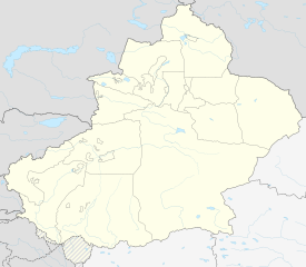
English: Location map of Xinjiang, People's Republic of China
|
||||||||||||
| تریخ | |||||||||||||
| سروت |
Own work using:
|
||||||||||||
| لکھاری | NordNordWest | ||||||||||||
| دوجے ورژن |
|
||||||||||||
| SVG genesis | This world map was created with Adobe Illustrator.
|
||||||||||||


لائسنس –
Usage of this file with:

explanatory notes: Legally binding is only the full legalcode. For a free usage I recommend to respect the following licence conditions:
1. Provide my name as given above: NordNordWest,
2. a copy of, or the URI for, the applicable license: https://creativecommons.org/licenses/by-sa/3.0/de/legalcode,
3. the title of the work,
4. in the case of an adaptation, a credit identifying the use of the work in the adaptation.
This license and the rights granted hereunder will terminate automatically upon any breach by you of the terms of this license. Any of the above conditions can be waived if you get permission from the copyright holder. If you have questions or wish differing conditions, please contact me through nnwest or my discussion page ![]() t-online.de
t-online.de
- تہانوں کھلھ اے:
- حصہ کرنا – کاپی، ونڈنا تے کم بھیجنا
- فیر رلانا – کم نوں فٹ کرنا
- تھلے دتیاں شرطاں نال:
- کس دے ناں – تسیں لازمی ایس کم دے بناں والے بارے دسو جنج اونے آکھیا اے یا جنج لسنس چ آکھیا گیا ہے۔
- اکو جہا شئیر کرو۔ – اگر تسیں بدلدے یا ایس کم تے بناندے تے بنن والے کم نوں اینج دے لسنس نال ای ونڈو گے۔

فائل دی تریخ
فائل نو اس ویلے دی حالت وچ ویکھن واسطے تاریخ/ویلے تے کلک کرو۔
| تریخ تے ویلہ | نکی مورت | پاسے | ورتن والا | تیپّݨی کرو | |
|---|---|---|---|---|---|
| موجودہ | ۰۱:۰۶, ۱۵ فروری ۲۰۲۰ | | ۲,۲۲۰ × ۱,۹۳۹ (۴۸۵ کلوبائٹ) | NordNordWest | == {{int:filedesc}} == {{Information |Description= {{de|1=Positionskarte von Xinjiang, Volksrepublik China}} {{en|1=Location map of Xinjiang, People's Republic of China}} {{Location map series N |stretching=135 |top=49.4 |bottom=34.2 |left=73.2 |right=96.7 }} |Source={{Own using}} * United States National Imagery and Mapping Agency data * World Data Base II data |Date=2020-02-14 |Author={{U|NordNordWest}} |Permission= |other_versions=<gallery>China Xinjiang rel location map.svg</gallery> }} {... |
فائل دی ورتوں
تھلے دتے گئے 1 صفحے اس فائل نال جُڑدے نیں
فائل ویاپک ورتوں
ایہہ دوجے وکیاں ایس فائل نوں ورتدے نیں –
- bn.wikipedia.org تے ورتوں
- cdo.wikipedia.org تے ورتوں
- cv.wikipedia.org تے ورتوں
- de.wikipedia.org تے ورتوں
- en.wikipedia.org تے ورتوں
- Tashkurgan Tajik Autonomous County
- Shihezi
- Tacheng
- Aral, Xinjiang
- Ürümqi Diwopu International Airport
- Wujiaqu
- Qapqal Xibe Autonomous County
- Burqin County
- Qinggil County
- Jeminay County
- Yumin County
- Shawan, Xinjiang
- Toli County
- Emin County
- Xinhe County, Xinjiang
- Kalpin County
- Awat County
- Baicheng County
- Kargilik County
- Yopurga County
- Makit County
- Ulugqat County
ایس فائل دا ویکھو ہور جگت ورتن .