
فائل:El Camino Real de Tierra Adentro National Historic Trail by Samat Jain.jpg

ایس وکھالے دا ناپ: ۸۰۰ × ۴۹۴ پکسلز۔ دوجے ریزولوشنز: ۳۲۰ × ۱۹۸ پکسلز | ۶۴۰ × ۳۹۶ پکسلز | ۱,۰۲۴ × ۶۳۳ پکسلز | ۱,۲۸۰ × ۷۹۱ پکسلز | ۲,۵۶۰ × ۱,۵۸۲ پکسلز | ۳,۸۷۲ × ۲,۳۹۳ پکسلز ۔
اصل فائل (۳,۸۷۲ × ۲,۳۹۳ پکسلز, فائل حجم: ۴.۰۷ میگابائٹ, MIME type: image/jpeg)
خلاصہ
| تفصیل |
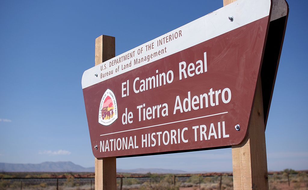
The Yost Escarpment Trailhead sign, just off of Upham Road east of Truth or Consequences, New Mexico, and a mile south of Spaceport America. The El Camino Real de Tierra Adentro (Spanish for "The Royal Road of the Interior Land") is an ancient travel route between Santa Fe and Mexico City, whose use started in the late 16th century. The portion that travels through New Mexico passes through an arid desert known as the Jornada del Muerto (Spanish for "Journey of the Dead Man"), within which was recently created a National Historic Trail. Portions of this trail are open for hiking. |
| تریخ | |
| سروت |
El Camino Real de Tierra Adentro National Historic Trail
|
| لکھاری | Samat Jain from New York City, USA |
| Camera location | | View this and other nearby images on: OpenStreetMap |
|---|
لائسنس –
ایس فائل نوں کریٹو کامنز Attribution 2.0 جنرک لائسنس دتا گیا.
- تہانوں کھلھ اے:
- حصہ کرنا – کاپی، ونڈنا تے کم بھیجنا
- فیر رلانا – کم نوں فٹ کرنا
- تھلے دتیاں شرطاں نال:
- کس دے ناں – تسیں لازمی ایس کم دے بناں والے بارے دسو جنج اونے آکھیا اے یا جنج لسنس چ آکھیا گیا ہے۔
- اکو جہا شئیر کرو۔ – اگر تسیں بدلدے یا ایس کم تے بناندے تے بنن والے کم نوں اینج دے لسنس نال ای ونڈو گے۔
| This image, originally posted to Flickr, was reviewed on March 16, 2012 by the administrator or reviewer File Upload Bot (Magnus Manske), who confirmed that it was available on Flickr under the stated license on that date. |
فائل دی تریخ
فائل نو اس ویلے دی حالت وچ ویکھن واسطے تاریخ/ویلے تے کلک کرو۔
| تریخ تے ویلہ | نکی مورت | پاسے | ورتن والا | تیپّݨی کرو | |
|---|---|---|---|---|---|
| موجودہ | ۱۸:۵۸, ۱۶ مارچ ۲۰۱۲ | | ۳,۸۷۲ × ۲,۳۹۳ (۴.۰۷ میگابائٹ) | File Upload Bot (Magnus Manske) | {{Information |Description=The Yost Escarpment Trailhead sign, just off of Upham Road east of Truth or Consequences, New Mexico, and a mile south of Spaceport America. The [http://en.wikipedia.org/wiki/El_Camino_Real_de_Tierra_Adentro El Camino Real d... |
فائل دی ورتوں
تھلے دتے گئے 1 صفحے اس فائل نال جُڑدے نیں
فائل ویاپک ورتوں
ایہہ دوجے وکیاں ایس فائل نوں ورتدے نیں –
- de.wikipedia.org تے ورتوں
- en.wikipedia.org تے ورتوں
- en.wikivoyage.org تے ورتوں
- es.wikipedia.org تے ورتوں
- he.wikipedia.org تے ورتوں
- hr.wikipedia.org تے ورتوں
- it.wikivoyage.org تے ورتوں
- ja.wikipedia.org تے ورتوں
- mt.wikipedia.org تے ورتوں
- no.wikipedia.org تے ورتوں
- tr.wikipedia.org تے ورتوں
- ur.wikipedia.org تے ورتوں