
فائل:England in the uk outline map.png
اس توں وڈی مورت موجود نہیں۔
England_in_the_uk_outline_map.png (۳۶۹ × ۴۲۰ پکسلز, فائل حجم: ۷ کلوبائٹ, MIME type: image/png)
خلاصہ
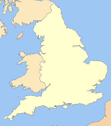
| تفصیل |
English: A blank map of the England, inside the United Kingdom |
| سروت | File:Uk outline map.png |
| لکھاری | ChrisO modified by User:Xhandler |
| دوجے ورژن | Derivative works of this file: England in the UK - Northumberland outlined.png |
لائسنس –

|
کاپی کرن، ونڈن تے بدلن دی ایس ڈوکومنٹ لئی اجازت دتی جاندی اے ایہناں GNU Free Documentation License, Version 1.2 شرطاں نال یا مگروں کسے وی چھپے ورین Free Software Foundation توں بنا کسے انویرینٹ سیکشن دے، ناں فرنٹ کور لکھت تے ناں بیک کور لکھت دے۔ لسنس دی اک کاپی سیکشن وچ ہیگی اے جہدا ناں اے GNU Free Documentation License۔ |
| ایس فائل نوں کریٹو کامنز Attribution 2.5 پولینڈ لائسنس دتا گیا. | ||
| ||
| اس لائسنس دا ٹیگ GFDL دے مطابق اس فائل چ پایا گیا اے licensing update۔ |
فائل دی تریخ
فائل نو اس ویلے دی حالت وچ ویکھن واسطے تاریخ/ویلے تے کلک کرو۔
| تریخ تے ویلہ | نکی مورت | پاسے | ورتن والا | تیپّݨی کرو | |
|---|---|---|---|---|---|
| موجودہ | ۰۳:۱۶, ۲۰ مارچ ۲۰۰۹ | | ۳۶۹ × ۴۲۰ (۷ کلوبائٹ) | Mahahahaneapneap | Compressed |
| ۱۲:۵۹, ۱۱ جولائی ۲۰۰۸ |  | ۳۶۹ × ۴۲۰ (۱۱ کلوبائٹ) | Chandler~commonswiki | zoomed in | |
| ۱۱:۲۳, ۱۱ جولائی ۲۰۰۸ |  | ۶۰۰ × ۸۰۰ (۲۵ کلوبائٹ) | Chandler~commonswiki | {{Information |Description={{en|1=A blank map of the England, inside the United Kingdom}} |Source=Image:Uk_outline_map.png |Author=ChrisO modified by User:Xhandler |Date= |Permission= |other_versions= }} {{ImageUpload|full}} [[Cat |
فائل دی ورتوں
تھلے دتے گئے 1 صفحے اس فائل نال جُڑدے نیں
فائل ویاپک ورتوں
ایہہ دوجے وکیاں ایس فائل نوں ورتدے نیں –
- cy.wikipedia.org تے ورتوں
- de.wikipedia.org تے ورتوں
- en.wikipedia.org تے ورتوں
- fr.wikipedia.org تے ورتوں
- he.wikipedia.org تے ورتوں
- hy.wikipedia.org تے ورتوں
- uk.wikipedia.org تے ورتوں
- zh.wikipedia.org تے ورتوں