
فائل:Europa 1890.jpg

ایس وکھالے دا ناپ: ۷۶۶ × ۵۹۹ پکسلز۔ دوجے ریزولوشنز: ۳۰۷ × ۲۴۰ پکسلز | ۶۱۴ × ۴۸۰ پکسلز | ۹۸۲ × ۷۶۸ پکسلز | ۱,۲۸۰ × ۱,۰۰۱ پکسلز | ۲,۵۰۰ × ۱,۹۵۶ پکسلز ۔
اصل فائل (۲,۵۰۰ × ۱,۹۵۶ پکسلز, فائل حجم: ۱.۸۴ میگابائٹ, MIME type: image/jpeg)
خلاصہ
| Description |
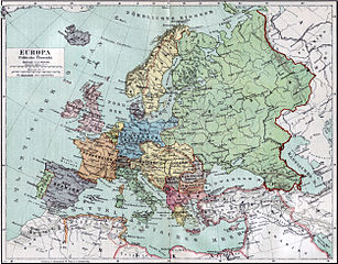
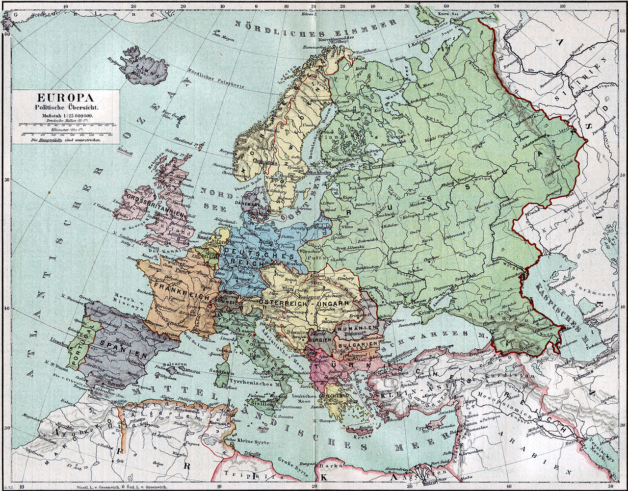
Politische Karte Europas ca. 1890 |
|||||
| تریخ | ||||||
| سروت | Meyers Kleines Konversationslexikon. Fünfte, umgearbeitete und vermehrte Auflage. Bd. 1. Bibliographisches Institut, Leipzig und Wien 1892. | |||||
| Creator |
unbekannt, scan by sidonius 15:36, 7 November 2006 (UTC) |
|||||
| اجازت (فائل نوں دوبارہ ورتنا) |
|
|||||
| Georeferencing | If inappropriate please set warp_status = skip to hide. | |||||
| دوجے ورژن | Derivative works of this file: Blank map of Europe 1890.svg |

_en.png)
.png)
.jpg)
فائل دی تریخ
فائل نو اس ویلے دی حالت وچ ویکھن واسطے تاریخ/ویلے تے کلک کرو۔
| تریخ تے ویلہ | نکی مورت | پاسے | ورتن والا | تیپّݨی کرو | |
|---|---|---|---|---|---|
| موجودہ | ۲۰:۳۶, ۷ نومبر ۲۰۰۶ | | ۲,۵۰۰ × ۱,۹۵۶ (۱.۸۴ میگابائٹ) | Sidonius | {{Information |Description=Politische Karte Europas ca. 1890 |Source=Meyers Kleines Konversationslexikon. Fünfte, umgearbeitete und vermehrte Auflage. Bd. 1. Bibliographisches Institut, Leipzig und Wien 1892. |Date=1892 |Author=unbekannt, |
فائل دی ورتوں
تھلے دتے گئے 1 صفحے اس فائل نال جُڑدے نیں
فائل ویاپک ورتوں
ایہہ دوجے وکیاں ایس فائل نوں ورتدے نیں –
- bn.wikipedia.org تے ورتوں
- de.wikipedia.org تے ورتوں
- de.wikibooks.org تے ورتوں
- en.wikipedia.org تے ورتوں
- et.wikipedia.org تے ورتوں
- fa.wikipedia.org تے ورتوں
- fr.wikipedia.org تے ورتوں
- hu.wikipedia.org تے ورتوں
- it.wikipedia.org تے ورتوں
- mk.wikipedia.org تے ورتوں
- pl.wikipedia.org تے ورتوں
- sa.wikipedia.org تے ورتوں
- scn.wikipedia.org تے ورتوں
- skr.wikipedia.org تے ورتوں
- uk.wikipedia.org تے ورتوں
- ur.wikipedia.org تے ورتوں