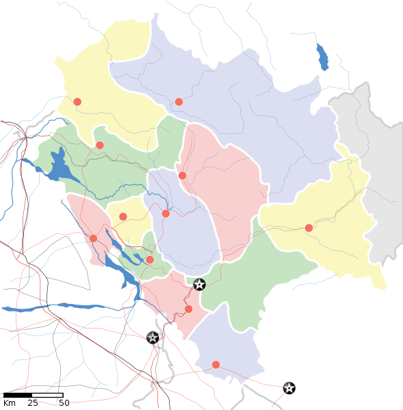
فائل:Himachal Pradesh locator map.svg

Size of this PNG preview of this SVG file: ۵۸۹ × ۵۹۹ پکسلز. دوجے ریزولوشنز: ۲۳۶ × ۲۴۰ پکسلز | ۴۷۲ × ۴۸۰ پکسلز | ۷۵۵ × ۷۶۸ پکسلز | ۱,۰۰۷ × ۱,۰۲۴ پکسلز | ۲,۰۱۳ × ۲,۰۴۸ پکسلز | ۱,۰۳۹ × ۱,۰۵۷ پکسلز ۔
اصل فائل (ایس وی جی فائل، پکسل:۱,۰۳۹ × ۱,۰۵۷، فائل سائز: ۱۳۸ کلوبائٹ)
فائل دی تریخ
فائل نو اس ویلے دی حالت وچ ویکھن واسطے تاریخ/ویلے تے کلک کرو۔
| تریخ تے ویلہ | نکی مورت | پاسے | ورتن والا | تیپّݨی کرو | |
|---|---|---|---|---|---|
| موجودہ | ۲۳:۰۶, ۱۴ اپریل ۲۰۲۰ |  | ۱,۰۳۹ × ۱,۰۵۷ (۱۳۸ کلوبائٹ) | C1MM | Reverted to version as of 08:30, 11 April 2016 (UTC) |
| ۲۳:۰۵, ۱۴ اپریل ۲۰۲۰ |  | ۱,۷۳۵ × ۱,۷۶۱ (۱۲۷ کلوبائٹ) | C1MM | Standardized | |
| ۱۳:۳۰, ۱۱ اپریل ۲۰۱۶ |  | ۱,۰۳۹ × ۱,۰۵۷ (۱۳۸ کلوبائٹ) | Snjsharma | Reverted to version as of 16:48, 4 June 2007 (UTC) | |
| ۱۱:۴۹, ۱۴ مئی ۲۰۱۳ |  | ۲,۰۰۰ × ۲,۰۳۵ (۸۵۴ کلوبائٹ) | Snjsharma | New Version. | |
| ۲۱:۴۸, ۴ جون ۲۰۰۷ |  | ۱,۰۳۹ × ۱,۰۵۷ (۱۳۸ کلوبائٹ) | Planemad | {{WikiProject_India_Maps |Title=Himachal Pradesh locator map |Description=Map of w:Himachal Pradesh with road and rail lines. |Source= |Date=June 2007 |Author=w:user:Planemad }} Category:WikiProject India State Maps |
فائل دی ورتوں
تھلے دتے گئے 2 صفحے اس فائل نال جُڑدے نیں
فائل ویاپک ورتوں
ایہہ دوجے وکیاں ایس فائل نوں ورتدے نیں –
- ar.wikipedia.org تے ورتوں
- ast.wikipedia.org تے ورتوں
- as.wikipedia.org تے ورتوں
- awa.wikipedia.org تے ورتوں
- azb.wikipedia.org تے ورتوں
- ساری مولاق
- سادهوپول
- جاوالی, هیماچال پرادش
- سیر قوباردهان
- مالانا, هیماچال پرادش
- سیمبال, هیماچال پرادش
- ماهوناق
- جایی (هیندوستان)
- جایدوی
- جاهو (هیماچال پرادش)
- راجپور داقالی
- ایچهی (هیندوستان)
- زاکاتخانا
- هیکیم, هیماچال پرادش
- پوبووال
- پراقپور
- هالر, هیماچال پرادش
- واشیشت, هیماچال پرادش
- قوپالپور, هیماچال پرادش
- دانپور, هیماچال پرادش
- دانکار ویلیج
- قالون (هیندوستان)
- دلان, هیماچال پرادش
- دارلاقات
- دانقوه خورد
- داده (هیندوستان)
- چیتکول
- ناور-والی
- ناونی (هیندوستان)
- چاونترا
- ناکو, هیماچال پرادش
- چاکی مود
- بیر, هیماچال پرادش
- بارواین
- کیبر (هیندوستان)
- تاشیقانق
- تاکسال
- کاردانق
ایس فائل دا ویکھو ہور جگت ورتن .
