
فائل:Lake Athabasca, Canada.jpg

ایس وکھالے دا ناپ: ۸۰۰ × ۳۳۸ پکسلز۔ دوجے ریزولوشنز: ۳۲۰ × ۱۳۵ پکسلز | ۶۴۰ × ۲۷۰ پکسلز | ۱,۱۵۶ × ۴۸۸ پکسلز ۔
اصل فائل (۱,۱۵۶ × ۴۸۸ پکسلز, فائل حجم: ۱۷۳ کلوبائٹ, MIME type: image/jpeg)
خلاصہ
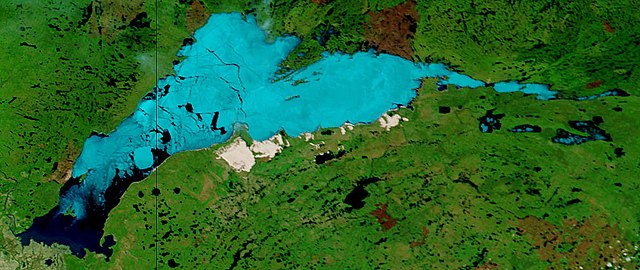
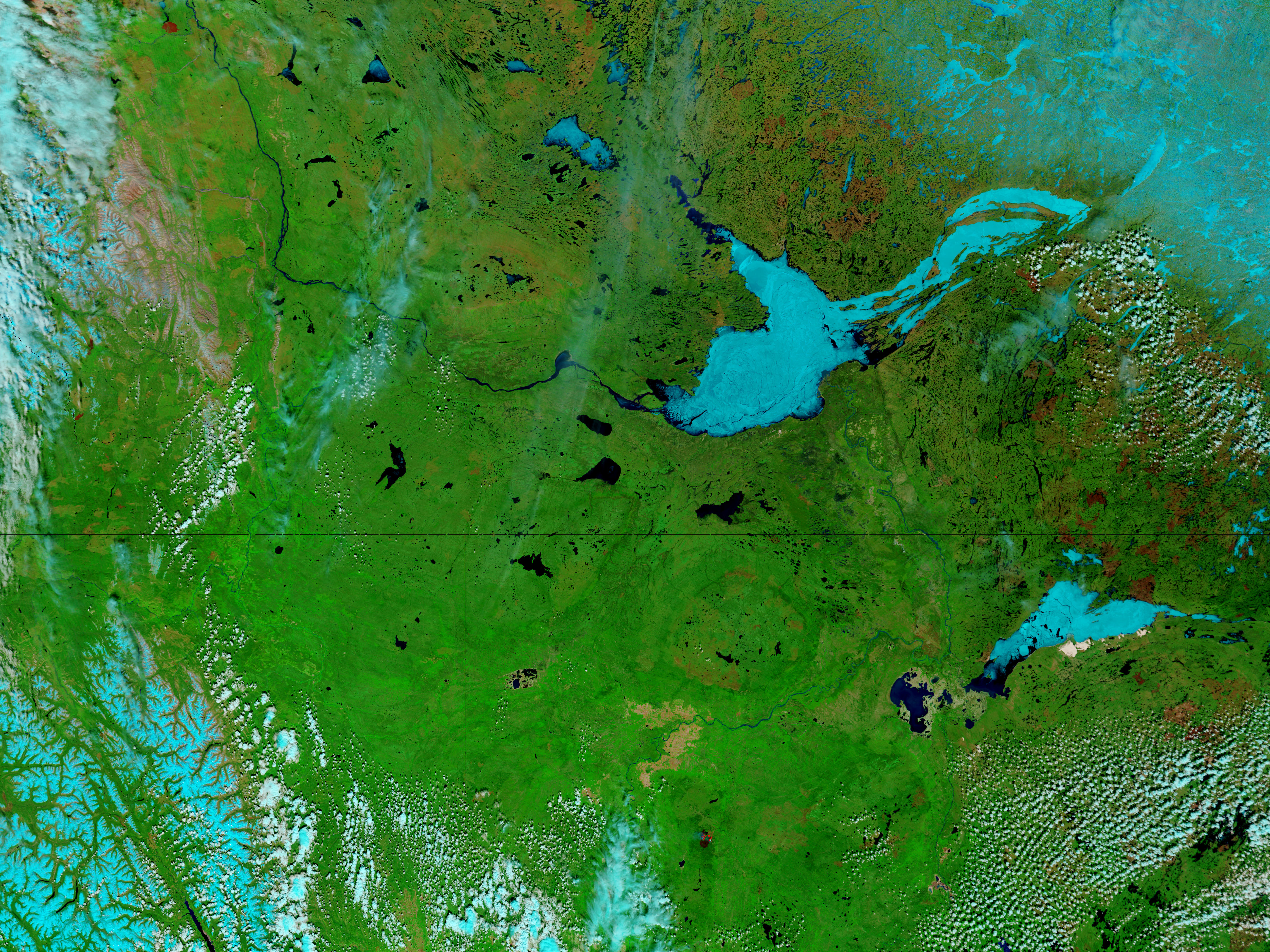
| تفصیل | Lake Athabasca, Canada. Lake Athabasca straddles the border between Alberta (west) and Saskatchewan (east) - the black line. In the false-color image, vegetation is green, water is dark blue, and ice (or snow) is light blue. |
| تریخ | Visualization Date: 2002-06-18 |
| سروت | Visible Earth, NASA (extract) |
| لکھاری | Jacques Descloitres, MODIS Land Rapid Response Team, NASA/GSFC |
Cropped from the original 4800 x 3600 JPEG (4.4MB) image.
لائسنس –
| This file is in the public domain in the United States because it was solely created by NASA. NASA copyright policy states that "NASA material is not protected by copyright unless noted". (See Template:PD-USGov, NASA copyright policy page or JPL Image Use Policy.) | ||
 |
Warnings:
|
فائل دی تریخ
فائل نو اس ویلے دی حالت وچ ویکھن واسطے تاریخ/ویلے تے کلک کرو۔
| تریخ تے ویلہ | نکی مورت | پاسے | ورتن والا | تیپّݨی کرو | |
|---|---|---|---|---|---|
| موجودہ | ۱۶:۳۷, ۱۸ اگست ۲۰۰۶ | | ۱,۱۵۶ × ۴۸۸ (۱۷۳ کلوبائٹ) | Feydey | {{Information |Description= Lake Athabasca, Canada. Lake Athabasca straddles the border between Alberta (west) and Saskatchewan (east) - the black line. In the false-color image, vegetation is green, water is dark blue, and ice (or snow) is light blue. |S |
فائل دی ورتوں
تھلے دتے گئے 1 صفحے اس فائل نال جُڑدے نیں
فائل ویاپک ورتوں
ایہہ دوجے وکیاں ایس فائل نوں ورتدے نیں –
- af.wikipedia.org تے ورتوں
- ar.wikipedia.org تے ورتوں
- arz.wikipedia.org تے ورتوں
- be.wikipedia.org تے ورتوں
- bg.wikipedia.org تے ورتوں
- bn.wikipedia.org تے ورتوں
- bs.wikipedia.org تے ورتوں
- ca.wikipedia.org تے ورتوں
- ceb.wikipedia.org تے ورتوں
- cv.wikipedia.org تے ورتوں
- cy.wikipedia.org تے ورتوں
- da.wikipedia.org تے ورتوں
- el.wikipedia.org تے ورتوں
- en.wikipedia.org تے ورتوں
- eo.wikipedia.org تے ورتوں
- es.wikipedia.org تے ورتوں
- eu.wikipedia.org تے ورتوں
- fa.wikipedia.org تے ورتوں
- frr.wikipedia.org تے ورتوں
- fr.wikipedia.org تے ورتوں
- fy.wikipedia.org تے ورتوں
- hu.wikipedia.org تے ورتوں
- hy.wikipedia.org تے ورتوں
- id.wikipedia.org تے ورتوں
- incubator.wikimedia.org تے ورتوں
- it.wikipedia.org تے ورتوں
- ka.wikipedia.org تے ورتوں
- kk.wikipedia.org تے ورتوں
- ky.wikipedia.org تے ورتوں
- lt.wikipedia.org تے ورتوں
- lv.wikipedia.org تے ورتوں
- nl.wikipedia.org تے ورتوں
- no.wikipedia.org تے ورتوں
- pl.wikipedia.org تے ورتوں
- pl.wiktionary.org تے ورتوں
- pt.wikipedia.org تے ورتوں
- ro.wikipedia.org تے ورتوں
- ru.wikipedia.org تے ورتوں
- sv.wikipedia.org تے ورتوں
ایس فائل دا ویکھو ہور جگت ورتن .