
فائل:Map of Finland-en.svg

Size of this PNG preview of this SVG file: ۴۰۹ × ۵۹۹ پکسلز. دوجے ریزولوشنز: ۱۶۴ × ۲۴۰ پکسلز | ۳۲۸ × ۴۸۰ پکسلز | ۵۲۴ × ۷۶۸ پکسلز | ۶۹۹ × ۱,۰۲۴ پکسلز | ۱,۳۹۹ × ۲,۰۴۸ پکسلز | ۱,۳۷۱ × ۲,۰۰۷ پکسلز ۔
اصل فائل (ایس وی جی فائل، پکسل:۱,۳۷۱ × ۲,۰۰۷، فائل سائز: ۳.۵۷ میگابائٹ)
خلاصہ
| تفصیل |
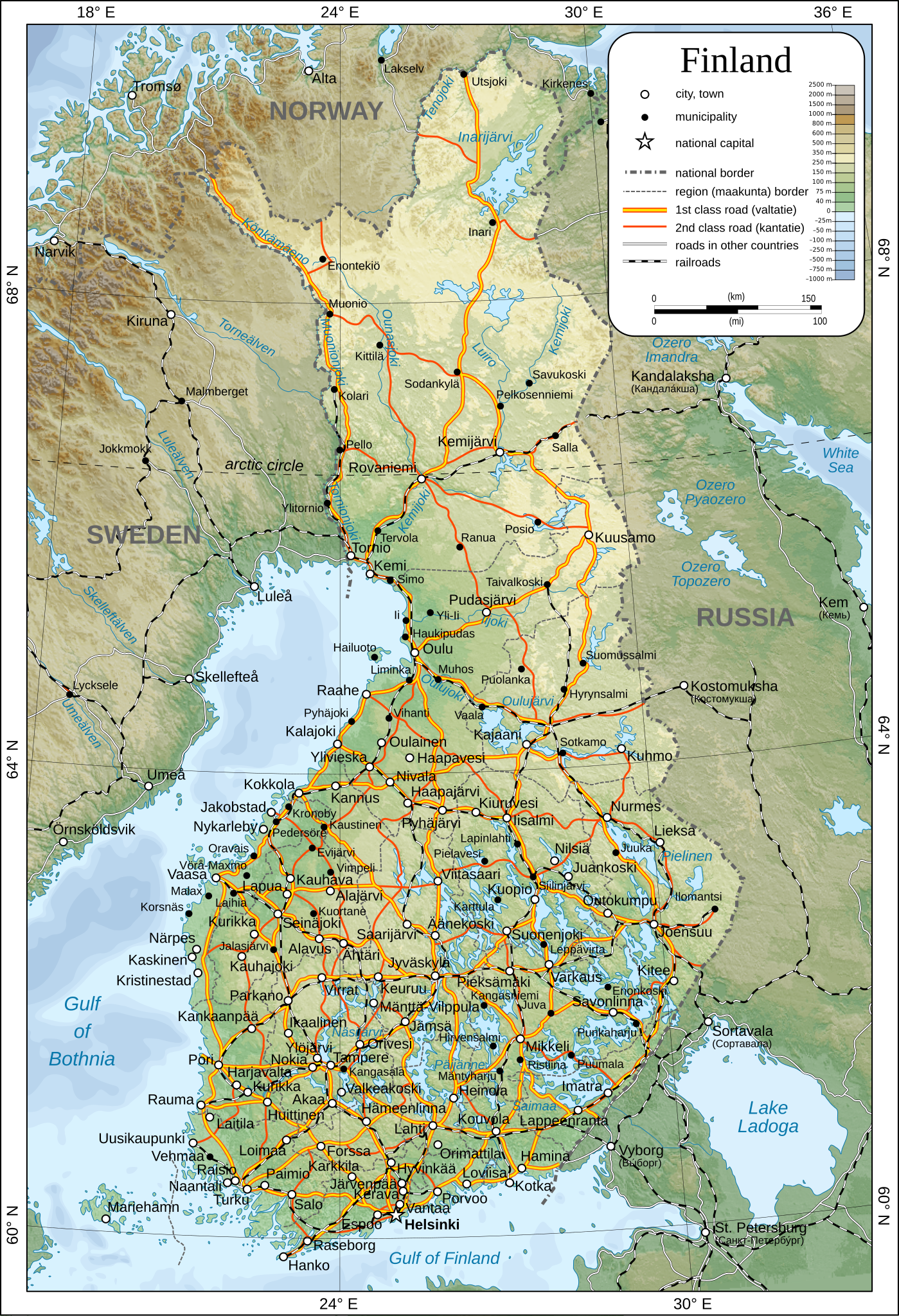
English: Map of Finland.
Suomi: Suomen kartta.
Svenska: Karta över Finland.
|
| تریخ | |
| سروت | آپݨا کم |
| لکھاری | Oona Räisänen |
| اجازت (فائل نوں دوبارہ ورتنا) |
See below. I've worked hard to create this map, so even though not mandatory, please attribute me wherever it is suitable. |
| دوجے ورژن |
[]
|
| SVG genesis |


لائسنس –
| میں، اس کم دے کاپیرائٹ دا مالک، اس کم نوں لوکاں واسطے دیندا واں۔ اے سارے جگ واسطے لاگو اے۔ کج ملکاں چ قانونی طور تے اے ممکن نئیں اے؛ اگر انج ای اے ے: میں ہر کسے نوں اس کم نوں کسے وی مقصد واسطے ورتن دا بغیر کسے شرط دے حق دیندا واں، اگر اوہ قانون دے خلاف نا ہوۓ۔ |
فائل دی تریخ
فائل نو اس ویلے دی حالت وچ ویکھن واسطے تاریخ/ویلے تے کلک کرو۔
| تریخ تے ویلہ | نکی مورت | پاسے | ورتن والا | تیپّݨی کرو | |
|---|---|---|---|---|---|
| موجودہ | ۱۸:۴۴, ۲۶ دسمبر ۲۰۰۹ | | ۱,۳۷۱ × ۲,۰۰۷ (۳.۵۷ میگابائٹ) | Mysid | added some cities, municipalities, and height color legend |
| ۱۵:۱۸, ۲۴ دسمبر ۲۰۰۹ |  | ۱,۳۷۱ × ۲,۰۰۷ (۳.۴۶ میگابائٹ) | Mysid | updated with topography, bathymetry, and revised provinces | |
| ۰۵:۴۰, ۵ مارچ ۲۰۰۹ |  | ۱,۳۷۱ × ۲,۰۰۷ (۸۸۶ کلوبائٹ) | Mysid | fonts | |
| ۰۵:۳۷, ۵ مارچ ۲۰۰۹ |  | ۱,۳۷۱ × ۲,۰۰۷ (۸۸۵ کلوبائٹ) | Mysid | {{Information |Description={{en|1=Map of w:Finland.}} {{fi|1=Suomen kartta.}} {{sv|1=Karta över sv:Finland.}} |Source=Self-made in Inkscape after CIA. |Author=Mysid |Date=2009-03-05 |Permission= |other_versions= |
فائل دی ورتوں
تھلے دتے گئے 1 صفحے اس فائل نال جُڑدے نیں
فائل ویاپک ورتوں
ایہہ دوجے وکیاں ایس فائل نوں ورتدے نیں –
- af.wikipedia.org تے ورتوں
- ar.wikipedia.org تے ورتوں
- avk.wikipedia.org تے ورتوں
- be.wikipedia.org تے ورتوں
- bg.wikipedia.org تے ورتوں
- cs.wikipedia.org تے ورتوں
- cy.wikipedia.org تے ورتوں
- de.wikipedia.org تے ورتوں
- en.wikipedia.org تے ورتوں
- fa.wikipedia.org تے ورتوں
- fr.wikipedia.org تے ورتوں
- he.wikipedia.org تے ورتوں
- hr.wiktionary.org تے ورتوں
- hy.wikipedia.org تے ورتوں
- io.wikipedia.org تے ورتوں
- ja.wikipedia.org تے ورتوں
- ka.wikipedia.org تے ورتوں
- mk.wikipedia.org تے ورتوں
- nl.wikipedia.org تے ورتوں
- pl.wikipedia.org تے ورتوں
- pl.wiktionary.org تے ورتوں
- rm.wikipedia.org تے ورتوں
- ro.wikipedia.org تے ورتوں
- ru.wikipedia.org تے ورتوں
- sco.wikipedia.org تے ورتوں
- simple.wikipedia.org تے ورتوں
- sr.wikipedia.org تے ورتوں
- tr.wikipedia.org تے ورتوں
- uk.wikipedia.org تے ورتوں
- zh.wikipedia.org تے ورتوں