
فائل:Map of Indonesia Demis.png

ایس وکھالے دا ناپ: ۸۰۰ × ۳۵۹ پکسلز۔ دوجے ریزولوشنز: ۳۲۰ × ۱۴۴ پکسلز | ۶۴۰ × ۲۸۷ پکسلز | ۱,۴۹۲ × ۶۷۰ پکسلز ۔
اصل فائل (۱,۴۹۲ × ۶۷۰ پکسلز, فائل حجم: ۳۴۵ کلوبائٹ, MIME type: image/png)
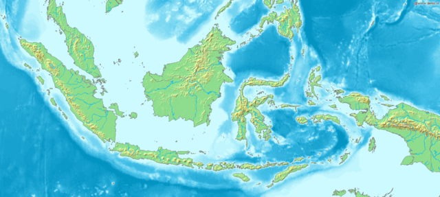
Map of Indonesia
Bounding box West 93°, South -12°, East 142°, North 10°. Center at 1°00′00″S 117°30′00″E / 1.00000°S 117.50000°E.
This image is in the public domain because it came from the site https://www.demis.nl/products/web-map-server/examples/ and was released by the copyright holder. Permission is granted to copy, distribute and/or modify this map since it is based on free of copyright images from: www.demis.nl. See also approval email on de.wp and its clarification.
|
| This work has been released into the public domain by its copyright holder, www.demis.nl. This applies worldwide. کج ملکاں چ قانونی طور تے اے ممکن نئیں اے؛ اگر انج ای اے ے: www.demis.nl ہر کسے نوں اس کم نوں کسے وی مقصد واسطے ورتن دا بغیر کسے شرط دے حق دیندا واں، اگر اوہ قانون دے خلاف نا ہوۓ۔
|
فائل دی تریخ
فائل نو اس ویلے دی حالت وچ ویکھن واسطے تاریخ/ویلے تے کلک کرو۔
| تریخ تے ویلہ | نکی مورت | پاسے | ورتن والا | تیپّݨی کرو | |
|---|---|---|---|---|---|
| موجودہ | ۲۲:۴۸, ۲۰ دسمبر ۲۰۰۶ | | ۱,۴۹۲ × ۶۷۰ (۳۴۵ کلوبائٹ) | Mats Halldin~commonswiki | Map of Indonesia Bounding box West 93°, South -12°, East 142°, North 10°. Center at {{coor d|1.00000|S|117.50000|E|scale:13200000}}. {{demis-pd}} Category:Maps of Indonesia |
فائل دی ورتوں
تھلے دتے گئے 1 صفحے اس فائل نال جُڑدے نیں
فائل ویاپک ورتوں
ایہہ دوجے وکیاں ایس فائل نوں ورتدے نیں –
- ar.wikipedia.org تے ورتوں
- bg.wikipedia.org تے ورتوں
- bn.wikipedia.org تے ورتوں
- es.wikipedia.org تے ورتوں
- et.wikipedia.org تے ورتوں
- eu.wikipedia.org تے ورتوں
- fr.wikipedia.org تے ورتوں
- hr.wikipedia.org تے ورتوں
- hy.wikipedia.org تے ورتوں
- id.wikipedia.org تے ورتوں
- ja.wikipedia.org تے ورتوں
- km.wikipedia.org تے ورتوں
- ko.wikipedia.org تے ورتوں
- la.wikipedia.org تے ورتوں
- nl.wikipedia.org تے ورتوں
- pl.wikipedia.org تے ورتوں
- sq.wikipedia.org تے ورتوں
- uk.wikipedia.org تے ورتوں
- vep.wikipedia.org تے ورتوں
- vi.wikipedia.org تے ورتوں