
فائل:Map of USA MA.svg

Size of this PNG preview of this SVG file: ۲۸۶ × ۱۸۶ پکسلز. دوجے ریزولوشنز: ۳۲۰ × ۲۰۸ پکسلز | ۶۴۰ × ۴۱۶ پکسلز | ۱,۰۲۴ × ۶۶۶ پکسلز | ۱,۲۸۰ × ۸۳۲ پکسلز | ۲,۵۶۰ × ۱,۶۶۵ پکسلز ۔
اصل فائل (ایس وی جی فائل، پکسل:۲۸۶ × ۱۸۶، فائل سائز: ۱۶۷ کلوبائٹ)
Clickable version
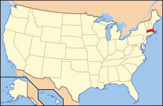
| تفصیل | Map of USA with Massachusetts highlighted | ||||||||
| تریخ | see file history below. | ||||||||
| سروت | own work by uploader, based on Image:Map of USA without state names.svg | ||||||||
| لکھاری |
This version: uploader Base versions this one is derived from: originally created by en:User:Wapcaplet |
||||||||
| اجازت (فائل نوں دوبارہ ورتنا) |
اے فائل ایس لائسنس تھلے آندی اے Creative Commons Attribution 1.0 Generic .
|
||||||||
| دوجے ورژن | image:Map of USA with state names.svg |

فائل دی تریخ
فائل نو اس ویلے دی حالت وچ ویکھن واسطے تاریخ/ویلے تے کلک کرو۔
| تریخ تے ویلہ | نکی مورت | پاسے | ورتن والا | تیپّݨی کرو | |
|---|---|---|---|---|---|
| موجودہ | ۱۲:۰۰, ۹ جون ۲۰۰۶ | | ۲۸۶ × ۱۸۶ (۱۶۷ کلوبائٹ) | Huebi~commonswiki | {{Information| |Description=Map of USA with Massachusettes highlighted |other_versions=image:Map of USA with state names.svg }} Category:Maps of the United States Category:Maps of Massachusettes Category:SVG maps {{GFDL-en}}{{cc-by-2.0} |
فائل دی ورتوں
تھلے دتے گئے 1 صفحے اس فائل نال جُڑدے نیں
فائل ویاپک ورتوں
ایہہ دوجے وکیاں ایس فائل نوں ورتدے نیں –
- af.wikipedia.org تے ورتوں
- ang.wikipedia.org تے ورتوں
- arc.wikipedia.org تے ورتوں
- ay.wikipedia.org تے ورتوں
- az.wiktionary.org تے ورتوں
- ba.wikipedia.org تے ورتوں
- bcl.wikipedia.org تے ورتوں
- be-tarask.wikipedia.org تے ورتوں
- bi.wikipedia.org تے ورتوں
- bpy.wikipedia.org تے ورتوں
- bxr.wikipedia.org تے ورتوں
- ca.wikipedia.org تے ورتوں
- ce.wikipedia.org تے ورتوں
- co.wikipedia.org تے ورتوں
- cs.wikipedia.org تے ورتوں
- Administrativní dělení Spojených států amerických
- Cambridge (Massachusetts)
- Winchendon
- Uxbridge (Massachusetts)
- Provincetown
- Williamstown (Massachusetts)
- Leicester (Massachusetts)
- South Deerfield
- Sterling (Massachusetts)
- Salem (Massachusetts)
- Beverly (Massachusetts)
- Peabody (Massachusetts)
- Concord (Massachusetts)
- Foxborough
- Amherst
- Webster (Massachusetts)
- Fitchburg (Massachusetts)
- Oxford (Massachusetts)
- Shrewsbury (Massachusetts)
- Berlin (Massachusetts)
- cu.wikipedia.org تے ورتوں
- cv.wikipedia.org تے ورتوں
- da.wikipedia.org تے ورتوں
ایس فائل دا ویکھو ہور جگت ورتن .