
فائل:Mexico states map small.png
اس توں وڈی مورت موجود نہیں۔
Mexico_states_map_small.png (۴۵۰ × ۳۱۲ پکسلز, فائل حجم: ۷۲ کلوبائٹ, MIME type: image/png)

|
This locator map image could be re-created using vector graphics as an SVG file. This has several advantages; see Commons:Media for cleanup for more information. If an SVG form of this image is available, please upload it and afterwards replace this template with
{{vector version available|new image name}}.
It is recommended to name the SVG file “Mexico states map small.svg”—then the template Vector version available (or Vva) does not need the new image name parameter. |
خلاصہ
| تفصیل |
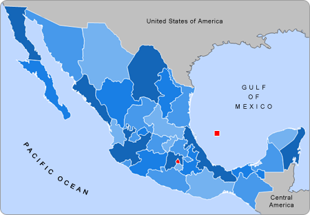
English: Small map of Mexico in use in the clickable map in various Wikipedias |
| سروت | Alex Covarrubias |
| لکھاری | AlexCovarrubias |
لائسنس –
| اس کم نوں لوکاں لئی ایدے لکھاریAlexCovarrubias at English وکیپیڈیا نے دے دتا اے، اے سارے جگ واسطے لاگو اے۔ کج ملکاں چ قانونی طور تے اے ممکن نئیں اے؛ اگر انج ای اے ے: AlexCovarrubias ہر کسے نوں اس کم نوں کسے وی مقصد واسطے ورتن دا بغیر کسے شرط دے حق دیندا واں، اگر اوہ قانون دے خلاف نا ہوۓ۔ |
پہلا اپلوڈ دا ریکارڈ
The original description page was here. All following user names refer to en.wikipedia.
- 2007-09-28 04:55 AlexCovarrubias 450×312× (74224 bytes) Changed border color (same used by Wikipedia thumbs)
- 2007-09-28 04:52 AlexCovarrubias 450×312× (73917 bytes) Rounded borders
- 2007-03-16 17:35 AlexCovarrubias 450×312× (65230 bytes)
- 2007-03-16 17:28 AlexCovarrubias 450×312× (69110 bytes) == Summary == Political division of Mexico. Map created for the [[Template:Mexico Labelled Map small]]. Designed by [[User:AlexCovarrubias|Alex Covarrubias]] == Licensing == {{PD-self}}
فائل دی تریخ
فائل نو اس ویلے دی حالت وچ ویکھن واسطے تاریخ/ویلے تے کلک کرو۔
| تریخ تے ویلہ | نکی مورت | پاسے | ورتن والا | تیپّݨی کرو | |
|---|---|---|---|---|---|
| موجودہ | ۲۲:۵۵, ۲۳ اگست ۲۰۰۹ | | ۴۵۰ × ۳۱۲ (۷۲ کلوبائٹ) | Feydey | update |
| ۰۳:۱۳, ۲۸ اگست ۲۰۰۷ |  | ۴۵۰ × ۳۱۲ (۶۴ کلوبائٹ) | AlexCovarrubias | {{Information |Description=Small map of Mexico in use in the clickable map in various Wikipedias |Source=Alex Covarrubias |Date= |Author= AlexCovarrubias }} |
فائل دی ورتوں
تھلے دتے گئے 3 صفحے اس فائل نال جُڑدے نیں
فائل ویاپک ورتوں
ایہہ دوجے وکیاں ایس فائل نوں ورتدے نیں –
- an.wikipedia.org تے ورتوں
- bn.wikipedia.org تے ورتوں
- ca.wikipedia.org تے ورتوں
- en.wikipedia.org تے ورتوں
- hu.wikipedia.org تے ورتوں
- pt.wikipedia.org تے ورتوں
- ta.wikipedia.org تے ورتوں
- ur.wikipedia.org تے ورتوں
- vi.wikipedia.org تے ورتوں
- zh.wikipedia.org تے ورتوں