
فائل:Peru location map.svg

Size of this PNG preview of this SVG file: ۴۹۲ × ۵۹۹ پکسلز. دوجے ریزولوشنز: ۱۹۷ × ۲۴۰ پکسلز | ۳۹۴ × ۴۸۰ پکسلز | ۶۳۱ × ۷۶۸ پکسلز | ۸۴۱ × ۱,۰۲۴ پکسلز | ۱,۶۸۲ × ۲,۰۴۸ پکسلز | ۲,۲۰۰ × ۲,۶۷۹ پکسلز ۔
اصل فائل (ایس وی جی فائل، پکسل:۲,۲۰۰ × ۲,۶۷۹، فائل سائز: ۱۵.۷۲ میگابائٹ)
خلاصہ
| تفصیل |
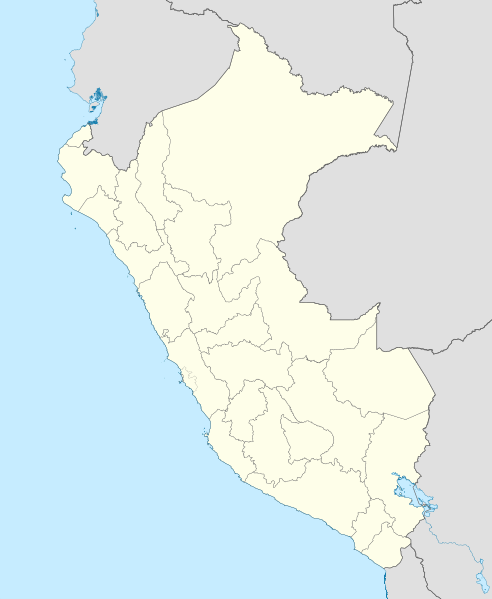
English: Blank political map of Peru
Equirectangular projection, Geographic limits of the map:
|
| تریخ | (UTC) |
| سروت | Peru_-_(Template).svg |
| لکھاری | User:Spischot |
.svg)
| This is a retouched picture, which means that it has been digitally altered from its original version. Modifications: Changed style to conform location maps 2008. The original can be viewed here: Peru - (Template).svg:
|
لائسنس –
میں، اس کم دے کاپیرائٹ دا مالک، اس کم نوں اس لائسنس دے مطابق چھاپدا واں:
ایس فائل نوں کریٹو کامنز Attribution 2.5 پولینڈ لائسنس دتا گیا.
- تہانوں کھلھ اے:
- حصہ کرنا – کاپی، ونڈنا تے کم بھیجنا
- فیر رلانا – کم نوں فٹ کرنا
- تھلے دتیاں شرطاں نال:
- کس دے ناں – تسیں لازمی ایس کم دے بناں والے بارے دسو جنج اونے آکھیا اے یا جنج لسنس چ آکھیا گیا ہے۔
- اکو جہا شئیر کرو۔ – اگر تسیں بدلدے یا ایس کم تے بناندے تے بنن والے کم نوں اینج دے لسنس نال ای ونڈو گے۔
پہلا اپلوڈ دا ریکارڈ
This image is a derivative work of the following images:
- File:Peru_-_(Template).svg licensed with Cc-by-sa-3.0
- 2009-07-21T07:54:54Z Huhsunqu 820x1000 (1674312 Bytes) detail map
- 2009-07-15T06:39:44Z Huhsunqu 820x1000 (1396540 Bytes) ANCHOS
- 2009-07-06T05:07:34Z Huhsunqu 820x1000 (1398457 Bytes) {{Information |Description={{en|1=Blank political map of Perú}} {{es|1=Mapa plantilla de las regiones y departamentos del Perú.}} |Source=trabajo propio (own work) |Author=[[User:Huhsunqu|Huhsunqu]] |Date=2009-07-05 |Permis
Uploaded with derivativeFX
فائل دی تریخ
فائل نو اس ویلے دی حالت وچ ویکھن واسطے تاریخ/ویلے تے کلک کرو۔
| تریخ تے ویلہ | نکی مورت | پاسے | ورتن والا | تیپّݨی کرو | |
|---|---|---|---|---|---|
| موجودہ | ۰۵:۵۲, ۱۲ مارچ ۲۰۲۳ | | ۲,۲۰۰ × ۲,۶۷۹ (۱۵.۷۲ میگابائٹ) | Waterloo1883 | Corrección del marco izquierdo y disminución del grosor de los limites administrativos. |
| ۰۳:۱۵, ۲۴ دسمبر ۲۰۲۰ |  | ۱,۰۳۳ × ۱,۲۵۸ (۱۳.۷۸ میگابائٹ) | Waterloo1883 | Límites departamentales actuales. | |
| ۰۰:۲۰, ۲ مئی ۲۰۱۸ |  | ۸۲۰ × ۱,۰۰۰ (۷۷۷ کلوبائٹ) | Janitoalevic | Fixed size | |
| ۲۳:۵۴, ۱ مئی ۲۰۱۸ |  | ۸۷۵ × ۱,۰۶۷ (۷۷۵ کلوبائٹ) | Janitoalevic | *Fixed coastline, international and internal borders. *Added San Lorenzo island *Better Lake Titicaca | |
| ۰۲:۳۳, ۲۴ اکتوبر ۲۰۰۹ |  | ۸۲۰ × ۱,۰۰۰ (۸۰۷ کلوبائٹ) | Spischot | {{Information |Description={{en|1=Blank political map of en:Peru}} Equirectangular projection, Geographic limits of the map: * N: 0.73° N * S: 19.36° S * W: 83.25° W * E: 66.75° W |Source=*File:Peru_-_(Template).svg |Date=2009-10-23 21:27 |
.svg)
فائل دی ورتوں
تھلے دتے گئے 1 صفحے اس فائل نال جُڑدے نیں
فائل ویاپک ورتوں
ایہہ دوجے وکیاں ایس فائل نوں ورتدے نیں –
- af.wikipedia.org تے ورتوں
- an.wikipedia.org تے ورتوں
- ar.wikipedia.org تے ورتوں
- ast.wikipedia.org تے ورتوں
- Llagu Titicaca
- Ríu Amazones
- Lima
- Rumicolca
- Base aérea El Pato
- Concepción (Perú)
- Ríu Apurímac
- Mismi
- Ríu Madre de Dios
- Cuzco
- Sacsayhuamán
- Jenaro Herrera (Perú)
- Palaciu Llexislativu del Perú
- La Rinconada (Perú)
- Santuariu históricu de Machu Picchu
- Tabayones les Trés Hermanes
- Tabayón Yumbilla
- Catarata Gocta
- Huandoy
- Huascarán
- Yerupajá
- Módulu:Mapa de llocalización/datos/Perú
- Módulu:Mapa de llocalización/datos/Perú/usu
- Copa América 2004
- Campeonatu Descentralizáu 2018
- Callao
- Universidá Inca Garcilaso de la Vega
- Aeropuertu Alf. FAP David Figueroa Fernandini
- Aeropuertu Cadete FAP Guillermo del Castillo Paredes
- Aeropuertu Capitán FAP Renán Elías Olivera
- Aeropuertu Francisco Carlé
- Aeropuertu Internacional Alejandro Velasco Astete
- Aeropuertu Internacional Capitán FAP José A. Quiñones
- Aeropuertu Internacional Coronel FAP Carlos Ciriani Santa Rosa
- Aeropuertu Internacional Inca Manco Cápac
ایس فائل دا ویکھو ہور جگت ورتن .