
فائل:Punjab in India.png
Punjab_in_India.png (۳۵۰ × ۴۲۶ پکسلز, فائل حجم: ۷۶ کلوبائٹ, MIME type: image/png)
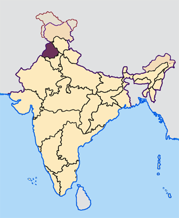
Map made by me, Nichalp
Note: The Indian state of w:Jammu and Kashmir is claimed by w:India, w:Pakistan and the w:People's Republic of China. This map depicts the boundaries of the state as it was in 1947. Areas administered by India is coloured as per the rest of the states, and the area administered by Pakistan and China are coloured in a neutral colour. See the map of Jammu and Kashmir.
The Indian state of w:Arunachal Pradesh is claimed by China as a part of w:South Tibet. The claimed region is depicted in a pale shade of pink. See the map of Arunachal Pradesh.
The Indian territorial waters extend to a distance of twelve nautical miles.

|
کاپی کرن، ونڈن تے بدلن دی ایس ڈوکومنٹ لئی اجازت دتی جاندی اے ایہناں GNU Free Documentation License, Version 1.2 شرطاں نال یا مگروں کسے وی چھپے ورین Free Software Foundation توں بنا کسے انویرینٹ سیکشن دے، ناں فرنٹ کور لکھت تے ناں بیک کور لکھت دے۔ لسنس دی اک کاپی سیکشن وچ ہیگی اے جہدا ناں اے GNU Free Documentation License۔ |
| ایس فائل نوں کریٹو کامنز Attribution 2.5 پولینڈ لائسنس دتا گیا. | ||
| ||
| اس لائسنس دا ٹیگ GFDL دے مطابق اس فائل چ پایا گیا اے licensing update۔ |
فائل دی تریخ
فائل نو اس ویلے دی حالت وچ ویکھن واسطے تاریخ/ویلے تے کلک کرو۔
| تریخ تے ویلہ | نکی مورت | پاسے | ورتن والا | تیپّݨی کرو | |
|---|---|---|---|---|---|
| موجودہ | ۱۲:۳۳, ۲۳ اپریل ۲۰۰۵ | | ۳۵۰ × ۴۲۶ (۷۶ کلوبائٹ) | Nichalp | NPOV map |
| ۱۲:۲۲, ۲۳ اپریل ۲۰۰۵ |  | ۲۰۰ × ۲۳۱ (۲۲ کلوبائٹ) | Kerpal | Reverted to earlier revision | |
| ۱۱:۲۷, ۲۳ اپریل ۲۰۰۵ |  | ۵۰۰ × ۶۰۸ (۱۲۱ کلوبائٹ) | Nichalp | Reverted to earlier revision | |
| ۱۰:۰۰, ۲۳ اپریل ۲۰۰۵ |  | ۲۰۰ × ۲۳۱ (۲۲ کلوبائٹ) | Kerpal | Reverted to earlier revision | |
| ۰۹:۵۴, ۲۳ اپریل ۲۰۰۵ |  | ۵۰۰ × ۶۰۸ (۱۲۱ کلوبائٹ) | Nichalp | Reverted to earlier revision | |
| ۰۲:۰۶, ۲۳ اپریل ۲۰۰۵ |  | ۲۰۰ × ۲۳۱ (۲۲ کلوبائٹ) | Kerpal | Reverted to earlier revision | |
| ۱۸:۳۸, ۲۲ اپریل ۲۰۰۵ |  | ۵۰۰ × ۶۰۸ (۱۲۱ کلوبائٹ) | Nichalp | Reverted to earlier revision | |
| ۱۴:۴۳, ۲۲ اپریل ۲۰۰۵ |  | ۲۰۰ × ۲۳۱ (۲۲ کلوبائٹ) | Kerpal | originally by en:User:Morwen | |
| ۲۳:۰۶, ۲۱ اپریل ۲۰۰۵ |  | ۵۰۰ × ۶۰۸ (۱۲۱ کلوبائٹ) | Nichalp | ---- Map made by me, ~~~ ---- Note: The Indian state of w:Jammu and Kashmir is claimed by w:India, w:Pakistan and the w:People's Republic of China. This map depicts the boundaries of the state as it was in 1947. Areas administered by Indi |
فائل دی ورتوں
تھلے دتے گئے 5 صفحے اس فائل نال جُڑدے نیں
فائل ویاپک ورتوں
ایہہ دوجے وکیاں ایس فائل نوں ورتدے نیں –
- awa.wikipedia.org تے ورتوں
- bh.wikipedia.org تے ورتوں
- अमृतसर जिला
- बरनाला जिला
- भटिंडा जिला
- फिरोजपुर जिला
- फरीदकोट जिला
- फतेहगढ़ साहिब जिला
- फजिल्का जिला
- गुरदासपुर जिला
- होशियारपुर जिला
- जालंधर जिला
- कपूरथला जिला
- लुधियाना जिला
- मानसा जिला
- मोगा जिला
- श्री मुक्तसर साहिब जिला
- पठानकोट जिला
- पटियाला जिला
- रूपनगर जिला
- संगरूर जिला
- शहीद भगत सिंह नगर जिला
- तरनतारन जिला
- टेम्पलेट:पंजाब
- bn.wikipedia.org تے ورتوں
- bxr.wikipedia.org تے ورتوں
- en.wikipedia.org تے ورتوں
ایس فائل دا ویکھو ہور جگت ورتن .