
فائل:Rio Grande RT Hill 1899b.jpg

ایس وکھالے دا ناپ: ۸۰۰ × ۵۸۲ پکسلز۔ دوجے ریزولوشنز: ۳۲۰ × ۲۳۳ پکسلز | ۶۴۰ × ۴۶۶ پکسلز | ۱,۰۲۴ × ۷۴۵ پکسلز | ۱,۲۸۰ × ۹۳۱ پکسلز | ۲,۵۶۰ × ۱,۸۶۲ پکسلز | ۴,۴۳۲ × ۳,۲۲۴ پکسلز ۔
اصل فائل (۴,۴۳۲ × ۳,۲۲۴ پکسلز, فائل حجم: ۳.۰۶ میگابائٹ, MIME type: image/jpeg)
خلاصہ
| تفصیل |
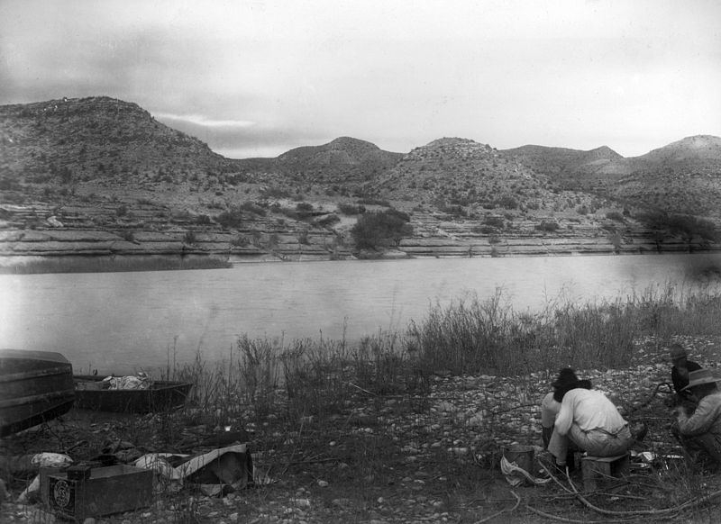
English: Rio Grande near San Francisco Creek. USGS survey party led by Robert T. Hill in right foreground. Brewster County, Texas. 1899. |
| تریخ | |
| سروت | U.S. Geological Survey Photographic Library, http://libraryphoto.cr.usgs.gov/ |
| لکھاری | Robert T. Hill |
| Camera location | | View this and other nearby images on: OpenStreetMap |
|---|
لائسنس –
This image is in the public domain in the United States because it only contains materials that originally came from the United States Geological Survey, an agency of the United States Department of the Interior. For more information, see the official USGS copyright policy.
|
فائل دی تریخ
فائل نو اس ویلے دی حالت وچ ویکھن واسطے تاریخ/ویلے تے کلک کرو۔
| تریخ تے ویلہ | نکی مورت | پاسے | ورتن والا | تیپّݨی کرو | |
|---|---|---|---|---|---|
| موجودہ | ۰۷:۴۵, ۲۰ اکتوبر ۲۰۰۹ | | ۴,۴۳۲ × ۳,۲۲۴ (۳.۰۶ میگابائٹ) | Leaflet | {{Information |Description={{en|1=Rio Grande near San Francisco Creek. Robert T. Hill's USGS survey party eating in right foreground. Brewster County, Texas. 1899.}} |Source=U.S. Geological Survey Photographic Library, http://libraryphoto.cr.usgs.gov/ |A |
فائل دی ورتوں
تھلے دتے گئے 1 صفحے اس فائل نال جُڑدے نیں
فائل ویاپک ورتوں
ایہہ دوجے وکیاں ایس فائل نوں ورتدے نیں –
- da.wikipedia.org تے ورتوں
- de.wikipedia.org تے ورتوں
- en.wikipedia.org تے ورتوں
- incubator.wikimedia.org تے ورتوں
- ko.wikipedia.org تے ورتوں
- mk.wikipedia.org تے ورتوں
- sco.wikipedia.org تے ورتوں
- war.wikipedia.org تے ورتوں