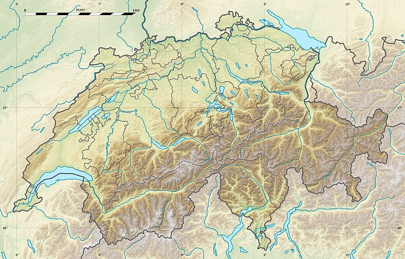
فائل:Switzerland relief location map.jpg

ایس وکھالے دا ناپ: ۸۰۰ × ۵۱۳ پکسلز۔ دوجے ریزولوشنز: ۳۲۰ × ۲۰۵ پکسلز | ۶۴۰ × ۴۱۰ پکسلز | ۱,۰۲۴ × ۶۵۷ پکسلز | ۱,۳۴۹ × ۸۶۵ پکسلز ۔
اصل فائل (۱,۳۴۹ × ۸۶۵ پکسلز, فائل حجم: ۶۰۲ کلوبائٹ, MIME type: image/jpeg)
فائل دی تریخ
فائل نو اس ویلے دی حالت وچ ویکھن واسطے تاریخ/ویلے تے کلک کرو۔
| تریخ تے ویلہ | نکی مورت | پاسے | ورتن والا | تیپّݨی کرو | |
|---|---|---|---|---|---|
| موجودہ | ۰۲:۰۴, ۱۸ دسمبر ۲۰۱۷ |  | ۱,۳۴۹ × ۸۶۵ (۶۰۲ کلوبائٹ) | Reinhard Kraasch | Verlauf des Doubs korrigiert / Doubs River course retouched |
| ۱۸:۲۸, ۱۹ جولائی ۲۰۱۰ |  | ۱,۳۴۹ × ۸۶۵ (۴۳۹ کلوبائٹ) | Sting | Color profile | |
| ۱۹:۲۷, ۴ دسمبر ۲۰۰۹ |  | ۱,۳۴۹ × ۸۶۵ (۴۵۶ کلوبائٹ) | Sting | == {{int:filedesc}} == {{Location|46|49|30|N|8|15|00|E|scale:1000000}} <br/> {{Information |Description={{de|Relief Positionskarte der Schweiz.}} {{en|Blank physical map of Switzerland, for geo-location purpose.}} {{fr| |
فائل دی ورتوں
تھلے دتے گئے 1 صفحے اس فائل نال جُڑدے نیں
فائل ویاپک ورتوں
ایہہ دوجے وکیاں ایس فائل نوں ورتدے نیں –
- als.wikipedia.org تے ورتوں
- Langensee
- Gotthardpass
- Rheinwaldhorn
- Pfäffikersee
- Sarnersee
- Etzel (Berg)
- Höhronen (Berg)
- Sattel (Pass)
- Churfirsten
- Säntis
- Wohlensee
- Ruine Rifenstein
- Wartenberg (Muttenz)
- Lägern
- Schloss Lenzburg
- Uetliberg
- Schloss Chillon
- Schloss Bottmingen
- Schloss Pratteln
- Ruine Madeln
- Burg Kropfenstein
- Vorlage:Positionskarte Schweiz
- Schloss Klingnau
- Ruine Iberg
- Ruine Besserstein
- Rengg
- Schloss Rümligen
- Pilatus
- Festung Aarburg
- Dufourspitze
- Schloss Schwarzwasserstelz
- Schloss Stein
- Schloss Uster
- Stausee Wettingen
- Grosser St. Bernhard
- Malojapass
- Splügenpass
- Matterhorn
- Schwendisee
- Morgenberghorn
- Ruine Schenkenberg
- Schloss Auenstein
- Schloss Kasteln
- Siggenberg
- Chestenberg
- Bruggerberg
- Wartenberg-Ruinen
- Scheidegg (Tecknau)
- Ruine Münchenstein
- Ruine Farnsburg
ایس فائل دا ویکھو ہور جگت ورتن .


