
فائل:Thailand BMNG.png

ایس وکھالے دا ناپ: ۴۰۵ × ۵۹۹ پکسلز۔ دوجے ریزولوشنز: ۱۶۲ × ۲۴۰ پکسلز | ۳۲۴ × ۴۸۰ پکسلز | ۵۱۹ × ۷۶۸ پکسلز | ۶۹۲ × ۱,۰۲۴ پکسلز | ۱,۹۵۰ × ۲,۸۸۴ پکسلز ۔
اصل فائل (۱,۹۵۰ × ۲,۸۸۴ پکسلز, فائل حجم: ۶.۶ میگابائٹ, MIME type: image/png)
| This image is in the public domain because it is a screenshot from NASA’s globe software World Wind using a public domain layer, such as Blue Marble, MODIS, Landsat, SRTM, USGS or GLOBE.
|
 |
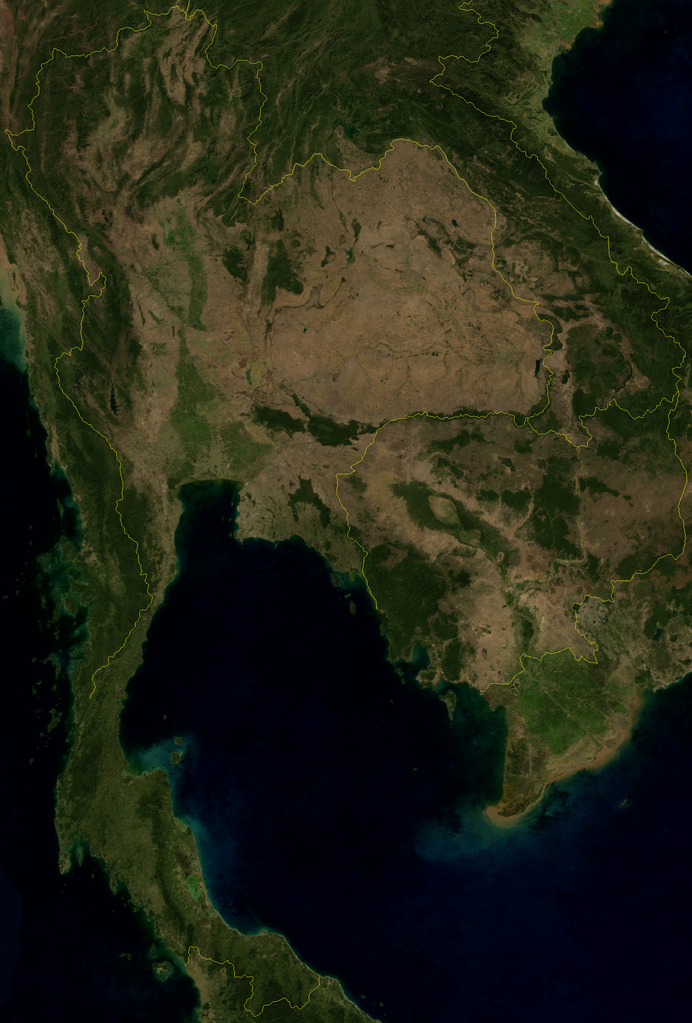
Satellite image of Thailand in January 2004.
Screenshot from NASA World Wind, Blue Marble Next-Generation layer.
فائل دی تریخ
فائل نو اس ویلے دی حالت وچ ویکھن واسطے تاریخ/ویلے تے کلک کرو۔
| تریخ تے ویلہ | نکی مورت | پاسے | ورتن والا | تیپّݨی کرو | |
|---|---|---|---|---|---|
| موجودہ | ۲۱:۵۴, ۱ مئی ۲۰۰۶ | | ۱,۹۵۰ × ۲,۸۸۴ (۶.۶ میگابائٹ) | Hautala | {{PD-WorldWind}} Satellite image of Thailand in January 2004. Screenshot from NASA World Wind, Blue Marble Next-Generation layer. Category:Satellite photos of Thailand |
فائل دی ورتوں
تھلے دتے گئے 1 صفحے اس فائل نال جُڑدے نیں
فائل ویاپک ورتوں
ایہہ دوجے وکیاں ایس فائل نوں ورتدے نیں –
- af.wikipedia.org تے ورتوں
- ar.wikipedia.org تے ورتوں
- ast.wikipedia.org تے ورتوں
- ba.wikipedia.org تے ورتوں
- be-tarask.wikipedia.org تے ورتوں
- bn.wikipedia.org تے ورتوں
- ca.wikipedia.org تے ورتوں
- el.wikipedia.org تے ورتوں
- en.wikipedia.org تے ورتوں
- eo.wikipedia.org تے ورتوں
- eu.wikipedia.org تے ورتوں
- fa.wikipedia.org تے ورتوں
- gl.wikipedia.org تے ورتوں
- hy.wikipedia.org تے ورتوں
- id.wikipedia.org تے ورتوں
- is.wikipedia.org تے ورتوں
- it.wikivoyage.org تے ورتوں
- km.wikipedia.org تے ورتوں
- ko.wikipedia.org تے ورتوں
- ku.wikipedia.org تے ورتوں
- mn.wikipedia.org تے ورتوں
- mzn.wikipedia.org تے ورتوں
- no.wikipedia.org تے ورتوں
- or.wikipedia.org تے ورتوں
- pt.wikipedia.org تے ورتوں
- ro.wikipedia.org تے ورتوں
- th.wikipedia.org تے ورتوں
- vi.wikipedia.org تے ورتوں
- www.wikidata.org تے ورتوں