
فائل:Un-ghana.png
اصل فائل (۲,۳۶۷ × ۳,۰۹۲ پکسلز, فائل حجم: ۱.۸۷ میگابائٹ, MIME type: image/png)
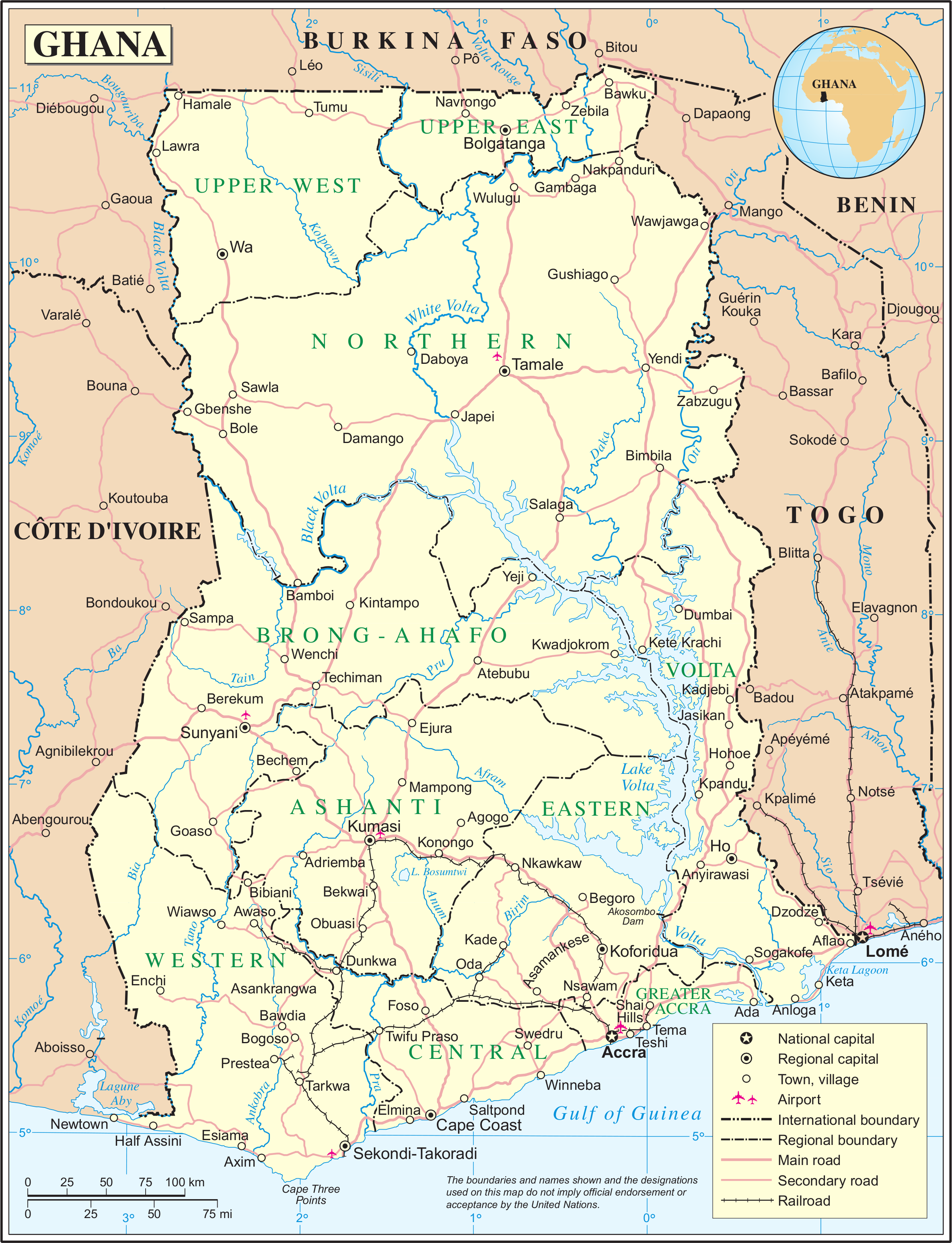
| This image is a map derived from a United Nations map.
Unless stated otherwise, UN maps are to be considered in the public domain. This applies worldwide. UN maps are, in principle, open source material and you can use them in your work or for making your own map. UN requests however that you delete the UN name, logo and reference number upon any modification to the map. Content of your map will be your responsibility. You can state in your publication, if you wish, something like: based on UN map … (map name, map number, revision number and date). See: Geospatial Information Section. And: Geospatial, location data for a better world. |
 |
فائل دی تریخ
فائل نو اس ویلے دی حالت وچ ویکھن واسطے تاریخ/ویلے تے کلک کرو۔
| تریخ تے ویلہ | نکی مورت | پاسے | ورتن والا | تیپّݨی کرو | |
|---|---|---|---|---|---|
| موجودہ | ۰۶:۰۴, ۲۴ اکتوبر ۲۰۰۷ | | ۲,۳۶۷ × ۳,۰۹۲ (۱.۸۷ میگابائٹ) | Jeroen | {{UN map}} Category:Maps of Ghana |
فائل دی ورتوں
تھلے دتے گئے 1 صفحے اس فائل نال جُڑدے نیں
فائل ویاپک ورتوں
ایہہ دوجے وکیاں ایس فائل نوں ورتدے نیں –
- ar.wikipedia.org تے ورتوں
- dag.wikipedia.org تے ورتوں
- de.wikipedia.org تے ورتوں
- en.wikipedia.org تے ورتوں
- fa.wikipedia.org تے ورتوں
- fi.wikipedia.org تے ورتوں
- it.wikipedia.org تے ورتوں
- ml.wikipedia.org تے ورتوں
- nl.wikipedia.org تے ورتوں
- pl.wiktionary.org تے ورتوں
- ro.wikipedia.org تے ورتوں
- sw.wikipedia.org تے ورتوں
- uk.wikipedia.org تے ورتوں
- ur.wikipedia.org تے ورتوں