
فائل:Whangarei Territorial Authority.PNG
اس توں وڈی مورت موجود نہیں۔
Whangarei_Territorial_Authority.PNG (۲۴۶ × ۳۵۲ پکسلز, فائل حجم: ۷ کلوبائٹ, MIME type: image/png)
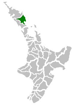
(Location map of the Whangarei Territorial Authority, New Zealand)
| |
اس کم نوں لوکاں لئی ایدے لکھاریTom the Boffin, at the English وکیپیڈیا project نے دے دتا اے، اے سارے جگ واسطے لاگو اے۔ In case this is not legally possible: |
Uploaded to Commons by user:PerPlex:
فائل دی تریخ
فائل نو اس ویلے دی حالت وچ ویکھن واسطے تاریخ/ویلے تے کلک کرو۔
| تریخ تے ویلہ | نکی مورت | پاسے | ورتن والا | تیپّݨی کرو | |
|---|---|---|---|---|---|
| موجودہ | ۲۱:۳۸, ۱ جولائی ۲۰۰۷ | | ۲۴۶ × ۳۵۲ (۷ کلوبائٹ) | PerPlex | (Location map of the Hokianga Harbour, New Zealand) {{PD-user-w|en|English Wikipedia|Tom the Boffin}} Uploaded to Commons by user:PerPlex: Category:New Zealand Category:Maps of New Zealand |
فائل دی ورتوں
تھلے دتے گئے 1 صفحے اس فائل نال جُڑدے نیں
فائل ویاپک ورتوں
ایہہ دوجے وکیاں ایس فائل نوں ورتدے نیں –
- ca.wikipedia.org تے ورتوں
- it.wikipedia.org تے ورتوں
- ms.wikipedia.org تے ورتوں
- nn.wikipedia.org تے ورتوں
- sv.wikipedia.org تے ورتوں
- www.wikidata.org تے ورتوں
- zh.wikipedia.org تے ورتوں