
فائل:Australia Victoria Glenelg Shire location map.svg

Size of this PNG preview of this SVG file: ۴۲۱ × ۶۰۰ پکسلز. دوجے ریزولوشنز: ۱۶۸ × ۲۴۰ پکسلز | ۳۳۷ × ۴۸۰ پکسلز | ۵۳۹ × ۷۶۸ پکسلز | ۷۱۹ × ۱,۰۲۴ پکسلز | ۱,۴۳۸ × ۲,۰۴۸ پکسلز | ۵۳۳ × ۷۵۹ پکسلز ۔
اصل فائل (ایس وی جی فائل، پکسل:۵۳۳ × ۷۵۹، فائل سائز: ۵۰۶ کلوبائٹ)
| تفصیل |
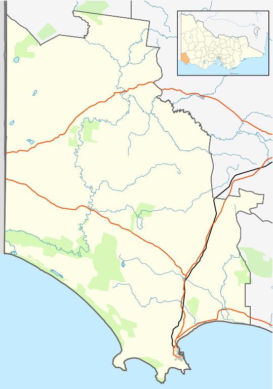
English: Blank map of w:Glenelg Shire, Victoria, Australia, with the following information shown:
Geographic limits:
|
||
| سروت | آپݨا کم + VicMap Lite | ||
| لکھاری | Cassowary |

| Annotations | This image is annotated: View the annotations at Commons |
فائل دی تریخ
فائل نو اس ویلے دی حالت وچ ویکھن واسطے تاریخ/ویلے تے کلک کرو۔
| تریخ تے ویلہ | نکی مورت | پاسے | ورتن والا | تیپّݨی کرو | |
|---|---|---|---|---|---|
| موجودہ | ۱۹:۴۲, ۱۷ فروری ۲۰۱۱ | | ۵۳۳ × ۷۵۹ (۵۰۶ کلوبائٹ) | Cassowary | {{Information |Description ={{en|1= Blank map of w:Glenelg Shire, Victoria, Australia, with the following information shown: * LGA boundaries * Coastline, lakes and rivers * Roads and railways * Urban areas * Parks Geographic limits: * North: 37.3 |
فائل دی ورتوں
تھلے دتے گئے 1 صفحے اس فائل نال جُڑدے نیں
فائل ویاپک ورتوں
ایہہ دوجے وکیاں ایس فائل نوں ورتدے نیں –
- ar.wikipedia.org تے ورتوں
- ceb.wikipedia.org تے ورتوں
- en.wikipedia.org تے ورتوں
- Portland, Victoria
- Shire of Glenelg
- Heywood, Victoria
- Allestree, Victoria
- Nelson, Victoria
- Cape Bridgewater
- Casterton, Victoria
- Dartmoor, Victoria
- Merino, Victoria
- Template:Towns in Glenelg Shire
- Tyrendarra
- Henty, Victoria
- Narrawong
- Condah
- Digby, Victoria
- Sandford, Victoria
- Module:Location map/data/Australia Victoria Shire of Glenelg/doc
- Lawrence Rocks
- Tahara, Victoria
- Paschendale, Victoria
- Gorae West
- Heathmere
- Hotspur, Victoria
- Drumborg
- Module:Location map/data/Australia Victoria Shire of Glenelg
- Bahgallah
- Bolwarra, Victoria
- Breakaway Creek, Victoria
- Brimboal
- Carapook
- Cashmore, Victoria
- Chetwynd, Victoria
- User:Viatori/sandbox
- User:ThylacineHunter/LGA
- fa.wikipedia.org تے ورتوں
- incubator.wikimedia.org تے ورتوں
- kn.wikipedia.org تے ورتوں
- si.wikipedia.org تے ورتوں
- tr.wikipedia.org تے ورتوں
- ur.wikipedia.org تے ورتوں
- uz.wikipedia.org تے ورتوں
- vi.wikipedia.org تے ورتوں
- war.wikipedia.org تے ورتوں