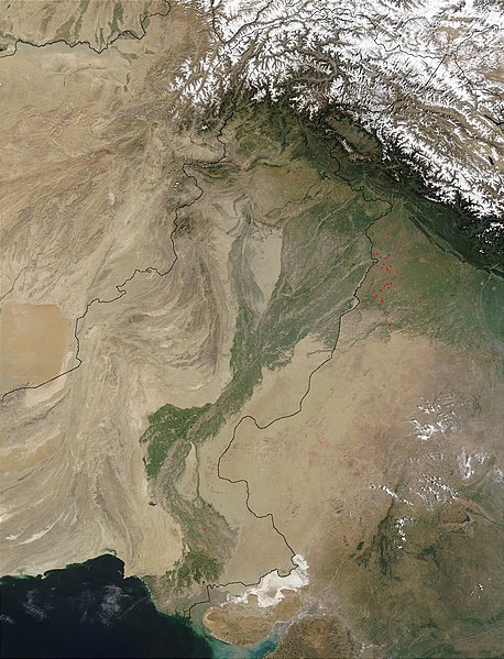
فائل:Indus.A2002274.0610.1km.jpg

ایس وکھالے دا ناپ: ۴۵۸ × ۵۹۹ پکسلز۔ دوجے ریزولوشنز: ۱۸۳ × ۲۴۰ پکسلز | ۳۶۷ × ۴۸۰ پکسلز | ۵۸۷ × ۷۶۸ پکسلز | ۷۸۳ × ۱,۰۲۴ پکسلز | ۱,۳۰۰ × ۱,۷۰۰ پکسلز ۔
اصل فائل (۱,۳۰۰ × ۱,۷۰۰ پکسلز, فائل حجم: ۴۸۰ کلوبائٹ, MIME type: image/jpeg)
فائل دی تریخ
فائل نو اس ویلے دی حالت وچ ویکھن واسطے تاریخ/ویلے تے کلک کرو۔
| تریخ تے ویلہ | نکی مورت | پاسے | ورتن والا | تیپّݨی کرو | |
|---|---|---|---|---|---|
| موجودہ | ۱۸:۰۳, ۲۸ مارچ ۲۰۰۸ |  | ۱,۳۰۰ × ۱,۷۰۰ (۴۸۰ کلوبائٹ) | File Upload Bot (Magnus Manske) | {{BotMoveToCommons|en.wikipedia}} {{Information |Description={{en|en:Satellite image of the en:Indus River basin. Red dots indicate fires. International boundaries are superimposed; the boundary through en:Jammu and Kashmir reflects the [[ |
فائل دی ورتوں
فائل ویاپک ورتوں
ایہہ دوجے وکیاں ایس فائل نوں ورتدے نیں –
- af.wikipedia.org تے ورتوں
- ar.wikipedia.org تے ورتوں
- arz.wikipedia.org تے ورتوں
- ast.wikipedia.org تے ورتوں
- as.wikipedia.org تے ورتوں
- azb.wikipedia.org تے ورتوں
- az.wikipedia.org تے ورتوں
- ba.wikipedia.org تے ورتوں
- be-tarask.wikipedia.org تے ورتوں
- bh.wikipedia.org تے ورتوں
- bn.wikipedia.org تے ورتوں
- bo.wikipedia.org تے ورتوں
- br.wikipedia.org تے ورتوں
- bxr.wikipedia.org تے ورتوں
- ca.wikipedia.org تے ورتوں
- ceb.wikipedia.org تے ورتوں
- ce.wikipedia.org تے ورتوں
- ckb.wikipedia.org تے ورتوں
- cy.wikipedia.org تے ورتوں
- da.wikipedia.org تے ورتوں
- en.wikipedia.org تے ورتوں
- eo.wikipedia.org تے ورتوں
- es.wikipedia.org تے ورتوں
- fa.wikipedia.org تے ورتوں
- fiu-vro.wikipedia.org تے ورتوں
- gd.wikipedia.org تے ورتوں
- gl.wikipedia.org تے ورتوں
- hi.wikipedia.org تے ورتوں
- hy.wikipedia.org تے ورتوں
- ia.wikipedia.org تے ورتوں
- id.wikipedia.org تے ورتوں
- ilo.wikipedia.org تے ورتوں
- incubator.wikimedia.org تے ورتوں
- is.wikipedia.org تے ورتوں
- it.wikipedia.org تے ورتوں
ایس فائل دا ویکھو ہور جگت ورتن .


