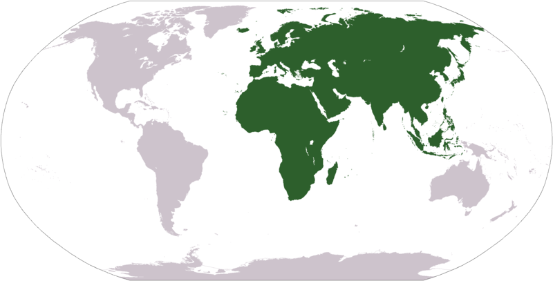
فائل:LocationAfricaEurasia.png

ایس وکھالے دا ناپ: ۸۰۰ × ۴۰۷ پکسلز۔ دوجے ریزولوشنز: ۳۲۰ × ۱۶۳ پکسلز | ۶۴۰ × ۳۲۶ پکسلز | ۱,۰۲۴ × ۵۲۱ پکسلز | ۱,۲۸۰ × ۶۵۱ پکسلز | ۲,۷۵۹ × ۱,۴۰۴ پکسلز ۔
اصل فائل (۲,۷۵۹ × ۱,۴۰۴ پکسلز, فائل حجم: ۹۹ کلوبائٹ, MIME type: image/png)
فائل دی تریخ
فائل نو اس ویلے دی حالت وچ ویکھن واسطے تاریخ/ویلے تے کلک کرو۔
| تریخ تے ویلہ | نکی مورت | پاسے | ورتن والا | تیپّݨی کرو | |
|---|---|---|---|---|---|
| موجودہ | ۱۷:۲۸, ۱۹ جنوری ۲۰۰۸ |  | ۲,۷۵۹ × ۱,۴۰۴ (۹۹ کلوبائٹ) | F l a n k e r | Transparency |
| ۱۸:۵۶, ۱ اکتوبر ۲۰۰۶ |  | ۲,۷۵۹ × ۱,۴۰۴ (۵۵ کلوبائٹ) | Cogito ergo sumo~commonswiki | World map: Africa-Eurasia (location) | |
| ۰۲:۱۴, ۳ ستمبر ۲۰۰۶ |  | ۲,۷۵۹ × ۱,۴۰۴ (۵۵ کلوبائٹ) | Cogito ergo sumo~commonswiki | World map: Africa-Eurasia (location) | |
| ۲۳:۵۹, ۱۲ اکتوبر ۲۰۰۵ |  | ۲,۷۵۹ × ۱,۴۰۴ (۵۵ کلوبائٹ) | E Pluribus Anthony~commonswiki | World map: Africa-Eurasia (location) |
فائل دی ورتوں
تھلے دتے گئے 2 صفحے اس فائل نال جُڑدے نیں
فائل ویاپک ورتوں
ایہہ دوجے وکیاں ایس فائل نوں ورتدے نیں –
- ar.wikipedia.org تے ورتوں
- arz.wikipedia.org تے ورتوں
- ast.wikipedia.org تے ورتوں
- az.wikipedia.org تے ورتوں
- bat-smg.wikipedia.org تے ورتوں
- ba.wikipedia.org تے ورتوں
- bcl.wikipedia.org تے ورتوں
- be-tarask.wikipedia.org تے ورتوں
- beta.wikiversity.org تے ورتوں
- be.wikipedia.org تے ورتوں
- bn.wikipedia.org تے ورتوں
- bpy.wikipedia.org تے ورتوں
- br.wikipedia.org تے ورتوں
- bs.wikipedia.org تے ورتوں
- bxr.wikipedia.org تے ورتوں
- ca.wikipedia.org تے ورتوں
- ckb.wikipedia.org تے ورتوں
- co.wikipedia.org تے ورتوں
- cv.wikipedia.org تے ورتوں
- cy.wikipedia.org تے ورتوں
- da.wikipedia.org تے ورتوں
- da.wikisource.org تے ورتوں
ایس فائل دا ویکھو ہور جگت ورتن .


