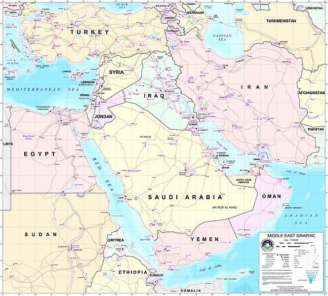
فائل:Middle east graphic 2003.jpg

ایس وکھالے دا ناپ: ۶۶۴ × ۶۰۰ پکسلز۔ دوجے ریزولوشنز: ۲۶۶ × ۲۴۰ پکسلز | ۵۳۲ × ۴۸۰ پکسلز | ۸۵۰ × ۷۶۸ پکسلز | ۱,۱۳۴ × ۱,۰۲۴ پکسلز | ۲,۲۶۸ × ۲,۰۴۸ پکسلز | ۲,۹۷۳ × ۲,۶۸۵ پکسلز ۔
اصل فائل (۲,۹۷۳ × ۲,۶۸۵ پکسلز, فائل حجم: ۳.۹۱ میگابائٹ, MIME type: image/jpeg)
فائل دی تریخ
فائل نو اس ویلے دی حالت وچ ویکھن واسطے تاریخ/ویلے تے کلک کرو۔
| تریخ تے ویلہ | نکی مورت | پاسے | ورتن والا | تیپّݨی کرو | |
|---|---|---|---|---|---|
| موجودہ | ۰۳:۳۰, ۹ فروری ۲۰۱۲ |  | ۲,۹۷۳ × ۲,۶۸۵ (۳.۹۱ میگابائٹ) | M0tty | Remove compression artefacts by a bilateral filtering. |
| ۰۲:۴۳, ۱۵ جولائی ۲۰۰۶ |  | ۲,۹۷۳ × ۲,۶۸۵ (۱,۰۱۳ کلوبائٹ) | Unquietwiki | ''Courtesy of the University of Texas Libraries, The University of Texas at Austin'' [http://www.lib.utexas.edu/maps/middle_east.html http://www.lib.utexas.edu/maps/middle_east.html] High-resolution political / railway / roadmap of the Middle East. |
فائل دی ورتوں
تھلے دتے گئے 2 صفحے اس فائل نال جُڑدے نیں
فائل ویاپک ورتوں
ایہہ دوجے وکیاں ایس فائل نوں ورتدے نیں –
- ar.wikipedia.org تے ورتوں
- ويكيبيديا:قوالب/بذور
- ويكيبيديا:قوالب/بذور/جدول بذرة 1
- قالب:بذرة جغرافيا الشرق الأوسط
- بادية الشام
- محافظة العاصمة (البحرين)
- خليج عدن
- دزفول
- زاغروس
- مسجد سليمان
- زاينده
- مسرح أحداث الشرق الأوسط خلال الحرب العالمية الثانية
- الحويزة (مدينة)
- قائمة جزر الخليج العربي
- شرق المتوسط
- قائمة نزاعات الشرق الأوسط الحديثة
- مستخدم:Adnanzoom/مساعدات
- عبد الله بن سعيد
- قرار مجلس الأمن التابع للأمم المتحدة رقم 1381
- مستخدم:ASammour/بذرة-بوابة
- شرف الدين بن الحسن
- فخر الدين بن عدي
- صخر بن صخر بن مسافر
- قالب:بذرة أعلام الشرق الأوسط
- أبجر التاسع
- arz.wikipedia.org تے ورتوں
- ba.wikipedia.org تے ورتوں
- bn.wikipedia.org تے ورتوں
- ca.wikipedia.org تے ورتوں
- ce.wikipedia.org تے ورتوں
- ckb.wikipedia.org تے ورتوں
- el.wikipedia.org تے ورتوں
- en.wikipedia.org تے ورتوں
ایس فائل دا ویکھو ہور جگت ورتن .


