
فائل:1855 Colton Map of Turkey, Iraq, and Syria - Geographicus - TurkeyIraq-colton-1855.jpg
اصل فائل (۳,۵۰۰ × ۳,۰۳۴ پکسلز, فائل حجم: ۳.۲۲ میگابائٹ, MIME type: image/jpeg)
| J. H. Colton: Turkey in Asia and the Caucasian Provinces of Russia
( |
|||||||||||||||||||||
|---|---|---|---|---|---|---|---|---|---|---|---|---|---|---|---|---|---|---|---|---|---|
| آرٹسٹ |
|
||||||||||||||||||||
| سرخی |
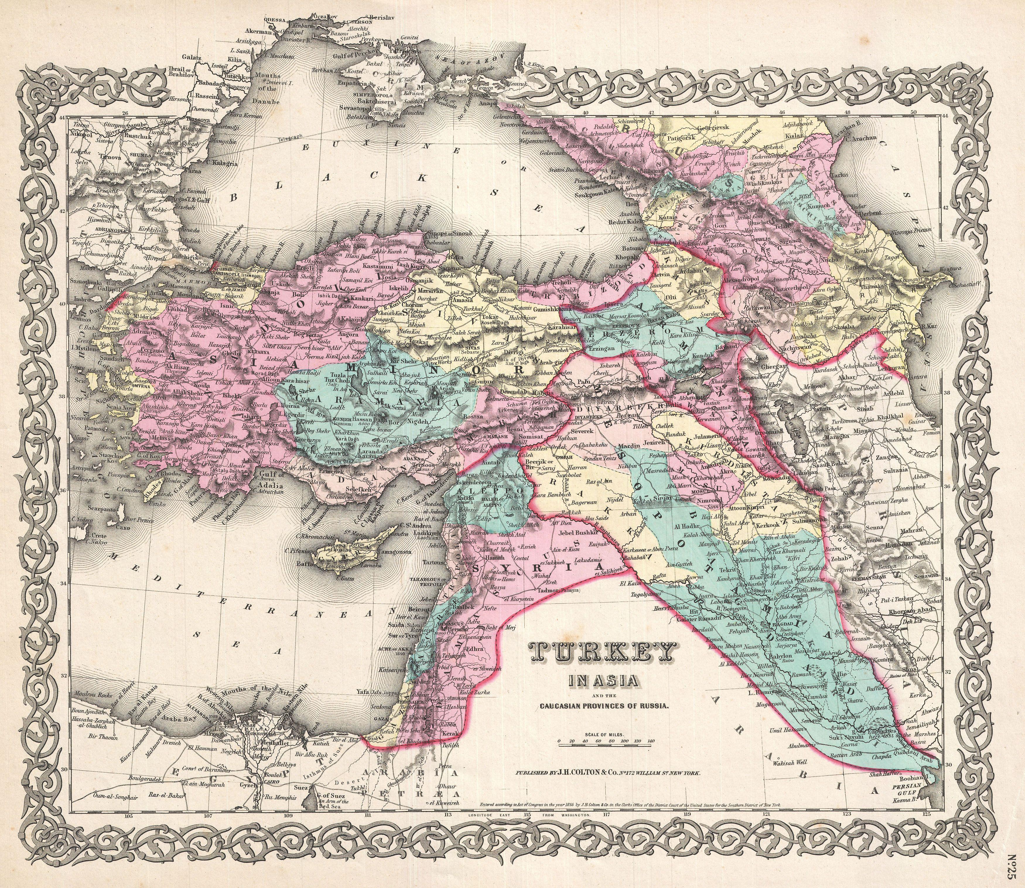
Turkey in Asia and the Caucasian Provinces of Russia |
||||||||||||||||||||
| تفصیل |
العربية: خريطة جميلة لِإيالات الدولة العُثمانيَّة في آسيا وتظهر فيها المُقاطعات القوقازيَّة التي تُسيطر عليها روسيا. تعود هذه الخريطة لِلطبعة الأولى لِأطلس كولتون الصادر سنة 1855م.
English: A beautiful 1855 first edition example of Colton's map of the Ottoman Empire (Turkey) in Asia and the Caucuses.
|
||||||||||||||||||||
| تریخ | ۱۸۵۵ (dated) | ||||||||||||||||||||
| ڈائمنشن | height: ۱۳.۰ in (۳۳.۰ cm)؛ width: ۱۶.۵ in (۴۱.۹ cm) | ||||||||||||||||||||
| ملن نمبر |
Geographicus link: TurkeyIraq-colton-1855 |
||||||||||||||||||||
| ذریعہ/فوٹوگرافر |
Colton, G. W., Colton's Atlas of the World Illustrating Physical and Political Geography, Vol 2, New York, 1855 (First Edition).
|
||||||||||||||||||||
| اجازت (فائل نوں دوبارہ ورتنا) |
|
||||||||||||||||||||

|
فائل دی تریخ
فائل نو اس ویلے دی حالت وچ ویکھن واسطے تاریخ/ویلے تے کلک کرو۔
| تریخ تے ویلہ | نکی مورت | پاسے | ورتن والا | تیپّݨی کرو | |
|---|---|---|---|---|---|
| موجودہ | ۲۰:۳۳, ۲۳ مارچ ۲۰۱۱ | | ۳,۵۰۰ × ۳,۰۳۴ (۳.۲۲ میگابائٹ) | BotMultichillT | {{subst:User:Multichill/Geographicus |link=http://www.geographicus.com/P/AntiqueMap/TurkeyIraq-colton-1855 |product_name=1855 Colton Map of Turkey, Iraq, and Syria |map_title=Turkey in Asia and the Caucasian Provinces of Russia. |description=A beautiful 1 |
فائل دی ورتوں
تھلے دتے گئے 2 صفحے اس فائل نال جُڑدے نیں
فائل ویاپک ورتوں
ایہہ دوجے وکیاں ایس فائل نوں ورتدے نیں –
- ar.wikipedia.org تے ورتوں
- الأقاليم السورية الشمالية
- إيالة عثمانية
- العراق العثماني
- بوابة:الدولة العثمانية/صورة
- مستخدم:عمرو بن كلثوم/الأقاليم السورية الشمالية
- ويكيبيديا:صور مختارة/رسومات وجداول وخرائط/خرائط
- قائمة إيالات الدولة العثمانية
- ويكيبيديا:ترشيحات الصور المختارة/الإيالات العثمانية الآسيوية
- ويكيبيديا:صورة اليوم المختارة/أغسطس 2017
- قالب:صورة اليوم المختارة/2017-08-11
- بوابة:الدولة العثمانية/صورة مختارة/35
- ويكيبيديا:صورة اليوم المختارة/يناير 2020
- قالب:صورة اليوم المختارة/2020-01-14
- الحدود الإيرانية التركية
- ويكيبيديا:صورة اليوم المختارة/نوفمبر 2022
- قالب:صورة اليوم المختارة/2022-11-16
- arz.wikipedia.org تے ورتوں
- az.wikipedia.org تے ورتوں
- bn.wikipedia.org تے ورتوں
- ckb.wikipedia.org تے ورتوں
- en.wikipedia.org تے ورتوں
- et.wikipedia.org تے ورتوں
- fa.wikipedia.org تے ورتوں
- it.wikipedia.org تے ورتوں
- ko.wikipedia.org تے ورتوں
- ku.wikipedia.org تے ورتوں
- ro.wikipedia.org تے ورتوں
- tr.wikipedia.org تے ورتوں
- ur.wikipedia.org تے ورتوں
- www.wikidata.org تے ورتوں
- zh.wikipedia.org تے ورتوں