
فائل:Arabian Peninsula (orthographic projection).png

ایس وکھالے دا ناپ: ۶۰۰ × ۶۰۰ پکسلز۔ دوجے ریزولوشنز: ۲۴۰ × ۲۴۰ پکسلز | ۴۸۰ × ۴۸۰ پکسلز | ۷۶۸ × ۷۶۸ پکسلز | ۱,۰۲۴ × ۱,۰۲۴ پکسلز | ۲,۰۰۰ × ۲,۰۰۰ پکسلز ۔
اصل فائل (۲,۰۰۰ × ۲,۰۰۰ پکسلز, فائل حجم: ۶۶۶ کلوبائٹ, MIME type: image/png)
.png)
خلاصہ
| تفصیل |
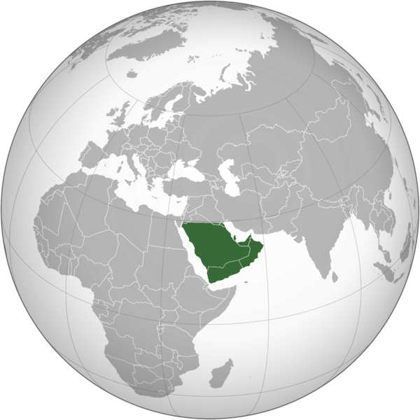
English: The Arabian Peninsula العربية: شبه الجزيرة العربية |
| تریخ | |
| سروت | آپݨا کم |
| لکھاری | Afrogindahood |
لائسنس –
| This map is ineligible for copyright and therefore in the public domain, because it consists entirely of information that is common property and contains no original authorship. For more information, see Commons:Threshold of originality § Maps.
|
فائل دی تریخ
فائل نو اس ویلے دی حالت وچ ویکھن واسطے تاریخ/ویلے تے کلک کرو۔
| تریخ تے ویلہ | نکی مورت | پاسے | ورتن والا | تیپّݨی کرو | |
|---|---|---|---|---|---|
| موجودہ | ۱۹:۱۴, ۷ مارچ ۲۰۲۳ | | ۲,۰۰۰ × ۲,۰۰۰ (۶۶۶ کلوبائٹ) | Treetoes023 | Reverted to version as of 23:11, 6 January 2020 (UTC): This version shows the geographic Arabian Peninsula. |
| ۰۲:۲۴, ۲۵ جنوری ۲۰۲۰ |  | ۲,۰۰۰ × ۲,۰۰۰ (۳۹۹ کلوبائٹ) | Ham105 | Reverted to version as of 03:49, 7 March 2015 (UTC) | |
| ۰۴:۱۱, ۷ جنوری ۲۰۲۰ |  | ۲,۰۰۰ × ۲,۰۰۰ (۶۶۶ کلوبائٹ) | Sariyr | Reverted to version as of 22:23, 4 January 2020 (UTC): Northern border line between the Gulf of Aqaba and the Kuwait Bay. | |
| ۰۹:۰۶, ۵ جنوری ۲۰۲۰ |  | ۲,۰۰۰ × ۲,۰۰۰ (۳۹۹ کلوبائٹ) | Ham105 | Reverted to version as of 03:49, 7 March 2015 (UTC) unsourced - take it to the discussion page | |
| ۰۳:۲۳, ۵ جنوری ۲۰۲۰ |  | ۲,۰۰۰ × ۲,۰۰۰ (۶۶۶ کلوبائٹ) | Sariyr | Reverted to version as of 02:46, 4 January 2020 (UTC): Northern border line between the Gulf of Akaba an the Kuwait Bay. | |
| ۲۰:۳۷, ۴ جنوری ۲۰۲۰ |  | ۲,۰۰۰ × ۲,۰۰۰ (۳۹۹ کلوبائٹ) | Ham105 | Reverted to version as of 03:49, 7 March 2015 (UTC) | |
| ۰۷:۴۶, ۴ جنوری ۲۰۲۰ |  | ۲,۰۰۰ × ۲,۰۰۰ (۶۶۶ کلوبائٹ) | Sariyr | Northern border line between the Gulf of Akaba an the Kuwait Bay. | |
| ۰۸:۴۹, ۷ مارچ ۲۰۱۵ |  | ۲,۰۰۰ × ۲,۰۰۰ (۳۹۹ کلوبائٹ) | Afrogindahood | User created page with UploadWizard |
فائل دی ورتوں
تھلے دتے گئے 1 صفحے اس فائل نال جُڑدے نیں
فائل ویاپک ورتوں
ایہہ دوجے وکیاں ایس فائل نوں ورتدے نیں –
- ar.wikipedia.org تے ورتوں
- arz.wikipedia.org تے ورتوں
- azb.wikipedia.org تے ورتوں
- bn.wikipedia.org تے ورتوں
- ckb.wikipedia.org تے ورتوں
- cs.wikipedia.org تے ورتوں
- el.wikiversity.org تے ورتوں
- en.wikipedia.org تے ورتوں
- fa.wikipedia.org تے ورتوں
- he.wikipedia.org تے ورتوں
- hy.wikipedia.org تے ورتوں
- hyw.wikipedia.org تے ورتوں
- id.wikipedia.org تے ورتوں
- it.wikivoyage.org تے ورتوں
- kn.wikipedia.org تے ورتوں
- mrj.wikipedia.org تے ورتوں
- ps.wikipedia.org تے ورتوں
- pt.wikipedia.org تے ورتوں
- sc.wikipedia.org تے ورتوں
- si.wikipedia.org تے ورتوں
- sl.wikipedia.org تے ورتوں
- sr.wikipedia.org تے ورتوں
- th.wikipedia.org تے ورتوں
- ur.wikipedia.org تے ورتوں
- uz.wikipedia.org تے ورتوں
- vi.wikipedia.org تے ورتوں
.png)