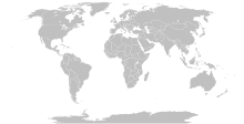
فائل:BlankMap-World-Compact.svg

Size of this PNG preview of this SVG file: ۸۰۰ × ۳۵۴ پکسلز. دوجے ریزولوشنز: ۳۲۰ × ۱۴۲ پکسلز | ۶۴۰ × ۲۸۴ پکسلز | ۱,۰۲۴ × ۴۵۴ پکسلز | ۱,۲۸۰ × ۵۶۷ پکسلز | ۲,۵۶۰ × ۱,۱۳۴ پکسلز ۔
اصل فائل (ایس وی جی فائل، پکسل:۲,۵۶۰ × ۱,۱۳۴، فائل سائز: ۱.۰۱ میگابائٹ)
فائل دی تریخ
فائل نو اس ویلے دی حالت وچ ویکھن واسطے تاریخ/ویلے تے کلک کرو۔
| تریخ تے ویلہ | نکی مورت | پاسے | ورتن والا | تیپّݨی کرو | |
|---|---|---|---|---|---|
| موجودہ | ۱۷:۵۶, ۱۱ اکتوبر ۲۰۲۳ |  | ۲,۵۶۰ × ۱,۱۳۴ (۱.۰۱ میگابائٹ) | Yodin | Latest version is minified, and no longer easily text-editable; Reverted to version as of 14:50, 16 March 2019 (UTC) |
| ۲۲:۰۷, ۱۰ اکتوبر ۲۰۲۳ |  | ۵۱۲ × ۲۲۷ (۷۵۴ کلوبائٹ) | Ahmed0arafat | fix african countries count to 54 | |
| ۱۹:۵۰, ۱۶ مارچ ۲۰۱۹ |  | ۲,۵۶۰ × ۱,۱۳۴ (۱.۰۱ میگابائٹ) | Gomoloko | I corrected Transnistria tag showing in a larger area than it should, instead of Moldova | |
| ۱۲:۰۹, ۱۱ مارچ ۲۰۱۹ |  | ۲,۵۶۰ × ۱,۱۳۴ (۱.۰۱ میگابائٹ) | Gomoloko | I corrected West Bank (State of Palestine) name not showing when the mouse was over the area | |
| ۰۵:۵۱, ۱۱ مارچ ۲۰۱۹ |  | ۲,۵۶۰ × ۱,۱۳۴ (۱.۰۱ میگابائٹ) | Gomoloko | last change :) Gambia, Republic of The | |
| ۰۵:۲۵, ۱۱ مارچ ۲۰۱۹ |  | ۲,۵۶۰ × ۱,۱۳۴ (۱.۰۱ میگابائٹ) | Gomoloko | I reverted all changes and made only the following according to www.un.org : North Macedonia, United States of America, Eswatini, United Kingdom of Great Britain and Northern Ireland, Cabo Verde | |
| ۰۲:۰۲, ۱۱ مارچ ۲۰۱۹ |  | ۲,۵۶۰ × ۱,۱۳۴ (۱.۰۱ میگابائٹ) | Gomoloko | North Macedonia, Republic of _ Congo, Democratic Republic of the _ Kyrgyz Republic _ Vietnam, Socialist Republic of _ China, People's Republic of _ United States of America _ Eswatini, Kingdom of _ Cabo Verde, Republic of | |
| ۰۲:۵۵, ۱۱ فروری ۲۰۱۸ |  | ۲,۵۶۰ × ۱,۱۳۴ (۱.۰۱ میگابائٹ) | Fibonacci | Updated the map with land and water outlines from the original. | |
| ۰۰:۳۲, ۲۶ اگست ۲۰۱۲ |  | ۹۴۰ × ۴۱۵ (۱.۴۵ میگابائٹ) | Kpengboy | Reverted to version as of 16:35, 13 February 2012 (there's a reason the code wasn't "optimised". re-add transparency if you think it's better) | |
| ۰۱:۵۷, ۱۸ اپریل ۲۰۱۲ |  | ۹۴۰ × ۴۱۵ (۸۱۸ کلوبائٹ) | Fred the Oyster | Corrected my faux pas with the upper and lower margins |
فائل دی ورتوں
اس فائل نال جڑیا کوئی صفحہ نئیں۔
فائل ویاپک ورتوں
ایہہ دوجے وکیاں ایس فائل نوں ورتدے نیں –
- de.wikipedia.org تے ورتوں
- en.wikipedia.org تے ورتوں
- fr.wikipedia.org تے ورتوں
- zh.wikipedia.org تے ورتوں


