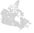
فائل:Canada blank map.svg

Page contents not supported in other languages.
آزاد انسائیکلوپیڈیا، وکیپیڈیا توں

اصل فائل(ایس وی جی فائل، پکسل:۱,۱۱۴ × ۹۴۲، فائل سائز: ۲۰۵ کلوبائٹ)

ایہ فائل Wikimedia Commons توں اے تے دوجیاں ویونتاں تے وی ورتی جاسکدی اے۔ گل بات اس دے فائل گل بات صفحہ تے تھلے دتی گئی۔

تفصیل
English: Blank SVG map of the territory claimed by Canada

Non-contiguous parts of a states/provinces are "grouped" together with the main area of the state/provinces, so any state/provinces can be coloured in completion with one click anywhere on the state/provinces's area.

Also, all states/provinces have a "id" attached to them, making them easy to find. Select "find" and then enter in the state/provinces's ISO 3166-2 code in the "id" field to find it. The codes can be found here.

There are 19 lakes shown; each has an ID that matches its official name. The lakes can be easily be found in the XML tree and they can be individually deleted to make room for text or other overlays.
تریخ 03-07-2007 edited 8-Aug-2007
سروت
لکھاری Lokal_Profil image cut to remove USA by Paul Robinson
اجازت
(فائل نوں دوبارہ ورتنا)
Public domain This map is ineligible for copyright and therefore in the public domain, because it consists entirely of information that is common property and contains no original authorship. For more information, see Commons:Threshold of originality § Maps.

English | Español | Galego | Română | slovenščina | العربية | 简体中文 | 繁體中文 | +/−

دوجے ورژن

Derivative works of this file:

Canada Labelled map.svg this map with province labels
Original blank map of USA and Canada, That image with labels,

Original USA/Canada map with labels
SVG genesis
InfoField
 
The SVG code is valid.
 
This map was created with Inkscape.

Captions

Add a one-line explanation of what this file represents

Items portrayed in this file

چترن

media type English

image/svg+xml

checksum English

3a165ea2ae3683659891b4c139a0f466e71efb69

determination method English: ؜SHA-1 English

data size English

۲۰۹,۵۳۲ بائٹ

height English

۹۴۲ pixel

width English

۱,۱۱۴ pixel

فائل دی تریخ

فائل نو اس ویلے دی حالت وچ ویکھن واسطے تاریخ/ویلے تے کلک کرو۔

تریخ تے ویلہنکی مورتپاسےورتن والاتیپّݨی کرو
موجودہ۰۴:۳۰, ۱۷ نومبر ۲۰۲۰۰۴:۳۰, ۱۷ نومبر ۲۰۲۰ ویلے دے ورژن ساتھ انگوٹھاکار روپ۱,۱۱۴ × ۹۴۲ (۲۰۵ کلوبائٹ)MapGridSync with File:Canada_location_map_2_-_lite.svg
۱۶:۴۳, ۵ دسمبر ۲۰۰۷۱۶:۴۳, ۵ دسمبر ۲۰۰۷ ویلے دے ورژن ساتھ انگوٹھاکار روپ۱,۳۰۴ × ۱,۲۶۳ (۱۱۳ کلوبائٹ)Lokal ProfilCleaned up code
۰۲:۲۵, ۱۰ اگست ۲۰۰۷۰۲:۲۵, ۱۰ اگست ۲۰۰۷ ویلے دے ورژن ساتھ انگوٹھاکار روپ۱,۳۰۴ × ۱,۲۶۳ (۱۱۵ کلوبائٹ)Rfc1394{{Information |Description={{en|Blank SVG map of Canada}} Non-contiguous parts of a states/provinces are "grouped" together with the main area of the state/provinces, so any state/provinces can be coloured in completion with one click anywhere on the stat

اس فائل نال جڑیا کوئی صفحہ نئیں۔

فائل ویاپک ورتوں

میٹا ڈیٹا