
فائل:Canada location map 2 - lite.svg

Size of this PNG preview of this SVG file: ۷۰۹ × ۶۰۰ پکسلز. دوجے ریزولوشنز: ۲۸۴ × ۲۴۰ پکسلز | ۵۶۸ × ۴۸۰ پکسلز | ۹۰۸ × ۷۶۸ پکسلز | ۱,۲۱۱ × ۱,۰۲۴ پکسلز | ۲,۴۲۲ × ۲,۰۴۸ پکسلز | ۱,۱۱۴ × ۹۴۲ پکسلز ۔
اصل فائل (ایس وی جی فائل، پکسل:۱,۱۱۴ × ۹۴۲، فائل سائز: ۲۷۹ کلوبائٹ)
خلاصہ
| تفصیل |
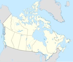
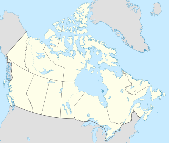
English: Location map of Canada with all five Great Lakes shown in full.
This is a lite version of the map with most rivers removed. |
| تریخ | |
| سروت | آپݨا کم |
| لکھاری | MapGrid |
| دوجے ورژن |
|
| SVG genesis |


Map Info
| Projection: | Lambert conformal conic |
|---|---|
| Datum: | WGS84 |
| Central Meridian: | 95.000000°W |
| Latitude of Origin: | 60.000000°N |
| Standard Parallel #1: | 49.000000°N |
| Standard Parallel #2: | 77.000000°N |
| x (%)= | 201.7818903*(((tan(pi*(90-$1)/360))*(((1+0.08181919084*sin(pi*$1/180))/(1-0.08181919084*sin(pi*$1/180)))^0.04090959542))^0.9007900864)*sin(0.01572175288*($2+95))+43.98563734
|
|---|---|
| y (%)= | 238.6252927*(((tan(pi*(90-$1)/360))*(((1+0.08181919084*sin(pi*$1/180))/(1-0.08181919084*sin(pi*$1/180)))^0.04090959542))^0.9007900864)*cos(0.01572175288*($2+95))-15.81495465
|
| $1: | latitude in degrees (positive for all locations in Canada). |
| $2: | longitude in degrees (negative for all locations in Canada). |
| x (%): | x coordinate expressed as percentage of image width (measured from left edge). |
| y (%): | y coordinate expressed as percentage of image height (measured from top edge). |
| x (px) | y (px) | x (%) | y (%) | Latitude | Longitude | |
|---|---|---|---|---|---|---|
| Top Left Corner: | 0.000 | 0.000 | 0.00 | 0.00 | 68.220310°N | 176.138684°W |
| Top Right Corner: | 1114.000 | 0.000 | 100.00 | 0.00 | 62.238635°N | 9.994317°W |
| Bottom Right Corner: | 1114.000 | 942.000 | 100.00 | 100.00 | 34.831244°N | 61.953430°W |
| Bottom Left Corner: | 0.000 | 942.000 | 0.00 | 100.00 | 37.392537°N | 121.850536°W |
| Centre: | 557.000 | 471.000 | 50.00 | 50.00 | 63.068962°N | 88.152750°W |
| Origin: | 490.000 | 541.000 | 43.99 | 57.43 | 60.000000°N | 95.000000°W |
| North Pole: | 490.000 | -148.977 | 43.99 | -15.81 | 90.000000°N | ⸻ |
| Thechàl Dhâl: | 67.523 | 368.241 | 6.06 | 39.09 | 61.022873°N | 138.564925°W |
لائسنس –
میں، اس کم دے کاپیرائٹ دا مالک، اس کم نوں اس لائسنس دے مطابق چھاپدا واں:
This file is licensed under the Creative Commons Attribution-Share Alike 4.0 International license.
- تہانوں کھلھ اے:
- حصہ کرنا – کاپی، ونڈنا تے کم بھیجنا
- فیر رلانا – کم نوں فٹ کرنا
- تھلے دتیاں شرطاں نال:
- کس دے ناں – تسیں لازمی ایس کم دے بناں والے بارے دسو جنج اونے آکھیا اے یا جنج لسنس چ آکھیا گیا ہے۔
- اکو جہا شئیر کرو۔ – اگر تسیں بدلدے یا ایس کم تے بناندے تے بنن والے کم نوں اینج دے لسنس نال ای ونڈو گے۔
فائل دی تریخ
فائل نو اس ویلے دی حالت وچ ویکھن واسطے تاریخ/ویلے تے کلک کرو۔
| تریخ تے ویلہ | نکی مورت | پاسے | ورتن والا | تیپّݨی کرو | |
|---|---|---|---|---|---|
| موجودہ | ۲۲:۳۶, ۲۹ دسمبر ۲۰۲۰ | | ۱,۱۱۴ × ۹۴۲ (۲۷۹ کلوبائٹ) | MapGrid | Added an international boundary line between Canada and St Pierre & Miquelon (as per request). Slightly thinner provincial/territorial border to match new provincial/territorial locator maps. |
| ۲۳:۵۹, ۲۵ دسمبر ۲۰۲۰ |  | ۱,۱۱۴ × ۹۴۲ (۲۷۹ کلوبائٹ) | MapGrid | Christmas Day edition... added the Nelson River | |
| ۰۳:۴۵, ۲۳ نومبر ۲۰۲۰ |  | ۱,۱۱۴ × ۹۴۲ (۲۶۹ کلوبائٹ) | MapGrid | Added Mackenzie River. And a few minor tweaks. | |
| ۰۰:۰۳, ۱۶ نومبر ۲۰۲۰ |  | ۱,۱۱۴ × ۹۴۲ (۲۶۴ کلوبائٹ) | MapGrid | Uploaded own work with UploadWizard |
فائل دی ورتوں
اس فائل نال جڑیا کوئی صفحہ نئیں۔
فائل ویاپک ورتوں
ایہہ دوجے وکیاں ایس فائل نوں ورتدے نیں –
- azb.wikipedia.org تے ورتوں
- bh.wikipedia.org تے ورتوں
- en.wikipedia.org تے ورتوں
- Geography of Canada
- Politics of Canada
- Economy of Canada
- Monarchy of Canada
- List of Canadian provincial and territorial symbols
- Music of Canada
- Same-sex marriage in Canada
- First Nations in Canada
- List of universities in Canada
- Index of Canada-related articles
- National Historic Sites of Canada
- Template:Subdivisions of Ontario
- Template:Administrative divisions of Quebec
- Template:Subdivisions of British Columbia
- List of current Canadian first ministers
- Egale Canada
- Same-sex marriage in Yukon
- List of extreme points of Canada
- Universities Canada
- Same-sex marriage in Ontario
- Same-sex marriage in Quebec
- Same-sex marriage in British Columbia
- Same-sex marriage in Manitoba
- Same-sex marriage in Nova Scotia
- List of universities and colleges in New Brunswick
- Same-sex marriage in Nunavut
- Same-sex marriage in Alberta
- Same-sex marriage in Saskatchewan
- Same-sex marriage in New Brunswick
- Same-sex marriage in Newfoundland and Labrador
- Same-sex marriage in Prince Edward Island
- Same-sex marriage in the Northwest Territories
- Civil unions in Quebec
- Members of the 38th Canadian Parliament and same-sex marriage
- Reference Re Same-Sex Marriage
- Civil Marriage Act
- Canadians for Equal Marriage
- Template:Subdivisions of Alberta
- Template:Same-sex marriage in Canada
- Template talk:Same-sex marriage in Canada
- Template:Subdivisions of New Brunswick
- Scouting and Guiding in Quebec
- List of colleges in Canada
- Scouting and Guiding in Canada
- LGBT rights in Canada
- Template:Subdivisions of Saskatchewan
- Template:Subdivisions of Nova Scotia
ایس فائل دا ویکھو ہور جگت ورتن .