
فائل:Départements et provinces de France.png
ایس وکھالے دا ناپ: ۶۴۱ × ۶۰۰ پکسلز۔ دوجے ریزولوشنز: ۲۵۷ × ۲۴۰ پکسلز | ۵۱۳ × ۴۸۰ پکسلز | ۸۲۱ × ۷۶۸ پکسلز | ۱,۰۹۵ × ۱,۰۲۴ پکسلز | ۱,۷۸۵ × ۱,۶۷۰ پکسلز ۔
اصل فائل (۱,۷۸۵ × ۱,۶۷۰ پکسلز, فائل حجم: ۳۱۰ کلوبائٹ, MIME type: image/png)

|
File:Départements et provinces de France.svg is a vector version of this file. It should be used in place of this PNG file when not inferior.
File:Départements et provinces de France.png → File:Départements et provinces de France.svg
For more information, see Help:SVG. |
 |
| تفصیل |
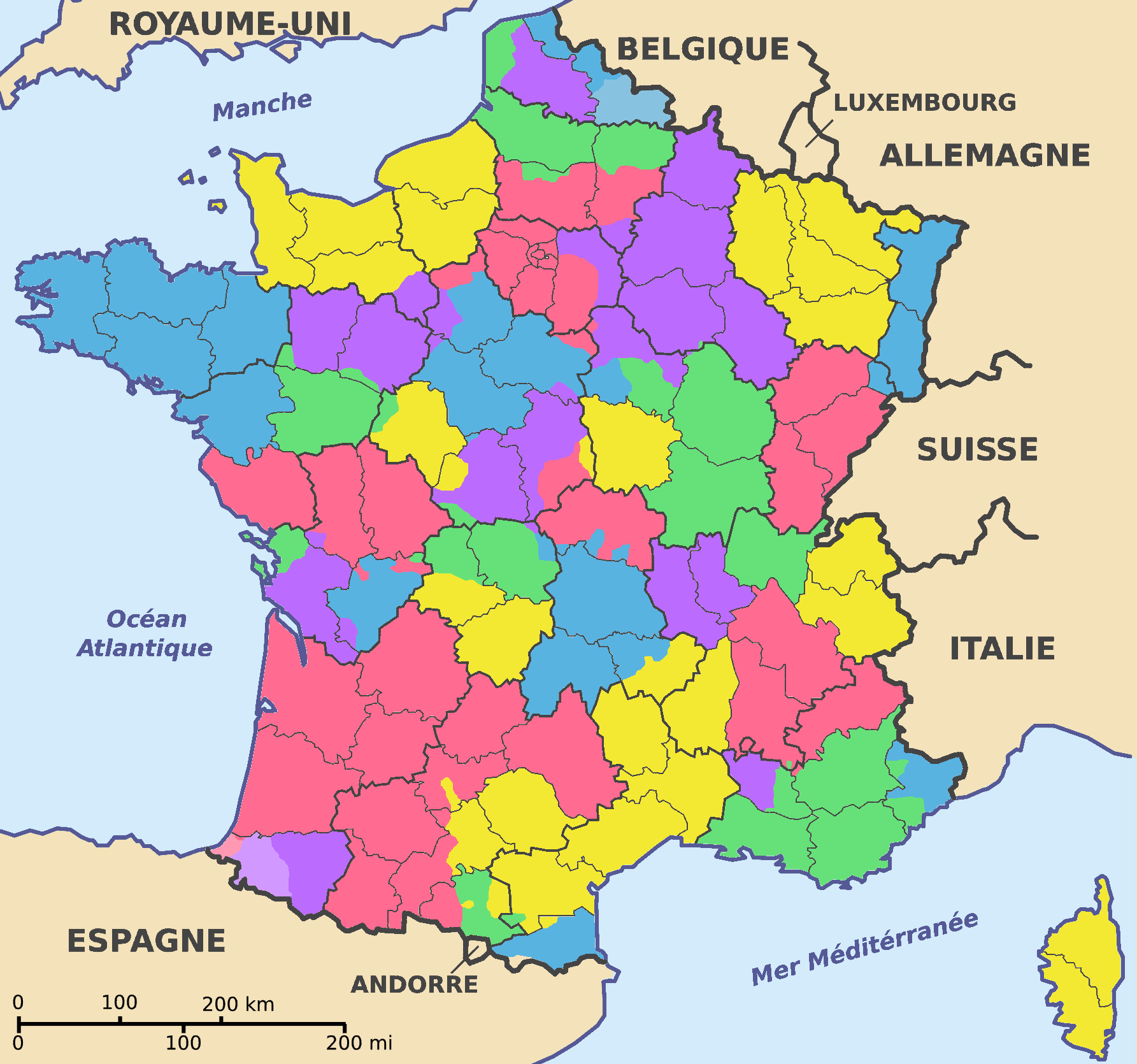
Français : Carte représentant les départements et provinces français d'après la Carte de la France en 1791 dans The Historical Atlas by William R. Shepherd (1926).
J'ai indiqué aussi le Hainaut et le Pays basque en tons clairs ; j'en ferais de même pour la Guyenne si les limites de cette dernière étaient moins floues. |
| تریخ | (UTC) |
| سروت | |
| لکھاری |
|
.jpg)
| میں، اس کم دے کاپیرائٹ دا مالک، اس کم نوں لوکاں واسطے دیندا واں۔ اے سارے جگ واسطے لاگو اے۔ کج ملکاں چ قانونی طور تے اے ممکن نئیں اے؛ اگر انج ای اے ے: میں ہر کسے نوں اس کم نوں کسے وی مقصد واسطے ورتن دا بغیر کسے شرط دے حق دیندا واں، اگر اوہ قانون دے خلاف نا ہوۓ۔ |
پہلا اپلوڈ دا ریکارڈ
This image is a derivative work of the following images:
- File:Departements_de_France_map.svg licensed with PD-self
- 2007-08-27T19:11:36Z Superwikifan 588x550 (310662 Bytes) {{Information |Description= carte représentant les départements français |Source=self-made |Date=27.08.2007 |Author= [[User:Superwikifan|Superwikifan]] }} [[Category:Maps of France]]
- File:France_departments_1791_(1).jpg licensed with PD-old
- 2008-09-22T08:46:23Z File Upload Bot (Magnus Manske) 741x599 (225908 Bytes) {{BotMoveToCommons|fr.wikipedia}} {{Information |Description={{fr|Carte de la France en 1791 (départements et anciennes provinces - en rouge) in The Historical Atlas by William R. Shepherd, 1926 == Licence == [[:fr:Cat�
Uploaded with derivativeFX
فائل دی تریخ
فائل نو اس ویلے دی حالت وچ ویکھن واسطے تاریخ/ویلے تے کلک کرو۔
| تریخ تے ویلہ | نکی مورت | پاسے | ورتن والا | تیپّݨی کرو | |
|---|---|---|---|---|---|
| موجودہ | ۲۰:۰۴, ۲۵ مارچ ۲۰۰۹ | | ۱,۷۸۵ × ۱,۶۷۰ (۳۱۰ کلوبائٹ) | QuartierLatin1968 | {{Information |Description=Carte représentant les départements et provinces français d'après la Carte de la France en 1791 dans ''The Historical Atlas'' by William R. Shepherd (1926). |Source=*File:Departements_de_France_map.svg *[[:File:France_ |
فائل دی ورتوں
تھلے دتے گئے 1 صفحے اس فائل نال جُڑدے نیں
فائل ویاپک ورتوں
ایہہ دوجے وکیاں ایس فائل نوں ورتدے نیں –
- ar.wikipedia.org تے ورتوں
- br.wikipedia.org تے ورتوں
- et.wikipedia.org تے ورتوں
- fr.wikipedia.org تے ورتوں
- lt.wikipedia.org تے ورتوں
- nl.wikipedia.org تے ورتوں
- pl.wikipedia.org تے ورتوں
- ro.wikipedia.org تے ورتوں
- sh.wikipedia.org تے ورتوں
- sv.wikipedia.org تے ورتوں
- ur.wikipedia.org تے ورتوں
- zh.wikipedia.org تے ورتوں