
فائل:Deutsch Ost-Afrika,1892.jpg

ایس وکھالے دا ناپ: ۴۶۷ × ۶۰۰ پکسلز۔ دوجے ریزولوشنز: ۱۸۷ × ۲۴۰ پکسلز | ۳۷۴ × ۴۸۰ پکسلز | ۵۹۸ × ۷۶۸ پکسلز | ۷۹۷ × ۱,۰۲۴ پکسلز | ۱,۵۹۵ × ۲,۰۴۸ پکسلز | ۳,۵۰۳ × ۴,۴۹۸ پکسلز ۔
اصل فائل (۳,۵۰۳ × ۴,۴۹۸ پکسلز, فائل حجم: ۱۰.۳۸ میگابائٹ, MIME type: image/jpeg)
خلاصہ
| تفصیل |
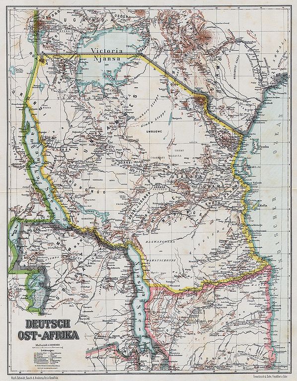
English: Map of German East Africa, 1892
Slovenčina: Mapa Nemeckej Východnej Afriky, 1892 |
| تریخ | |
| سروت | Geschichte des Araber-Aufstandes in Ost-Afrika |
| لکھاری | Schmidt, Rochus (1860-1938) |
| Open this image as an overlay in Google Earth (Google Maps, Bing) | (Help|Source) |
لائسنس –
|
This work is in the public domain in its country of origin and other countries and areas where the copyright term is the author's life plus 70 years or fewer. This work is in the public domain in the United States because it was published (or registered with the U.S. Copyright Office) before January 1, 1929. | |
| ایہ فائل دے بارے چ دس اے جے اے کاپی حف دیاں روکاں توں کھلی اے تے نالدے رلدے حقاں توں وی۔ | |
فائل دی تریخ
فائل نو اس ویلے دی حالت وچ ویکھن واسطے تاریخ/ویلے تے کلک کرو۔
| تریخ تے ویلہ | نکی مورت | پاسے | ورتن والا | تیپّݨی کرو | |
|---|---|---|---|---|---|
| موجودہ | ۱۱:۵۸, ۱۵ جولائی ۲۰۰۸ | | ۳,۵۰۳ × ۴,۴۹۸ (۱۰.۳۸ میگابائٹ) | Matriosa | {{Information |Description={{en|1=Map of German East Africa, 1892}} {{sk|1=Mapa Nemeckej Východnej Afriky, 1892}} |Source=Geschichte des Araber-Aufstandes in Ost-Afrika |Author=Schmidt, Rochus |Date=1892 |Permission= |other_versions= }} {{ImageUpload|fu |
فائل دی ورتوں
تھلے دتے گئے 1 صفحے اس فائل نال جُڑدے نیں
فائل ویاپک ورتوں
ایہہ دوجے وکیاں ایس فائل نوں ورتدے نیں –
- af.wikipedia.org تے ورتوں
- als.wikipedia.org تے ورتوں
- ar.wikipedia.org تے ورتوں
- azb.wikipedia.org تے ورتوں
- cs.wikipedia.org تے ورتوں
- de.wikipedia.org تے ورتوں
- en.wikipedia.org تے ورتوں
- es.wikipedia.org تے ورتوں
- eu.wikipedia.org تے ورتوں
- fr.wikipedia.org تے ورتوں
- fy.wikipedia.org تے ورتوں
- hr.wikipedia.org تے ورتوں
- ko.wikipedia.org تے ورتوں
- mt.wikipedia.org تے ورتوں
- nl.wikipedia.org تے ورتوں
- no.wikipedia.org تے ورتوں
- ro.wikipedia.org تے ورتوں
- ru.wikipedia.org تے ورتوں
- sr.wikipedia.org تے ورتوں
- sv.wikipedia.org تے ورتوں
- tum.wikipedia.org تے ورتوں
- ur.wikipedia.org تے ورتوں
- zh.wikipedia.org تے ورتوں