
فائل:False color of Hellas Planitia.jpeg

ایس وکھالے دا ناپ: ۴۸۶ × ۵۹۹ پکسلز۔ دوجے ریزولوشنز: ۱۹۵ × ۲۴۰ پکسلز | ۳۸۹ × ۴۸۰ پکسلز | ۶۲۳ × ۷۶۸ پکسلز | ۸۳۱ × ۱,۰۲۴ پکسلز | ۱,۹۰۹ × ۲,۳۵۳ پکسلز ۔
اصل فائل (۱,۹۰۹ × ۲,۳۵۳ پکسلز, فائل حجم: ۸۸۱ کلوبائٹ, MIME type: image/jpeg)
خلاصہ
| تفصیل |
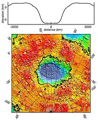
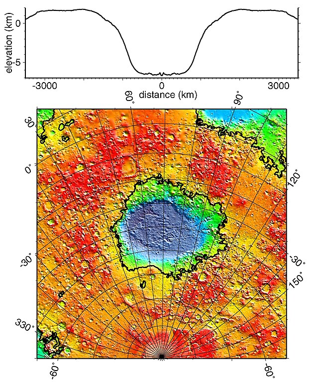
English: Regional topographic model of the Hellas basin (Hellas Planitia) taken by the MOLA instrument aboard the Mars Global Surveyor. (Top) Azimuthally-averaged radial topography used in the calculation of infilling the basin with surrounding material postulated to have been excavated from it. (Bottom) Color-coded topography plotted in an equal-area projection. The black lines correspond to zero-elevation contours. |
| تریخ | |
| سروت | http://photojournal.jpl.nasa.gov/catalog/PIA02033 |
| لکھاری | NASA/JPL/GSFC |
لائسنس –
| This file is in the public domain in the United States because it was solely created by NASA. NASA copyright policy states that "NASA material is not protected by copyright unless noted". (See Template:PD-USGov, NASA copyright policy page or JPL Image Use Policy.) | ||
 |
Warnings:
|
فائل دی تریخ
فائل نو اس ویلے دی حالت وچ ویکھن واسطے تاریخ/ویلے تے کلک کرو۔
| تریخ تے ویلہ | نکی مورت | پاسے | ورتن والا | تیپّݨی کرو | |
|---|---|---|---|---|---|
| موجودہ | ۲۳:۵۱, ۱۹ دسمبر ۲۰۱۰ | | ۱,۹۰۹ × ۲,۳۵۳ (۸۸۱ کلوبائٹ) | Orionist | high res version from original source |
| ۰۴:۴۲, ۳ فروری ۲۰۰۶ |  | ۲۷۴ × ۳۳۷ (۷۸ کلوبائٹ) | W-j-s | Hellas Planitia, NASA From [http://rst.gsfc.nasa.gov/Sect19/Sect19_12.html] {{PD-USGov-NASA}} |
فائل دی ورتوں
تھلے دتے گئے 1 صفحے اس فائل نال جُڑدے نیں
فائل ویاپک ورتوں
ایہہ دوجے وکیاں ایس فائل نوں ورتدے نیں –
- als.wikipedia.org تے ورتوں
- ca.wikipedia.org تے ورتوں
- de.wikipedia.org تے ورتوں
- el.wikipedia.org تے ورتوں
- en.wikipedia.org تے ورتوں
- fr.wikipedia.org تے ورتوں
- gl.wikipedia.org تے ورتوں
- hy.wikipedia.org تے ورتوں
- it.wikipedia.org تے ورتوں
- ja.wikipedia.org تے ورتوں
- lb.wikipedia.org تے ورتوں
- ml.wikipedia.org تے ورتوں
- pt.wikipedia.org تے ورتوں
- ro.wikipedia.org تے ورتوں
- ru.wikipedia.org تے ورتوں
- uk.wikipedia.org تے ورتوں
- ur.wikipedia.org تے ورتوں
- zh.wikipedia.org تے ورتوں