
فائل:Islip-town-map.gif
اس توں وڈی مورت موجود نہیں۔
Islip-town-map.gif (۵۷۵ × ۴۲۵ پکسلز, فائل حجم: ۴۸ کلوبائٹ, MIME type: image/gif)
خلاصہ

|
This file was moved to Wikimedia Commons from en.wikipedia using a bot script. All source information is still present. It requires review. Additionally, there may be errors in any or all of the information fields; information on this file should not be considered reliable and the file should not be used until it has been reviewed and any needed corrections have been made. Once the review has been completed, this template should be removed. For details about this file, see below. Check now! |
| تفصیل | |
| تریخ | |
| سروت | http://factfinder.census.gov |
| لکھاری | United States Census Bureau |
| اجازت (فائل نوں دوبارہ ورتنا) |
Public domain |
لائسنس –
This image or file is a work of a United States Census Bureau employee, taken or made as part of that person's official duties. As a work of the U.S. federal government, the image is in the public domain.
|
 |
پہلا اپلوڈ دا ریکارڈ
Transferred from en.wikipedia to Commons by Milicevic01 using CommonsHelper.
The original description page was here. All following user names refer to en.wikipedia.
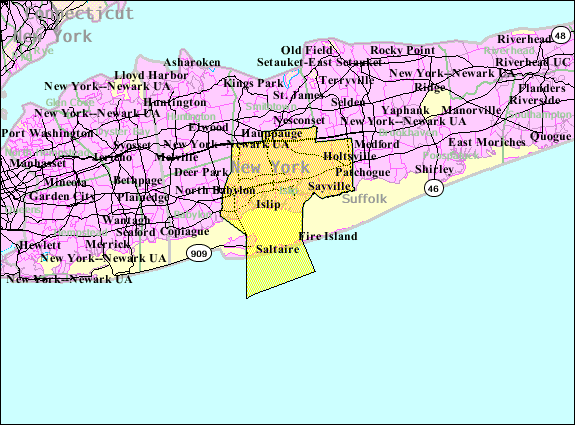
- 2007-10-22 23:38 Americasroof 575×425× (48766 bytes) [[Islip, New York]] town map from U.S. Census
فائل دی تریخ
فائل نو اس ویلے دی حالت وچ ویکھن واسطے تاریخ/ویلے تے کلک کرو۔
| تریخ تے ویلہ | نکی مورت | پاسے | ورتن والا | تیپّݨی کرو | |
|---|---|---|---|---|---|
| موجودہ | ۱۵:۵۶, ۲۲ اگست ۲۰۱۳ | | ۵۷۵ × ۴۲۵ (۴۸ کلوبائٹ) | File Upload Bot (Magnus Manske) | Transfered from en.wikipedia by User:Milicevic01 using CommonsHelper |
| ۱۵:۵۵, ۲۲ اگست ۲۰۱۳ |  | ۵۷۵ × ۴۲۵ (۴۸ کلوبائٹ) | File Upload Bot (Magnus Manske) | Transfered from en.wikipedia by User:Milicevic01 using CommonsHelper |
فائل دی ورتوں
تھلے دتے گئے 1 صفحے اس فائل نال جُڑدے نیں
فائل ویاپک ورتوں
ایہہ دوجے وکیاں ایس فائل نوں ورتدے نیں –
- ar.wikipedia.org تے ورتوں
- arz.wikipedia.org تے ورتوں
- de.wikipedia.org تے ورتوں
- en.wikipedia.org تے ورتوں
- es.wikipedia.org تے ورتوں
- fr.wikipedia.org تے ورتوں
- ht.wikipedia.org تے ورتوں
- nl.wikipedia.org تے ورتوں
- sh.wikipedia.org تے ورتوں
- sr.wikipedia.org تے ورتوں
- tt.wikipedia.org تے ورتوں
- ur.wikipedia.org تے ورتوں
- www.wikidata.org تے ورتوں