
فائل:Kerguelen Map.png

ایس وکھالے دا ناپ: ۶۱۸ × ۶۰۰ پکسلز۔ دوجے ریزولوشنز: ۲۴۷ × ۲۴۰ پکسلز | ۴۹۵ × ۴۸۰ پکسلز | ۷۹۱ × ۷۶۸ پکسلز | ۱,۰۵۵ × ۱,۰۲۴ پکسلز | ۱,۹۶۴ × ۱,۹۰۶ پکسلز ۔
اصل فائل (۱,۹۶۴ × ۱,۹۰۶ پکسلز, فائل حجم: ۳۳۷ کلوبائٹ, MIME type: image/png)

|
This map image could be re-created using vector graphics as an SVG file. This has several advantages; see Commons:Media for cleanup for more information. If an SVG form of this image is available, please upload it and afterwards replace this template with
{{vector version available|new image name}}.
It is recommended to name the SVG file “Kerguelen Map.svg”—then the template Vector version available (or Vva) does not need the new image name parameter. |
| تفصیل |
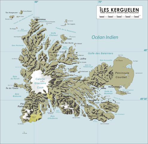
English: Map of the Kerguelen Islands, French Southern and Antarctic Territories
Deutsch: Karte des Kerguelen-Archipel |
||
| تریخ | ۸ اپریل ۲۰۰۶ (original upload date) | ||
| سروت | آپݨا کم | ||
| لکھاری | Varp | ||
| اجازت (فائل نوں دوبارہ ورتنا) |
|
فائل دی تریخ
فائل نو اس ویلے دی حالت وچ ویکھن واسطے تاریخ/ویلے تے کلک کرو۔
| تریخ تے ویلہ | نکی مورت | پاسے | ورتن والا | تیپّݨی کرو | |
|---|---|---|---|---|---|
| موجودہ | ۱۸:۰۴, ۱۶ اکتوبر ۲۰۰۸ | | ۱,۹۶۴ × ۱,۹۰۶ (۳۳۷ کلوبائٹ) | Ralf Roletschek | {{Information |Description= |Source= |Date= |Author= |Permission= |other_versions= }} |
| ۱۲:۴۰, ۱۳ اپریل ۲۰۰۶ |  | ۱,۹۶۴ × ۱,۹۰۶ (۹۰۴ کلوبائٹ) | Varp~commonswiki | ||
| ۱۲:۴۱, ۱۲ اپریل ۲۰۰۶ |  | ۱,۹۶۴ × ۱,۹۰۶ (۸۶۶ کلوبائٹ) | Varp~commonswiki | ||
| ۱۵:۱۴, ۹ اپریل ۲۰۰۶ |  | ۱,۹۶۴ × ۱,۹۰۶ (۸۶۶ کلوبائٹ) | Varp~commonswiki | ||
| ۱۹:۵۲, ۸ اپریل ۲۰۰۶ |  | ۱,۹۶۴ × ۱,۹۰۶ (۸۵۳ کلوبائٹ) | Varp~commonswiki | *Map of the Kerguelen Islands, French Southern and Antarctic Territories *drawn by varp |
فائل دی ورتوں
تھلے دتے گئے 1 صفحے اس فائل نال جُڑدے نیں
فائل ویاپک ورتوں
ایہہ دوجے وکیاں ایس فائل نوں ورتدے نیں –
- als.wikipedia.org تے ورتوں
- ar.wikipedia.org تے ورتوں
- da.wikipedia.org تے ورتوں
- de.wikipedia.org تے ورتوں
- de.wikivoyage.org تے ورتوں
- de.wiktionary.org تے ورتوں
- el.wikipedia.org تے ورتوں
- en.wikipedia.org تے ورتوں
- es.wikipedia.org تے ورتوں
- et.wikipedia.org تے ورتوں
- frr.wikipedia.org تے ورتوں
- fr.wikipedia.org تے ورتوں
- gag.wikipedia.org تے ورتوں
- gl.wikipedia.org تے ورتوں
- hr.wikipedia.org تے ورتوں
- hu.wikipedia.org تے ورتوں
- id.wikipedia.org تے ورتوں
- ie.wikipedia.org تے ورتوں
- is.wikipedia.org تے ورتوں
- ka.wikipedia.org تے ورتوں
- lt.wikipedia.org تے ورتوں
- nds.wikipedia.org تے ورتوں
- nn.wikipedia.org تے ورتوں
- no.wikipedia.org تے ورتوں
- pl.wikipedia.org تے ورتوں
- ro.wikipedia.org تے ورتوں
- sk.wikipedia.org تے ورتوں
- sr.wikipedia.org تے ورتوں
- sv.wikipedia.org تے ورتوں
- ug.wikipedia.org تے ورتوں
- uk.wikipedia.org تے ورتوں
- ur.wikipedia.org تے ورتوں
- vi.wikipedia.org تے ورتوں
- war.wikipedia.org تے ورتوں
- zh.wikipedia.org تے ورتوں